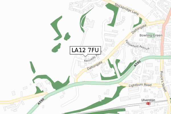
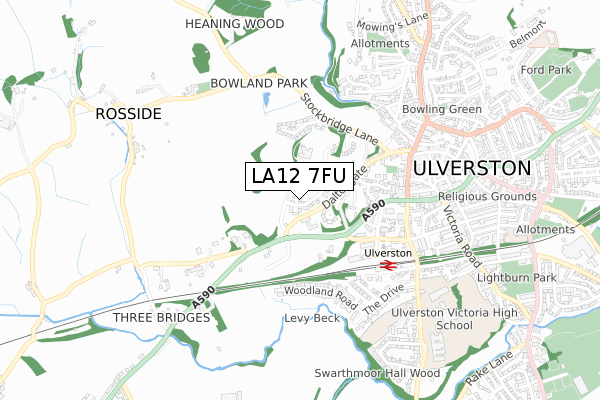
LA12 7FU is located in the Ulverston electoral ward, within the unitary authority of Westmorland and Furness and the English Parliamentary constituency of Barrow and Furness. The Sub Integrated Care Board (ICB) Location is NHS Lancashire and South Cumbria ICB - 01K and the police force is Cumbria. This postcode has been in use since June 2018.


GetTheData
Source: OS Open Zoomstack (Ordnance Survey)
Licence: Open Government Licence (requires attribution)
Attribution: Contains OS data © Crown copyright and database right 2024
Source: Open Postcode Geo
Licence: Open Government Licence (requires attribution)
Attribution: Contains OS data © Crown copyright and database right 2024; Contains Royal Mail data © Royal Mail copyright and database right 2024; Source: Office for National Statistics licensed under the Open Government Licence v.3.0
| Easting | 328097 |
| Northing | 478154 |
| Latitude | 54.194093 |
| Longitude | -3.103545 |
GetTheData
Source: Open Postcode Geo
Licence: Open Government Licence
| Country | England |
| Postcode District | LA12 |
| ➜ LA12 open data dashboard ➜ See where LA12 is on a map ➜ Where is Ulverston? | |
GetTheData
Source: Land Registry Price Paid Data
Licence: Open Government Licence
| Ward | Ulverston |
| Constituency | Barrow And Furness |
GetTheData
Source: ONS Postcode Database
Licence: Open Government Licence
7, KENNEDY PLACE, ULVERSTON, LA12 7FU 2018 26 JUL £534,995 |
3, KENNEDY PLACE, ULVERSTON, LA12 7FU 2018 15 JUN £544,995 |
5, KENNEDY PLACE, ULVERSTON, LA12 7FU 2018 15 JUN £515,995 |
GetTheData
Source: HM Land Registry Price Paid Data
Licence: Contains HM Land Registry data © Crown copyright and database right 2024. This data is licensed under the Open Government Licence v3.0.
| June 2022 | Shoplifting | On or near Lightburn Road | 168m |
| June 2022 | Anti-social behaviour | On or near Parking Area | 448m |
| June 2022 | Anti-social behaviour | On or near Mayfield Road | 477m |
| ➜ Get more crime data in our Crime section | |||
GetTheData
Source: data.police.uk
Licence: Open Government Licence
| Daltongate Business Centre (A590) | Ulverston | 140m |
| Daltongate Business Centre (Lightburn Road) | Ulverston | 244m |
| The Gill | North Ulverston | 539m |
| Rail Bridge (Three Bridges) | Three Bridges | 544m |
| County Square | Ulverston | 545m |
| Ulverston Station | 0.5km |
| Dalton Station | 6.6km |
GetTheData
Source: NaPTAN
Licence: Open Government Licence
| Percentage of properties with Next Generation Access | 100.0% |
| Percentage of properties with Superfast Broadband | 100.0% |
| Percentage of properties with Ultrafast Broadband | 100.0% |
| Percentage of properties with Full Fibre Broadband | 100.0% |
Superfast Broadband is between 30Mbps and 300Mbps
Ultrafast Broadband is > 300Mbps
| Percentage of properties unable to receive 2Mbps | 0.0% |
| Percentage of properties unable to receive 5Mbps | 0.0% |
| Percentage of properties unable to receive 10Mbps | 0.0% |
| Percentage of properties unable to receive 30Mbps | 0.0% |
GetTheData
Source: Ofcom
Licence: Ofcom Terms of Use (requires attribution)
GetTheData
Source: ONS Postcode Database
Licence: Open Government Licence


➜ Get more ratings from the Food Standards Agency
GetTheData
Source: Food Standards Agency
Licence: FSA terms & conditions
| Last Collection | |||
|---|---|---|---|
| Location | Mon-Fri | Sat | Distance |
| 21 Princes Street | 17:00 | 11:15 | 476m |
| 11 Market Place | 17:30 | 11:45 | 524m |
| 25 The Drive | 17:00 | 11:15 | 548m |
GetTheData
Source: Dracos
Licence: Creative Commons Attribution-ShareAlike
| Facility | Distance |
|---|---|
| St Marys Catholic Primary School Springfield Road, Ulverston Grass Pitches | 637m |
| Ulverston Victoria High School Springfield Road, Ulverston Grass Pitches, Sports Hall | 864m |
| Swarthmoor Football Club Park Road, Swarthmoor Grass Pitches | 1.3km |
GetTheData
Source: Active Places
Licence: Open Government Licence
| School | Phase of Education | Distance |
|---|---|---|
| St Mary's Catholic Primary School, Ulverston Springfield Road, Ulverston, LA12 0EA | Primary | 637m |
| Church Walk CofE Primary School Church Walk, Ulverston, LA12 7EN | Primary | 850m |
| Ulverston Victoria High School Springfield Road, Ulverston, LA12 0EB | Secondary | 864m |
GetTheData
Source: Edubase
Licence: Open Government Licence
The below table lists the International Territorial Level (ITL) codes (formerly Nomenclature of Territorial Units for Statistics (NUTS) codes) and Local Administrative Units (LAU) codes for LA12 7FU:
| ITL 1 Code | Name |
|---|---|
| TLD | North West (England) |
| ITL 2 Code | Name |
| TLD1 | Cumbria |
| ITL 3 Code | Name |
| TLD12 | East Cumbria |
| LAU 1 Code | Name |
| E07000031 | South Lakeland |
GetTheData
Source: ONS Postcode Directory
Licence: Open Government Licence
The below table lists the Census Output Area (OA), Lower Layer Super Output Area (LSOA), and Middle Layer Super Output Area (MSOA) for LA12 7FU:
| Code | Name | |
|---|---|---|
| OA | E00098073 | |
| LSOA | E01019393 | South Lakeland 014E |
| MSOA | E02004028 | South Lakeland 014 |
GetTheData
Source: ONS Postcode Directory
Licence: Open Government Licence
| LA12 7TN | The Knoll | 134m |
| LA12 7NG | Lightburn Road | 244m |
| LA12 7AP | New Church Gardens | 285m |
| LA12 7UB | Trinity Gardens | 309m |
| LA12 7XE | Machell Close | 320m |
| LA12 7XA | Stone Cross Gardens | 325m |
| LA12 7XD | Fallowfield Avenue | 333m |
| LA12 7NJ | Beehive Cottages | 337m |
| LA12 7BE | Daltongate | 343m |
| LA12 7XB | Deerfield | 348m |
GetTheData
Source: Open Postcode Geo; Land Registry Price Paid Data
Licence: Open Government Licence