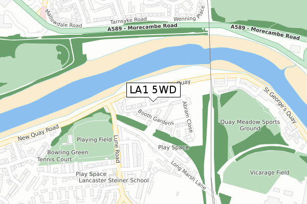
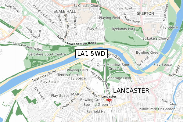
LA1 5WD is located in the Marsh electoral ward, within the local authority district of Lancaster and the English Parliamentary constituency of Lancaster and Fleetwood. The Sub Integrated Care Board (ICB) Location is NHS Lancashire and South Cumbria ICB - 01K and the police force is Lancashire. This postcode has been in use since April 2018.


GetTheData
Source: OS Open Zoomstack (Ordnance Survey)
Licence: Open Government Licence (requires attribution)
Attribution: Contains OS data © Crown copyright and database right 2025
Source: Open Postcode Geo
Licence: Open Government Licence (requires attribution)
Attribution: Contains OS data © Crown copyright and database right 2025; Contains Royal Mail data © Royal Mail copyright and database right 2025; Source: Office for National Statistics licensed under the Open Government Licence v.3.0
| Easting | 346970 |
| Northing | 462268 |
| Latitude | 54.053637 |
| Longitude | -2.811521 |
GetTheData
Source: Open Postcode Geo
Licence: Open Government Licence
| Country | England |
| Postcode District | LA1 |
➜ See where LA1 is on a map ➜ Where is Lancaster? | |
GetTheData
Source: Land Registry Price Paid Data
Licence: Open Government Licence
| Ward | Marsh |
| Constituency | Lancaster And Fleetwood |
GetTheData
Source: ONS Postcode Database
Licence: Open Government Licence
2021 30 SEP £280,000 |
1, WILLIAM PRIESTLEY PARK, LANCASTER, LA1 5WD 2019 3 OCT £176,995 |
2019 3 MAY £231,995 |
3, WILLIAM PRIESTLEY PARK, LANCASTER, LA1 5WD 2019 8 APR £269,995 |
4, WILLIAM PRIESTLEY PARK, LANCASTER, LA1 5WD 2019 29 MAR £231,995 |
16, WILLIAM PRIESTLEY PARK, LANCASTER, LA1 5WD 2018 28 DEC £221,996 |
20, WILLIAM PRIESTLEY PARK, LANCASTER, LA1 5WD 2018 29 JUN £224,995 |
18, WILLIAM PRIESTLEY PARK, LANCASTER, LA1 5WD 2018 27 APR £232,995 |
GetTheData
Source: HM Land Registry Price Paid Data
Licence: Contains HM Land Registry data © Crown copyright and database right 2025. This data is licensed under the Open Government Licence v3.0.
| Cricket Club (Lune Road) | Marsh | 158m |
| Cricket Club (Lune Road) | Marsh | 188m |
| Carlisle Bridge (Morecambe Road) | Ryelands | 274m |
| Carlisle Bridge (Morecambe Road) | Ryelands | 278m |
| Marshaw Road (Tarnsyke Road) | Ryelands | 281m |
| Lancaster Station | 0.6km |
| Bare Lane Station | 2.8km |
| Morecambe Station | 4.2km |
GetTheData
Source: NaPTAN
Licence: Open Government Licence
| Percentage of properties with Next Generation Access | 100.0% |
| Percentage of properties with Superfast Broadband | 100.0% |
| Percentage of properties with Ultrafast Broadband | 100.0% |
| Percentage of properties with Full Fibre Broadband | 100.0% |
Superfast Broadband is between 30Mbps and 300Mbps
Ultrafast Broadband is > 300Mbps
| Percentage of properties unable to receive 2Mbps | 0.0% |
| Percentage of properties unable to receive 5Mbps | 0.0% |
| Percentage of properties unable to receive 10Mbps | 0.0% |
| Percentage of properties unable to receive 30Mbps | 0.0% |
GetTheData
Source: Ofcom
Licence: Ofcom Terms of Use (requires attribution)
GetTheData
Source: ONS Postcode Database
Licence: Open Government Licence


➜ Get more ratings from the Food Standards Agency
GetTheData
Source: Food Standards Agency
Licence: FSA terms & conditions
| Last Collection | |||
|---|---|---|---|
| Location | Mon-Fri | Sat | Distance |
| Ryelands Road | 16:00 | 12:30 | 293m |
| West Road | 16:00 | 11:45 | 366m |
| Sefton Drive | 16:00 | 12:30 | 370m |
GetTheData
Source: Dracos
Licence: Creative Commons Attribution-ShareAlike
| Risk of LA1 5WD flooding from rivers and sea | Very Low |
| ➜ LA1 5WD flood map | |
GetTheData
Source: Open Flood Risk by Postcode
Licence: Open Government Licence
The below table lists the International Territorial Level (ITL) codes (formerly Nomenclature of Territorial Units for Statistics (NUTS) codes) and Local Administrative Units (LAU) codes for LA1 5WD:
| ITL 1 Code | Name |
|---|---|
| TLD | North West (England) |
| ITL 2 Code | Name |
| TLD4 | Lancashire |
| ITL 3 Code | Name |
| TLD44 | Lancaster and Wyre |
| LAU 1 Code | Name |
| E07000121 | Lancaster |
GetTheData
Source: ONS Postcode Directory
Licence: Open Government Licence
The below table lists the Census Output Area (OA), Lower Layer Super Output Area (LSOA), and Middle Layer Super Output Area (MSOA) for LA1 5WD:
| Code | Name | |
|---|---|---|
| OA | E00127388 | |
| LSOA | E01025099 | Lancaster 014C |
| MSOA | E02005234 | Lancaster 014 |
GetTheData
Source: ONS Postcode Directory
Licence: Open Government Licence
| LA1 5QX | Long Marsh Lane | 160m |
| LA1 5RE | Charnley Street | 163m |
| LA1 5QU | Lune Road | 187m |
| LA1 5RD | Briery Street | 192m |
| LA1 5QZ | Furness Street | 197m |
| LA1 5RB | Ford Street | 243m |
| LA1 1SA | St Georges Quay | 252m |
| LA1 5RG | Marsh Street | 255m |
| LA1 5QH | Lune Road | 256m |
| LA1 5QY | Long Marsh Lane | 257m |
GetTheData
Source: Open Postcode Geo; Land Registry Price Paid Data
Licence: Open Government Licence