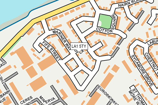
LA1 5TY is located in the Marsh electoral ward, within the local authority district of Lancaster and the English Parliamentary constituency of Lancaster and Fleetwood. The Sub Integrated Care Board (ICB) Location is NHS Lancashire and South Cumbria ICB - 01K and the police force is Lancashire. This postcode has been in use since March 2017.


GetTheData
Source: OS OpenMap – Local (Ordnance Survey)
Source: OS VectorMap District (Ordnance Survey)
Licence: Open Government Licence (requires attribution)
| Easting | 346314 |
| Northing | 461868 |
| Latitude | 54.049974 |
| Longitude | -2.821469 |
GetTheData
Source: Open Postcode Geo
Licence: Open Government Licence
| Country | England |
| Postcode District | LA1 |
➜ See where LA1 is on a map ➜ Where is Lancaster? | |
GetTheData
Source: Land Registry Price Paid Data
Licence: Open Government Licence
| Ward | Marsh |
| Constituency | Lancaster And Fleetwood |
GetTheData
Source: ONS Postcode Database
Licence: Open Government Licence
7, GOLD LANE, LANCASTER, LA1 5TY 2018 25 MAY £273,995 |
8, GOLD LANE, LANCASTER, LA1 5TY 2017 22 DEC £277,995 |
5, GOLD LANE, LANCASTER, LA1 5TY 2017 15 DEC £279,995 |
GetTheData
Source: HM Land Registry Price Paid Data
Licence: Contains HM Land Registry data © Crown copyright and database right 2025. This data is licensed under the Open Government Licence v3.0.
| Coverdale Road (Willow Lane) | Marsh | 332m |
| Coverdale Road (Willow Lane) | Marsh | 344m |
| Willow Lane School (Willows Lane) | Marsh | 390m |
| Willow Lane Infant School (Willow Lane) | Marsh | 426m |
| Denmark Street (Willow Lane) | Marsh | 510m |
| Lancaster Station | 0.9km |
| Bare Lane Station | 2.9km |
| Morecambe Station | 3.9km |
GetTheData
Source: NaPTAN
Licence: Open Government Licence
| Percentage of properties with Next Generation Access | 100.0% |
| Percentage of properties with Superfast Broadband | 90.0% |
| Percentage of properties with Ultrafast Broadband | 90.0% |
| Percentage of properties with Full Fibre Broadband | 90.0% |
Superfast Broadband is between 30Mbps and 300Mbps
Ultrafast Broadband is > 300Mbps
| Percentage of properties unable to receive 2Mbps | 0.0% |
| Percentage of properties unable to receive 5Mbps | 0.0% |
| Percentage of properties unable to receive 10Mbps | 0.0% |
| Percentage of properties unable to receive 30Mbps | 10.0% |
GetTheData
Source: Ofcom
Licence: Ofcom Terms of Use (requires attribution)
GetTheData
Source: ONS Postcode Database
Licence: Open Government Licence


➜ Get more ratings from the Food Standards Agency
GetTheData
Source: Food Standards Agency
Licence: FSA terms & conditions
| Last Collection | |||
|---|---|---|---|
| Location | Mon-Fri | Sat | Distance |
| Lune Industrial Estate | 17:30 | 12:30 | 273m |
| Cavendish Street | 16:00 | 12:30 | 366m |
| West Road | 16:00 | 11:45 | 589m |
GetTheData
Source: Dracos
Licence: Creative Commons Attribution-ShareAlike
| Risk of LA1 5TY flooding from rivers and sea | Very Low |
| ➜ LA1 5TY flood map | |
GetTheData
Source: Open Flood Risk by Postcode
Licence: Open Government Licence
The below table lists the International Territorial Level (ITL) codes (formerly Nomenclature of Territorial Units for Statistics (NUTS) codes) and Local Administrative Units (LAU) codes for LA1 5TY:
| ITL 1 Code | Name |
|---|---|
| TLD | North West (England) |
| ITL 2 Code | Name |
| TLD4 | Lancashire |
| ITL 3 Code | Name |
| TLD44 | Lancaster and Wyre |
| LAU 1 Code | Name |
| E07000121 | Lancaster |
GetTheData
Source: ONS Postcode Directory
Licence: Open Government Licence
The below table lists the Census Output Area (OA), Lower Layer Super Output Area (LSOA), and Middle Layer Super Output Area (MSOA) for LA1 5TY:
| Code | Name | |
|---|---|---|
| OA | E00127395 | |
| LSOA | E01025100 | Lancaster 017A |
| MSOA | E02005237 | Lancaster 017 |
GetTheData
Source: ONS Postcode Directory
Licence: Open Government Licence
| LA1 5TZ | Africa Drive | 67m |
| LA1 5FT | Lune Industrial Estate | 101m |
| LA1 5US | Cotton Square | 123m |
| LA1 5QW | New Quay Road | 202m |
| LA1 5RS | Sycamore Grove | 219m |
| LA1 5UZ | New Quay Road | 233m |
| LA1 5RP | Maple Grove | 258m |
| LA1 5QP | Lune Industrial Estate | 262m |
| LA1 5RU | Birch Grove | 275m |
| LA1 5UY | Nairn Road | 278m |
GetTheData
Source: Open Postcode Geo; Land Registry Price Paid Data
Licence: Open Government Licence