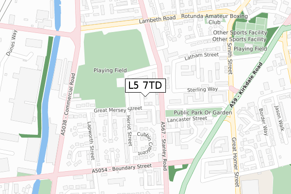
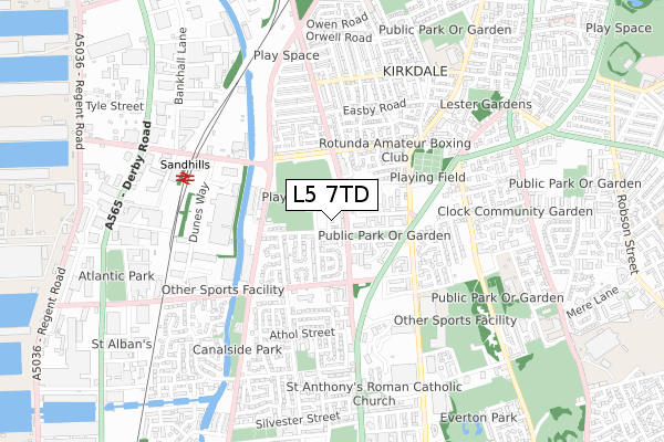
L5 7TD is located in the Kirkdale West electoral ward, within the metropolitan district of Liverpool and the English Parliamentary constituency of Liverpool, Riverside. The Sub Integrated Care Board (ICB) Location is NHS Cheshire and Merseyside ICB - 99A and the police force is Merseyside. This postcode has been in use since May 2018.


GetTheData
Source: OS Open Zoomstack (Ordnance Survey)
Licence: Open Government Licence (requires attribution)
Attribution: Contains OS data © Crown copyright and database right 2024
Source: Open Postcode Geo
Licence: Open Government Licence (requires attribution)
Attribution: Contains OS data © Crown copyright and database right 2024; Contains Royal Mail data © Royal Mail copyright and database right 2024; Source: Office for National Statistics licensed under the Open Government Licence v.3.0
| Easting | 334735 |
| Northing | 392829 |
| Latitude | 53.428209 |
| Longitude | -2.983698 |
GetTheData
Source: Open Postcode Geo
Licence: Open Government Licence
| Country | England |
| Postcode District | L5 |
| ➜ L5 open data dashboard ➜ See where L5 is on a map ➜ Where is Liverpool? | |
GetTheData
Source: Land Registry Price Paid Data
Licence: Open Government Licence
| Ward | Kirkdale West |
| Constituency | Liverpool, Riverside |
GetTheData
Source: ONS Postcode Database
Licence: Open Government Licence
| December 2023 | Criminal damage and arson | On or near Reading Close | 345m |
| December 2023 | Public order | On or near Reading Close | 345m |
| December 2023 | Violence and sexual offences | On or near Reading Close | 345m |
| ➜ Get more crime data in our Crime section | |||
GetTheData
Source: data.police.uk
Licence: Open Government Licence
| Sterling Way (Stanley Road) | Kirkdale | 69m |
| Boundary Street (Stanley Road) | Kirkdale | 162m |
| Lambeth Road (Stanley Road) | Kirkdale | 175m |
| Stanley Road (Boundary Street) | Kirkdale | 228m |
| Lancaster Street (Kirkdale Road) | Kirkdale | 243m |
| Sandhills Station | 0.6km |
| Bank Hall Station | 1.1km |
| Kirkdale Station | 1.4km |
GetTheData
Source: NaPTAN
Licence: Open Government Licence
| Percentage of properties with Next Generation Access | 100.0% |
| Percentage of properties with Superfast Broadband | 100.0% |
| Percentage of properties with Ultrafast Broadband | 0.0% |
| Percentage of properties with Full Fibre Broadband | 0.0% |
Superfast Broadband is between 30Mbps and 300Mbps
Ultrafast Broadband is > 300Mbps
| Percentage of properties unable to receive 2Mbps | 0.0% |
| Percentage of properties unable to receive 5Mbps | 0.0% |
| Percentage of properties unable to receive 10Mbps | 0.0% |
| Percentage of properties unable to receive 30Mbps | 0.0% |
GetTheData
Source: Ofcom
Licence: Ofcom Terms of Use (requires attribution)
GetTheData
Source: ONS Postcode Database
Licence: Open Government Licence

➜ Get more ratings from the Food Standards Agency
GetTheData
Source: Food Standards Agency
Licence: FSA terms & conditions
| Last Collection | |||
|---|---|---|---|
| Location | Mon-Fri | Sat | Distance |
| Lightbody Street | 17:15 | 12:00 | 1,048m |
| Heyworth Street | 16:30 | 12:00 | 1,117m |
| Blessington Road | 16:15 | 12:00 | 1,227m |
GetTheData
Source: Dracos
Licence: Creative Commons Attribution-ShareAlike
| Facility | Distance |
|---|---|
| William Collins Playing Fields Lambeth Road, Liverpool Grass Pitches | 209m |
| Powerleague (Liverpool) Whittle Street, Liverpool Artificial Grass Pitch | 384m |
| Notre Dame Catholic College Great Homer Street, Liverpool Sports Hall, Studio | 465m |
GetTheData
Source: Active Places
Licence: Open Government Licence
| School | Phase of Education | Distance |
|---|---|---|
| Notre Dame Catholic College 180 Great Homer Street, Liverpool, L5 5AF | Secondary | 465m |
| Notre Dame Catholic College 180 Great Homer Street, Liverpool, L5 5AF | Secondary | 479m |
| St John's Catholic Primary School Fountains Road, Kirkdale, Liverpool, L4 1UN | Primary | 712m |
GetTheData
Source: Edubase
Licence: Open Government Licence
The below table lists the International Territorial Level (ITL) codes (formerly Nomenclature of Territorial Units for Statistics (NUTS) codes) and Local Administrative Units (LAU) codes for L5 7TD:
| ITL 1 Code | Name |
|---|---|
| TLD | North West (England) |
| ITL 2 Code | Name |
| TLD7 | Merseyside |
| ITL 3 Code | Name |
| TLD72 | Liverpool |
| LAU 1 Code | Name |
| E08000012 | Liverpool |
GetTheData
Source: ONS Postcode Directory
Licence: Open Government Licence
The below table lists the Census Output Area (OA), Lower Layer Super Output Area (LSOA), and Middle Layer Super Output Area (MSOA) for L5 7TD:
| Code | Name | |
|---|---|---|
| OA | E00034371 | |
| LSOA | E01006779 | Liverpool 022D |
| MSOA | E02001368 | Liverpool 022 |
GetTheData
Source: ONS Postcode Directory
Licence: Open Government Licence
| L5 7TB | Lemon Street | 67m |
| L5 7TA | Stanley Road | 75m |
| L5 7SH | Heriot Street | 119m |
| L5 2PJ | Lancaster Street | 142m |
| L5 7SB | Heriot Street | 166m |
| L5 2SH | Vesuvius Place | 167m |
| L5 7TU | Cubbin Crescent | 170m |
| L5 2PL | Great Mersey Street | 172m |
| L5 2QH | Lancaster Close | 182m |
| L5 7QQ | Stanley Road | 213m |
GetTheData
Source: Open Postcode Geo; Land Registry Price Paid Data
Licence: Open Government Licence