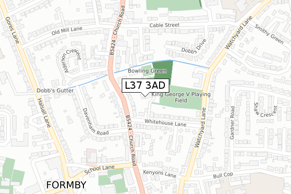
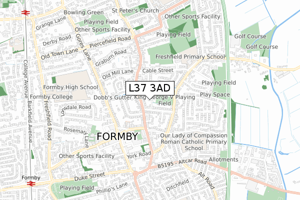
L37 3AD is located in the Ravenmeols electoral ward, within the metropolitan district of Sefton and the English Parliamentary constituency of Sefton Central. The Sub Integrated Care Board (ICB) Location is NHS Cheshire and Merseyside ICB - 01V and the police force is Merseyside. This postcode has been in use since February 2019.


GetTheData
Source: OS Open Zoomstack (Ordnance Survey)
Licence: Open Government Licence (requires attribution)
Attribution: Contains OS data © Crown copyright and database right 2024
Source: Open Postcode Geo
Licence: Open Government Licence (requires attribution)
Attribution: Contains OS data © Crown copyright and database right 2024; Contains Royal Mail data © Royal Mail copyright and database right 2024; Source: Office for National Statistics licensed under the Open Government Licence v.3.0
| Easting | 330148 |
| Northing | 407545 |
| Latitude | 53.559871 |
| Longitude | -3.055999 |
GetTheData
Source: Open Postcode Geo
Licence: Open Government Licence
| Country | England |
| Postcode District | L37 |
| ➜ L37 open data dashboard ➜ See where L37 is on a map ➜ Where is Formby? | |
GetTheData
Source: Land Registry Price Paid Data
Licence: Open Government Licence
| Ward | Ravenmeols |
| Constituency | Sefton Central |
GetTheData
Source: ONS Postcode Database
Licence: Open Government Licence
4, THE GREEN VIEW, FORMBY, LIVERPOOL, L37 3AD 2019 1 AUG £499,950 |
2, THE GREEN VIEW, FORMBY, LIVERPOOL, L37 3AD 2019 14 JUN £399,950 |
1, THE GREEN VIEW, FORMBY, LIVERPOOL, L37 3AD 2019 21 MAR £399,950 |
GetTheData
Source: HM Land Registry Price Paid Data
Licence: Contains HM Land Registry data © Crown copyright and database right 2024. This data is licensed under the Open Government Licence v3.0.
| December 2023 | Violence and sexual offences | On or near Smithy Green | 431m |
| June 2023 | Anti-social behaviour | On or near Smithy Green | 431m |
| June 2023 | Anti-social behaviour | On or near Smithy Green | 431m |
| ➜ Get more crime data in our Crime section | |||
GetTheData
Source: data.police.uk
Licence: Open Government Licence
| Alderson Crescent (Church Road) | Freshfield | 159m |
| Mittens Lane (Watchyard Lane) | Formby | 210m |
| Police Station (Church Road) | Formby | 219m |
| Old Mill Lane (Church Road) | Freshfield | 237m |
| Mittens Lane (Watchyard Lane) | Formby | 245m |
| Formby Station | 1.2km |
| Freshfield Station | 1.3km |
| Hightown Station | 3.9km |
GetTheData
Source: NaPTAN
Licence: Open Government Licence
GetTheData
Source: ONS Postcode Database
Licence: Open Government Licence


➜ Get more ratings from the Food Standards Agency
GetTheData
Source: Food Standards Agency
Licence: FSA terms & conditions
| Last Collection | |||
|---|---|---|---|
| Location | Mon-Fri | Sat | Distance |
| Formby Post Office | 17:15 | 12:00 | 605m |
| Freshfield Post Office | 17:15 | 12:00 | 754m |
| Cartmel Drive | 17:15 | 12:00 | 1,024m |
GetTheData
Source: Dracos
Licence: Creative Commons Attribution-ShareAlike
| Facility | Distance |
|---|---|
| King George V Playing Field (Formby) Whitehouse Lane, Formby, Liverpool Grass Pitches | 114m |
| Victoria Leisure Formby (Closed) The Cloisters, Halsall Lane, Formby, Liverpool Health and Fitness Gym, Studio | 415m |
| Holy Trinity Parish Hall Rosemary Lane, Formby, Liverpool Sports Hall | 565m |
GetTheData
Source: Active Places
Licence: Open Government Licence
| School | Phase of Education | Distance |
|---|---|---|
| Our Lady of Compassion Catholic Primary School Bull Cop, Formby, Liverpool, L37 8BZ | Primary | 438m |
| Freshfield Primary School Watchyard Lane, Formby, Liverpool, L37 3JT | Primary | 477m |
| Trinity St Peter's CofE Primary School Paradise Lane, Formby, Liverpool, L37 7EJ | Primary | 803m |
GetTheData
Source: Edubase
Licence: Open Government Licence
The below table lists the International Territorial Level (ITL) codes (formerly Nomenclature of Territorial Units for Statistics (NUTS) codes) and Local Administrative Units (LAU) codes for L37 3AD:
| ITL 1 Code | Name |
|---|---|
| TLD | North West (England) |
| ITL 2 Code | Name |
| TLD7 | Merseyside |
| ITL 3 Code | Name |
| TLD73 | Sefton |
| LAU 1 Code | Name |
| E08000014 | Sefton |
GetTheData
Source: ONS Postcode Directory
Licence: Open Government Licence
The below table lists the Census Output Area (OA), Lower Layer Super Output Area (LSOA), and Middle Layer Super Output Area (MSOA) for L37 3AD:
| Code | Name | |
|---|---|---|
| OA | E00035869 | |
| LSOA | E01007080 | Sefton 014C |
| MSOA | E02001442 | Sefton 014 |
GetTheData
Source: ONS Postcode Directory
Licence: Open Government Licence
| L37 3NG | Church Road | 76m |
| L37 3NA | Church Road | 108m |
| L37 3LT | Whitehouse Lane | 110m |
| L37 3LS | Whitehouse Lane | 126m |
| L37 3JQ | The Hamptons | 161m |
| L37 3QF | Church Close | 165m |
| L37 3LR | Whitehouse Avenue | 178m |
| L37 3QP | Watchyard Lane | 184m |
| L37 3NS | Davenham Road | 190m |
| L37 3NF | Church Road | 217m |
GetTheData
Source: Open Postcode Geo; Land Registry Price Paid Data
Licence: Open Government Licence