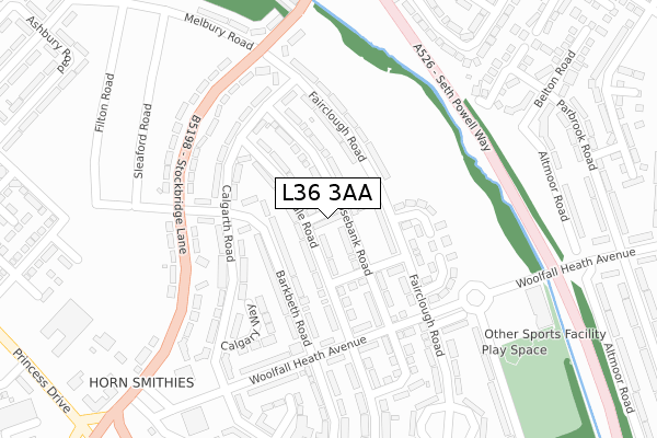
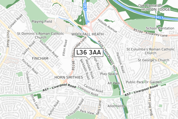
L36 3AA is located in the Page Moss electoral ward, within the metropolitan district of Knowsley and the English Parliamentary constituency of Knowsley. The Sub Integrated Care Board (ICB) Location is NHS Cheshire and Merseyside ICB - 01J and the police force is Merseyside. This postcode has been in use since April 2019.


GetTheData
Source: OS Open Zoomstack (Ordnance Survey)
Licence: Open Government Licence (requires attribution)
Attribution: Contains OS data © Crown copyright and database right 2024
Source: Open Postcode Geo
Licence: Open Government Licence (requires attribution)
Attribution: Contains OS data © Crown copyright and database right 2024; Contains Royal Mail data © Royal Mail copyright and database right 2024; Source: Office for National Statistics licensed under the Open Government Licence v.3.0
| Easting | 343372 |
| Northing | 392420 |
| Latitude | 53.425533 |
| Longitude | -2.853655 |
GetTheData
Source: Open Postcode Geo
Licence: Open Government Licence
| Country | England |
| Postcode District | L36 |
| ➜ L36 open data dashboard ➜ See where L36 is on a map ➜ Where is Huyton with Roby? | |
GetTheData
Source: Land Registry Price Paid Data
Licence: Open Government Licence
| Ward | Page Moss |
| Constituency | Knowsley |
GetTheData
Source: ONS Postcode Database
Licence: Open Government Licence
| January 2024 | Violence and sexual offences | On or near Belton Road | 260m |
| October 2023 | Other theft | On or near Calgary Way | 312m |
| September 2023 | Anti-social behaviour | On or near Calgary Way | 312m |
| ➜ Get more crime data in our Crime section | |||
GetTheData
Source: data.police.uk
Licence: Open Government Licence
| Fairclough Road (Woolfall Heath Avenue) | Woolfall Heath | 215m |
| Mardale Road (Woolfall Heath Avenue) | Woolfall Heath | 229m |
| Fairclough Road (Stockbridge Lane) | Woolfall Heath | 293m |
| Melbury Road (Stockbridge Lane) | Fincham | 301m |
| Barkbeth Road (Stockbridge Lane) | Woolfall Heath | 338m |
| Roby Station | 1.7km |
| Huyton Station | 1.9km |
| Broad Green Station | 3.4km |
GetTheData
Source: NaPTAN
Licence: Open Government Licence
| Percentage of properties with Next Generation Access | 100.0% |
| Percentage of properties with Superfast Broadband | 100.0% |
| Percentage of properties with Ultrafast Broadband | 0.0% |
| Percentage of properties with Full Fibre Broadband | 0.0% |
Superfast Broadband is between 30Mbps and 300Mbps
Ultrafast Broadband is > 300Mbps
| Percentage of properties unable to receive 2Mbps | 0.0% |
| Percentage of properties unable to receive 5Mbps | 0.0% |
| Percentage of properties unable to receive 10Mbps | 0.0% |
| Percentage of properties unable to receive 30Mbps | 0.0% |
GetTheData
Source: Ofcom
Licence: Ofcom Terms of Use (requires attribution)
GetTheData
Source: ONS Postcode Database
Licence: Open Government Licence


➜ Get more ratings from the Food Standards Agency
GetTheData
Source: Food Standards Agency
Licence: FSA terms & conditions
| Last Collection | |||
|---|---|---|---|
| Location | Mon-Fri | Sat | Distance |
| Glade Road | 17:00 | 12:00 | 953m |
| Pilch Lane East | 17:15 | 12:00 | 999m |
| Lordens Road | 16:00 | 12:00 | 1,046m |
GetTheData
Source: Dracos
Licence: Creative Commons Attribution-ShareAlike
| Facility | Distance |
|---|---|
| Alt Park Endmoor Road, Huyton Grass Pitches | 387m |
| Knowsley Community College Stockbridge Lane, Liverpool Sports Hall, Artificial Grass Pitch | 534m |
| Hope Primary School - A Joint Rc And Cofe Primary Sch Lordens Road, Liverpool Grass Pitches, Outdoor Tennis Courts | 697m |
GetTheData
Source: Active Places
Licence: Open Government Licence
| School | Phase of Education | Distance |
|---|---|---|
| Hope Primary School - A Joint Catholic and Church of England Primary School Lordens Road, Huyton, Knowsley, L14 8UD | Primary | 612m |
| Park View Academy Park View, Huyton, Liverpool, L36 2LL | Primary | 731m |
| St Aloysius Catholic Primary School Twig Lane, Huyton-with-Roby, Liverpool, L36 2LF | Primary | 847m |
GetTheData
Source: Edubase
Licence: Open Government Licence
The below table lists the International Territorial Level (ITL) codes (formerly Nomenclature of Territorial Units for Statistics (NUTS) codes) and Local Administrative Units (LAU) codes for L36 3AA:
| ITL 1 Code | Name |
|---|---|
| TLD | North West (England) |
| ITL 2 Code | Name |
| TLD7 | Merseyside |
| ITL 3 Code | Name |
| TLD71 | East Merseyside |
| LAU 1 Code | Name |
| E08000011 | Knowsley |
GetTheData
Source: ONS Postcode Directory
Licence: Open Government Licence
The below table lists the Census Output Area (OA), Lower Layer Super Output Area (LSOA), and Middle Layer Super Output Area (MSOA) for L36 3AA:
| Code | Name | |
|---|---|---|
| OA | E00032777 | |
| LSOA | E01033228 | Knowsley 008F |
| MSOA | E02001334 | Knowsley 008 |
GetTheData
Source: ONS Postcode Directory
Licence: Open Government Licence
| L36 3UR | Fairclough Road | 83m |
| L36 3UT | Fairclough Road | 106m |
| L36 3TD | Mardale Road | 151m |
| L36 3TB | Mardale Road | 177m |
| L36 3XW | Leonards Close | 203m |
| L36 3TX | Barkbeth Road | 207m |
| L36 3UQ | Calgarth Road | 237m |
| L36 3UZ | Altmoor Road | 240m |
| L36 3XJ | Belton Road | 243m |
| L36 3TU | Barkbeth Road | 244m |
GetTheData
Source: Open Postcode Geo; Land Registry Price Paid Data
Licence: Open Government Licence