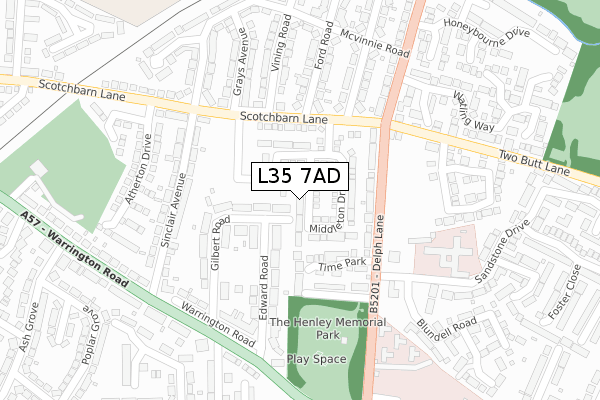
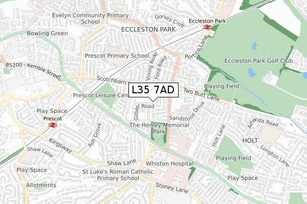
L35 7AD is located in the Prescot South electoral ward, within the metropolitan district of Knowsley and the English Parliamentary constituency of St Helens South and Whiston. The Sub Integrated Care Board (ICB) Location is NHS Cheshire and Merseyside ICB - 01J and the police force is Merseyside. This postcode has been in use since August 2018.


GetTheData
Source: OS Open Zoomstack (Ordnance Survey)
Licence: Open Government Licence (requires attribution)
Attribution: Contains OS data © Crown copyright and database right 2024
Source: Open Postcode Geo
Licence: Open Government Licence (requires attribution)
Attribution: Contains OS data © Crown copyright and database right 2024; Contains Royal Mail data © Royal Mail copyright and database right 2024; Source: Office for National Statistics licensed under the Open Government Licence v.3.0
| Easting | 347824 |
| Northing | 392359 |
| Latitude | 53.425445 |
| Longitude | -2.786655 |
GetTheData
Source: Open Postcode Geo
Licence: Open Government Licence
| Country | England |
| Postcode District | L35 |
| ➜ L35 open data dashboard ➜ See where L35 is on a map ➜ Where is Prescot? | |
GetTheData
Source: Land Registry Price Paid Data
Licence: Open Government Licence
| Ward | Prescot South |
| Constituency | St Helens South And Whiston |
GetTheData
Source: ONS Postcode Database
Licence: Open Government Licence
2023 14 APR £270,000 |
9, MIDDLETON DRIVE, PRESCOT, L35 7AD 2023 27 JAN £275,000 |
2022 27 MAY £295,000 |
2022 28 FEB £300,000 |
3, MIDDLETON DRIVE, PRESCOT, L35 7AD 2021 9 AUG £231,995 |
1, MIDDLETON DRIVE, PRESCOT, L35 7AD 2021 6 AUG £231,995 |
5, MIDDLETON DRIVE, PRESCOT, L35 7AD 2021 7 JUL £294,995 |
7, MIDDLETON DRIVE, PRESCOT, L35 7AD 2021 28 MAY £275,995 |
11, MIDDLETON DRIVE, PRESCOT, L35 7AD 2021 15 APR £229,995 |
9, MIDDLETON DRIVE, PRESCOT, L35 7AD 2021 12 APR £229,995 |
GetTheData
Source: HM Land Registry Price Paid Data
Licence: Contains HM Land Registry data © Crown copyright and database right 2024. This data is licensed under the Open Government Licence v3.0.
| October 2023 | Violence and sexual offences | On or near Sandstone Drive | 351m |
| September 2023 | Criminal damage and arson | On or near Sandstone Drive | 351m |
| May 2023 | Violence and sexual offences | On or near Sandstone Drive | 351m |
| ➜ Get more crime data in our Crime section | |||
GetTheData
Source: data.police.uk
Licence: Open Government Licence
| Scotchbarn Lane | Prescot | 112m |
| Scotchbarn Lane | Prescot | 154m |
| Fire Station Road (Delph Lane) | Prescot | 227m |
| Watling Way (Portico Lane) | Prescot | 230m |
| Fire Station Road (Delph Lane) | Prescot | 239m |
| Eccleston Park Station | 0.7km |
| Prescot Station | 0.9km |
| Whiston Station | 1.4km |
GetTheData
Source: NaPTAN
Licence: Open Government Licence
| Percentage of properties with Next Generation Access | 100.0% |
| Percentage of properties with Superfast Broadband | 100.0% |
| Percentage of properties with Ultrafast Broadband | 60.0% |
| Percentage of properties with Full Fibre Broadband | 60.0% |
Superfast Broadband is between 30Mbps and 300Mbps
Ultrafast Broadband is > 300Mbps
| Percentage of properties unable to receive 2Mbps | 0.0% |
| Percentage of properties unable to receive 5Mbps | 0.0% |
| Percentage of properties unable to receive 10Mbps | 0.0% |
| Percentage of properties unable to receive 30Mbps | 0.0% |
GetTheData
Source: Ofcom
Licence: Ofcom Terms of Use (requires attribution)
GetTheData
Source: ONS Postcode Database
Licence: Open Government Licence


➜ Get more ratings from the Food Standards Agency
GetTheData
Source: Food Standards Agency
Licence: FSA terms & conditions
| Last Collection | |||
|---|---|---|---|
| Location | Mon-Fri | Sat | Distance |
| Beechwood Grove | 17:15 | 12:00 | 531m |
| Prescot Station | 17:30 | 12:00 | 1,137m |
| Police Station/ High Street | 17:30 | 12:00 | 1,546m |
GetTheData
Source: Dracos
Licence: Creative Commons Attribution-ShareAlike
| Facility | Distance |
|---|---|
| St. Edmund Arrowsmith Catholic High School (Closed) Scotchbarn Lane, Prescot Grass Pitches, Sports Hall | 48m |
| Two Butt Lane Playing Fields Two Butt Lane, Rainhill, Prescot Grass Pitches | 433m |
| Prescot Soccer & Leisure Centre Warrington Road, Prescot Health and Fitness Gym, Artificial Grass Pitch | 437m |
GetTheData
Source: Active Places
Licence: Open Government Licence
| School | Phase of Education | Distance |
|---|---|---|
| Prescot Primary School Maryville Road, Prescot, L34 2TA | Primary | 508m |
| St Luke's Catholic Primary School Shaw Lane, Prescot, L35 5AT | Primary | 665m |
| Eccleston Lane Ends Primary School Albany Avenue, Prescot, L34 2QN | Primary | 810m |
GetTheData
Source: Edubase
Licence: Open Government Licence
The below table lists the International Territorial Level (ITL) codes (formerly Nomenclature of Territorial Units for Statistics (NUTS) codes) and Local Administrative Units (LAU) codes for L35 7AD:
| ITL 1 Code | Name |
|---|---|
| TLD | North West (England) |
| ITL 2 Code | Name |
| TLD7 | Merseyside |
| ITL 3 Code | Name |
| TLD71 | East Merseyside |
| LAU 1 Code | Name |
| E08000011 | Knowsley |
GetTheData
Source: ONS Postcode Directory
Licence: Open Government Licence
The below table lists the Census Output Area (OA), Lower Layer Super Output Area (LSOA), and Middle Layer Super Output Area (MSOA) for L35 7AD:
| Code | Name | |
|---|---|---|
| OA | E00032925 | |
| LSOA | E01006499 | Knowsley 009E |
| MSOA | E02001335 | Knowsley 009 |
GetTheData
Source: ONS Postcode Directory
Licence: Open Government Licence
| L35 7JD | Scotchbarn Lane | 114m |
| L35 7JE | Delph Lane | 116m |
| L35 5AH | Edward Road | 125m |
| L35 7NU | Time Park | 128m |
| L35 5AG | Gilbert Road | 133m |
| L35 7JB | Scotchbarn Lane | 139m |
| L35 5AQ | Gilbert Road | 158m |
| L35 5AJ | Edward Road | 163m |
| L35 7JH | Fire Station Road | 169m |
| L35 7LF | Ford Road | 195m |
GetTheData
Source: Open Postcode Geo; Land Registry Price Paid Data
Licence: Open Government Licence