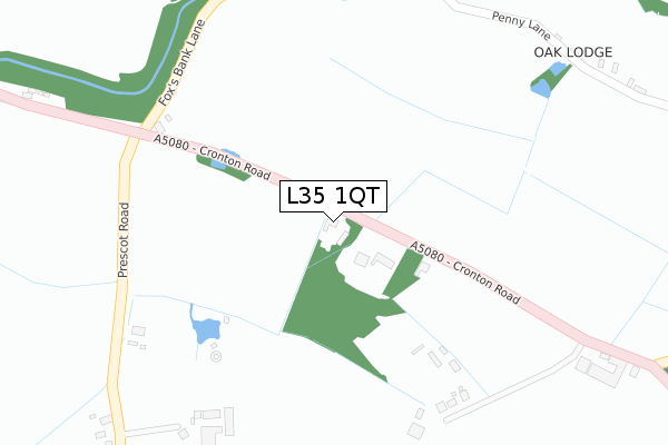
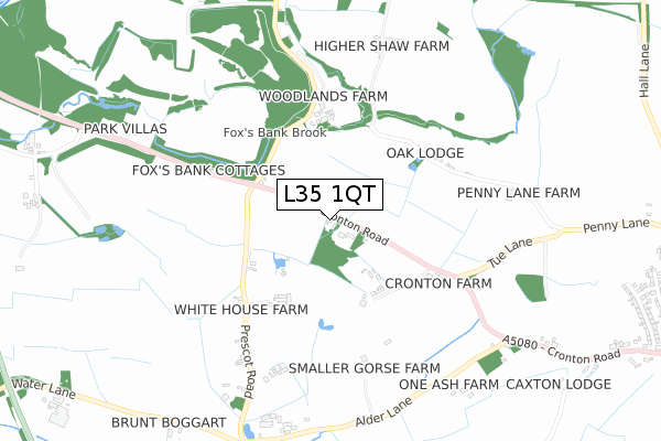
L35 1QT is located in the St Gabriels electoral ward, within the metropolitan district of Knowsley and the English Parliamentary constituency of Knowsley. The Sub Integrated Care Board (ICB) Location is NHS Cheshire and Merseyside ICB - 01J and the police force is Merseyside. This postcode has been in use since December 2019.


GetTheData
Source: OS Open Zoomstack (Ordnance Survey)
Licence: Open Government Licence (requires attribution)
Attribution: Contains OS data © Crown copyright and database right 2024
Source: Open Postcode Geo
Licence: Open Government Licence (requires attribution)
Attribution: Contains OS data © Crown copyright and database right 2024; Contains Royal Mail data © Royal Mail copyright and database right 2024; Source: Office for National Statistics licensed under the Open Government Licence v.3.0
| Easting | 345966 |
| Northing | 389384 |
| Latitude | 53.398519 |
| Longitude | -2.814102 |
GetTheData
Source: Open Postcode Geo
Licence: Open Government Licence
| Country | England |
| Postcode District | L35 |
| ➜ L35 open data dashboard ➜ See where L35 is on a map | |
GetTheData
Source: Land Registry Price Paid Data
Licence: Open Government Licence
| Ward | St Gabriels |
| Constituency | Knowsley |
GetTheData
Source: ONS Postcode Database
Licence: Open Government Licence
| June 2022 | Other theft | On or near Petrol Station | 262m |
| June 2022 | Other crime | On or near Petrol Station | 262m |
| June 2022 | Other theft | On or near M57 | 369m |
| ➜ Get more crime data in our Crime section | |||
GetTheData
Source: data.police.uk
Licence: Open Government Licence
| Wilson Road (Cronton Road) | Whitefield Lane End | 73m |
| Coppice Lane (Cronton Road) | Whitefield Lane End | 157m |
| Wilson Road (Stretton Way) | Huyton Quarry | 268m |
| Wilson Road (Stretton Way) | Huyton Quarry | 292m |
| Whitefield Lane (Cronton Road) | Huyton Quarry | 464m |
| Whiston Station | 2.1km |
| Huyton Station | 2.3km |
| Prescot Station | 3km |
GetTheData
Source: NaPTAN
Licence: Open Government Licence
GetTheData
Source: ONS Postcode Database
Licence: Open Government Licence


➜ Get more ratings from the Food Standards Agency
GetTheData
Source: Food Standards Agency
Licence: FSA terms & conditions
| Last Collection | |||
|---|---|---|---|
| Location | Mon-Fri | Sat | Distance |
| Halsnead Avenue | 16:30 | 11:30 | 801m |
| The Boundary | 17:30 | 12:00 | 895m |
| Huyton Post Office | 17:45 | 12:00 | 2,144m |
GetTheData
Source: Dracos
Licence: Creative Commons Attribution-ShareAlike
| Facility | Distance |
|---|---|
| Village Gym (Liverpool) Fallows Way, Whiston, Prescot Swimming Pool, Health and Fitness Gym, Studio, Squash Courts | 539m |
| Bodytorque Gym (Closed) Wilson Road, Liverpool Health and Fitness Gym | 1.1km |
| Cowper Way Amenity Space Cowper Way, Liverpool Grass Pitches | 1.1km |
GetTheData
Source: Active Places
Licence: Open Government Licence
| School | Phase of Education | Distance |
|---|---|---|
| St Gabriel's CofE Primary School Ellis Ashton Street, Huyton, Liverpool, L36 6BH | Primary | 1.5km |
| Sylvester Primary Academy St John's Road, Huyton, Liverpool, L36 0UX | Primary | 1.5km |
| Willow Tree Primary School Bedford Close, Huyton, Liverpool, L36 1XH | Primary | 1.9km |
GetTheData
Source: Edubase
Licence: Open Government Licence
The below table lists the International Territorial Level (ITL) codes (formerly Nomenclature of Territorial Units for Statistics (NUTS) codes) and Local Administrative Units (LAU) codes for L35 1QT:
| ITL 1 Code | Name |
|---|---|
| TLD | North West (England) |
| ITL 2 Code | Name |
| TLD7 | Merseyside |
| ITL 3 Code | Name |
| TLD71 | East Merseyside |
| LAU 1 Code | Name |
| E08000011 | Knowsley |
GetTheData
Source: ONS Postcode Directory
Licence: Open Government Licence
The below table lists the Census Output Area (OA), Lower Layer Super Output Area (LSOA), and Middle Layer Super Output Area (MSOA) for L35 1QT:
| Code | Name | |
|---|---|---|
| OA | E00032566 | |
| LSOA | E01006424 | Knowsley 017B |
| MSOA | E02001343 | Knowsley 017 |
GetTheData
Source: ONS Postcode Directory
Licence: Open Government Licence
| L36 6AW | Wilson Road | 212m |
| L35 1QL | Sevenoak Grove | 297m |
| L35 1SF | Smithford Walk | 419m |
| L35 1QJ | Cronton Road | 452m |
| L36 0YG | Bridgewater Way | 516m |
| L36 0YE | Bradley Fold | 529m |
| L35 1RN | Roscoe Close | 533m |
| L36 0YF | Bridgewater Way | 552m |
| L36 0YL | Warkworth Close | 556m |
| L36 0YJ | Newsham Road | 560m |
GetTheData
Source: Open Postcode Geo; Land Registry Price Paid Data
Licence: Open Government Licence