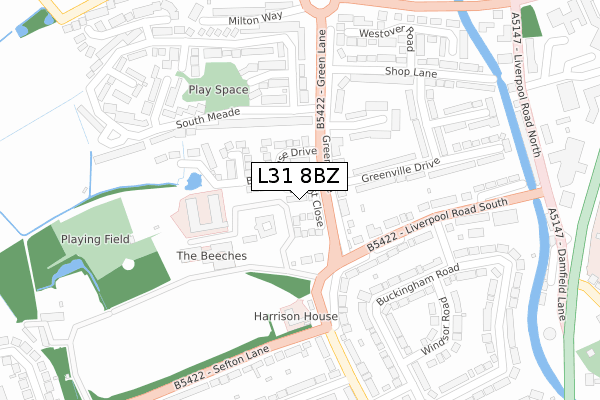
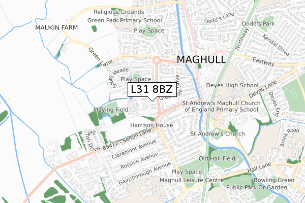
L31 8BZ is located in the Park electoral ward, within the metropolitan district of Sefton and the English Parliamentary constituency of Sefton Central. The Sub Integrated Care Board (ICB) Location is NHS Cheshire and Merseyside ICB - 01T and the police force is Merseyside. This postcode has been in use since November 2018.


GetTheData
Source: OS Open Zoomstack (Ordnance Survey)
Licence: Open Government Licence (requires attribution)
Attribution: Contains OS data © Crown copyright and database right 2024
Source: Open Postcode Geo
Licence: Open Government Licence (requires attribution)
Attribution: Contains OS data © Crown copyright and database right 2024; Contains Royal Mail data © Royal Mail copyright and database right 2024; Source: Office for National Statistics licensed under the Open Government Licence v.3.0
| Easting | 337051 |
| Northing | 402189 |
| Latitude | 53.512611 |
| Longitude | -2.950726 |
GetTheData
Source: Open Postcode Geo
Licence: Open Government Licence
| Country | England |
| Postcode District | L31 |
| ➜ L31 open data dashboard ➜ See where L31 is on a map ➜ Where is Maghull? | |
GetTheData
Source: Land Registry Price Paid Data
Licence: Open Government Licence
| Ward | Park |
| Constituency | Sefton Central |
GetTheData
Source: ONS Postcode Database
Licence: Open Government Licence
2022 14 OCT £365,000 |
9, BARTLETT CLOSE, LIVERPOOL, L31 8BZ 2019 30 OCT £409,995 |
11, BARTLETT CLOSE, LIVERPOOL, L31 8BZ 2019 25 OCT £384,995 |
20, BARTLETT CLOSE, LIVERPOOL, L31 8BZ 2019 18 OCT £384,995 |
10, BARTLETT CLOSE, LIVERPOOL, L31 8BZ 2019 13 SEP £379,995 |
2019 4 JUN £327,995 |
7, BARTLETT CLOSE, LIVERPOOL, L31 8BZ 2019 24 MAY £376,995 |
8, BARTLETT CLOSE, LIVERPOOL, L31 8BZ 2019 24 MAY £405,995 |
6, BARTLETT CLOSE, LIVERPOOL, L31 8BZ 2019 23 MAY £326,995 |
2, BARTLETT CLOSE, LIVERPOOL, L31 8BZ 2019 1 MAR £349,995 |
GetTheData
Source: HM Land Registry Price Paid Data
Licence: Contains HM Land Registry data © Crown copyright and database right 2024. This data is licensed under the Open Government Licence v3.0.
| June 2022 | Violence and sexual offences | On or near Green Lane | 127m |
| June 2022 | Other theft | On or near Windsor Road | 316m |
| June 2022 | Violence and sexual offences | On or near Claremont Avenue | 422m |
| ➜ Get more crime data in our Crime section | |||
GetTheData
Source: data.police.uk
Licence: Open Government Licence
| Liverpool Road South (Green Lane) | Maghull | 72m |
| Balmoral Road (Liverpool Road South) | Maghull | 156m |
| Balmoral Road (Liverpool Road South) | Maghull | 179m |
| Liverpool Road South (Sefton Lane) | Maghull | 232m |
| Shop Lane (Green Lane) | Maghull | 233m |
| Maghull Station | 1.5km |
| Old Roan Station | 2.9km |
| Aintree Station | 4.3km |
GetTheData
Source: NaPTAN
Licence: Open Government Licence
| Percentage of properties with Next Generation Access | 100.0% |
| Percentage of properties with Superfast Broadband | 100.0% |
| Percentage of properties with Ultrafast Broadband | 100.0% |
| Percentage of properties with Full Fibre Broadband | 100.0% |
Superfast Broadband is between 30Mbps and 300Mbps
Ultrafast Broadband is > 300Mbps
| Percentage of properties unable to receive 2Mbps | 0.0% |
| Percentage of properties unable to receive 5Mbps | 0.0% |
| Percentage of properties unable to receive 10Mbps | 0.0% |
| Percentage of properties unable to receive 30Mbps | 0.0% |
GetTheData
Source: Ofcom
Licence: Ofcom Terms of Use (requires attribution)
GetTheData
Source: ONS Postcode Database
Licence: Open Government Licence


➜ Get more ratings from the Food Standards Agency
GetTheData
Source: Food Standards Agency
Licence: FSA terms & conditions
| Last Collection | |||
|---|---|---|---|
| Location | Mon-Fri | Sat | Distance |
| Dodds Lane | 17:30 | 12:00 | 647m |
| Dover Road Post Office | 17:15 | 12:00 | 1,429m |
| Moorhey Road | 17:00 | 12:00 | 1,552m |
GetTheData
Source: Dracos
Licence: Creative Commons Attribution-ShareAlike
| Facility | Distance |
|---|---|
| St. Andrew's Maghull Ce Primary School Deyes Lane, Liverpool Grass Pitches | 557m |
| Anytime Fitness (Maghull) Stafford Moreton Way, Liverpool Health and Fitness Gym, Studio | 580m |
| Maghull High School Ormonde Drive, Liverpool Sports Hall, Health and Fitness Gym, Grass Pitches, Studio, Outdoor Tennis Courts | 653m |
GetTheData
Source: Active Places
Licence: Open Government Licence
| School | Phase of Education | Distance |
|---|---|---|
| Maghull High School Ormonde Drive, Maghull, Liverpool, L31 7AW | Secondary | 700m |
| Deyes High School Deyes Lane, Maghull, Liverpool, L31 6DE | Secondary | 706m |
| St Andrews Church of England Primary School, Maghull Deyes Lane, Maghull, Liverpool, L31 6DE | Primary | 716m |
GetTheData
Source: Edubase
Licence: Open Government Licence
The below table lists the International Territorial Level (ITL) codes (formerly Nomenclature of Territorial Units for Statistics (NUTS) codes) and Local Administrative Units (LAU) codes for L31 8BZ:
| ITL 1 Code | Name |
|---|---|
| TLD | North West (England) |
| ITL 2 Code | Name |
| TLD7 | Merseyside |
| ITL 3 Code | Name |
| TLD73 | Sefton |
| LAU 1 Code | Name |
| E08000014 | Sefton |
GetTheData
Source: ONS Postcode Directory
Licence: Open Government Licence
The below table lists the Census Output Area (OA), Lower Layer Super Output Area (LSOA), and Middle Layer Super Output Area (MSOA) for L31 8BZ:
| Code | Name | |
|---|---|---|
| OA | E00035817 | |
| LSOA | E01007071 | Sefton 020C |
| MSOA | E02001448 | Sefton 020 |
GetTheData
Source: ONS Postcode Directory
Licence: Open Government Licence
| L31 7DA | Green Lane | 97m |
| L31 8AB | Liverpool Road South | 103m |
| L31 7BX | Manor House Close | 160m |
| L31 7DF | Greenville Drive | 166m |
| L31 7DH | Liverpool Road South | 173m |
| L31 7DG | Liverpool Road South | 182m |
| L31 8EH | Glebe Close | 199m |
| L31 8EG | South Meade | 207m |
| L31 7DE | Greenville Drive | 225m |
| L31 8EF | South Meade | 229m |
GetTheData
Source: Open Postcode Geo; Land Registry Price Paid Data
Licence: Open Government Licence