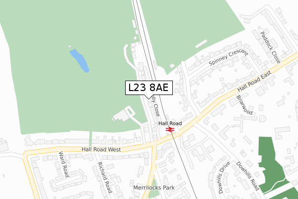
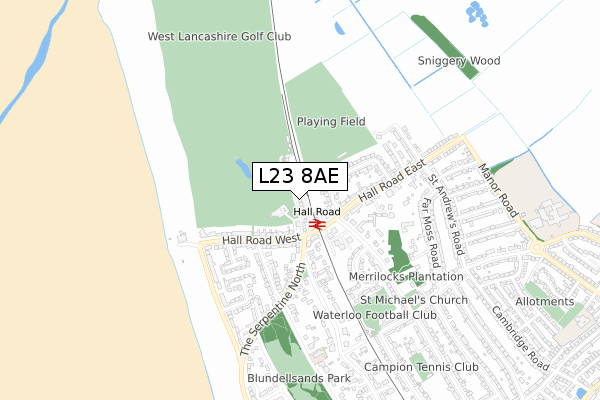
L23 8AE is located in the Blundellsands electoral ward, within the metropolitan district of Sefton and the English Parliamentary constituency of Sefton Central. The Sub Integrated Care Board (ICB) Location is NHS Cheshire and Merseyside ICB - 01T and the police force is Merseyside. This postcode has been in use since February 2019.


GetTheData
Source: OS Open Zoomstack (Ordnance Survey)
Licence: Open Government Licence (requires attribution)
Attribution: Contains OS data © Crown copyright and database right 2024
Source: Open Postcode Geo
Licence: Open Government Licence (requires attribution)
Attribution: Contains OS data © Crown copyright and database right 2024; Contains Royal Mail data © Royal Mail copyright and database right 2024; Source: Office for National Statistics licensed under the Open Government Licence v.3.0
| Easting | 330393 |
| Northing | 400725 |
| Latitude | 53.498614 |
| Longitude | -3.050783 |
GetTheData
Source: Open Postcode Geo
Licence: Open Government Licence
| Country | England |
| Postcode District | L23 |
| ➜ L23 open data dashboard ➜ See where L23 is on a map ➜ Where is Crosby? | |
GetTheData
Source: Land Registry Price Paid Data
Licence: Open Government Licence
| Ward | Blundellsands |
| Constituency | Sefton Central |
GetTheData
Source: ONS Postcode Database
Licence: Open Government Licence
2022 11 MAR £750,000 |
1, FOLLY CLOSE, LIVERPOOL, L23 8AE 2021 30 APR £679,750 |
9, FOLLY CLOSE, LIVERPOOL, L23 8AE 2021 16 JAN £679,750 |
11, FOLLY CLOSE, LIVERPOOL, L23 8AE 2020 24 JUL £640,750 |
8, FOLLY CLOSE, LIVERPOOL, L23 8AE 2020 24 JUL £679,750 |
7, FOLLY CLOSE, LIVERPOOL, L23 8AE 2020 12 JUN £640,750 |
3, FOLLY CLOSE, LIVERPOOL, L23 8AE 2019 20 DEC £679,750 |
12, FOLLY CLOSE, LIVERPOOL, L23 8AE 2019 6 DEC £640,750 |
2, FOLLY CLOSE, LIVERPOOL, L23 8AE 2019 1 NOV £724,750 |
5, FOLLY CLOSE, LIVERPOOL, L23 8AE 2019 8 OCT £724,750 |
GetTheData
Source: HM Land Registry Price Paid Data
Licence: Contains HM Land Registry data © Crown copyright and database right 2024. This data is licensed under the Open Government Licence v3.0.
| June 2022 | Public order | On or near Dowhills Park | 238m |
| June 2022 | Drugs | On or near Dowhills Park | 238m |
| June 2022 | Bicycle theft | On or near Ward Road | 375m |
| ➜ Get more crime data in our Crime section | |||
GetTheData
Source: data.police.uk
Licence: Open Government Licence
| Hall Road East (Dowhills Road) | Crosby | 210m |
| Hall Road East (Dowhills Road) | Crosby | 230m |
| The Serpentine North (Hall Road West) | Blundellsands | 236m |
| Halltine Close (The Serpentine North) | Blundellsands | 248m |
| Hall Road West | Blundellsands | 275m |
| Hall Road Station | 0.1km |
| Blundellsands & Crosby Station | 1.4km |
| Hightown Station | 3km |
GetTheData
Source: NaPTAN
Licence: Open Government Licence
GetTheData
Source: ONS Postcode Database
Licence: Open Government Licence


➜ Get more ratings from the Food Standards Agency
GetTheData
Source: Food Standards Agency
Licence: FSA terms & conditions
| Last Collection | |||
|---|---|---|---|
| Location | Mon-Fri | Sat | Distance |
| Merrilocks Road | 17:15 | 12:00 | 273m |
| Crescent Road Blundellsands | 17:15 | 12:00 | 701m |
| St Michaels Road | 17:15 | 12:00 | 712m |
GetTheData
Source: Dracos
Licence: Creative Commons Attribution-ShareAlike
| Facility | Distance |
|---|---|
| West Lancashire Golf Club Hall Road West, Blundellsands Golf | 108m |
| Merchant Taylors School Playing Fields Spinney Crescent, Crosby Grass Pitches | 187m |
| Blundellsands Lawn Tennis Club Warren Road, Warren Road, Liverpool Outdoor Tennis Courts | 916m |
GetTheData
Source: Active Places
Licence: Open Government Licence
| School | Phase of Education | Distance |
|---|---|---|
| St Michael's Church of England High School St Michael's Road, Crosby, L23 7UL | Secondary | 1.1km |
| Valewood Primary School Sherwood Avenue, Crosby, Liverpool, L23 7YG | Primary | 1.3km |
| Ursuline Catholic Primary School Nicholas Road, Liverpool, L23 6TT | Primary | 1.4km |
GetTheData
Source: Edubase
Licence: Open Government Licence
The below table lists the International Territorial Level (ITL) codes (formerly Nomenclature of Territorial Units for Statistics (NUTS) codes) and Local Administrative Units (LAU) codes for L23 8AE:
| ITL 1 Code | Name |
|---|---|
| TLD | North West (England) |
| ITL 2 Code | Name |
| TLD7 | Merseyside |
| ITL 3 Code | Name |
| TLD73 | Sefton |
| LAU 1 Code | Name |
| E08000014 | Sefton |
GetTheData
Source: ONS Postcode Directory
Licence: Open Government Licence
The below table lists the Census Output Area (OA), Lower Layer Super Output Area (LSOA), and Middle Layer Super Output Area (MSOA) for L23 8AE:
| Code | Name | |
|---|---|---|
| OA | E00035168 | |
| LSOA | E01006938 | Sefton 022C |
| MSOA | E02001450 | Sefton 022 |
GetTheData
Source: ONS Postcode Directory
Licence: Open Government Licence
| L23 8SZ | Hall Road West | 117m |
| L23 8RA | Hall Road West | 121m |
| L23 6XX | Halltine Close | 188m |
| L23 8ST | Dowhills Park | 213m |
| L23 8TZ | Spinney Crescent | 232m |
| L23 8TY | Spinney Crescent | 247m |
| L23 8SS | Dowhills Park | 270m |
| L23 8SR | Dowhills Park | 283m |
| L23 8SX | Hall Road West | 292m |
| L23 8TF | Richard Road | 304m |
GetTheData
Source: Open Postcode Geo; Land Registry Price Paid Data
Licence: Open Government Licence