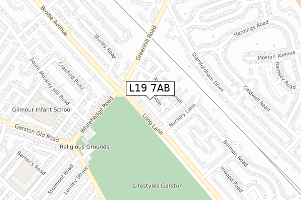
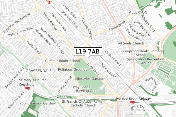
L19 7AB is located in the Garston electoral ward, within the metropolitan district of Liverpool and the English Parliamentary constituency of Garston and Halewood. The Sub Integrated Care Board (ICB) Location is NHS Cheshire and Merseyside ICB - 99A and the police force is Merseyside. This postcode has been in use since August 2017.


GetTheData
Source: OS Open Zoomstack (Ordnance Survey)
Licence: Open Government Licence (requires attribution)
Attribution: Contains OS data © Crown copyright and database right 2025
Source: Open Postcode Geo
Licence: Open Government Licence (requires attribution)
Attribution: Contains OS data © Crown copyright and database right 2025; Contains Royal Mail data © Royal Mail copyright and database right 2025; Source: Office for National Statistics licensed under the Open Government Licence v.3.0
| Easting | 340252 |
| Northing | 385455 |
| Latitude | 53.362591 |
| Longitude | -2.899281 |
GetTheData
Source: Open Postcode Geo
Licence: Open Government Licence
| Country | England |
| Postcode District | L19 |
➜ See where L19 is on a map ➜ Where is Liverpool? | |
GetTheData
Source: Land Registry Price Paid Data
Licence: Open Government Licence
| Ward | Garston |
| Constituency | Garston And Halewood |
GetTheData
Source: ONS Postcode Database
Licence: Open Government Licence
2024 28 NOV £390,000 |
2024 23 OCT £345,000 |
2023 28 JUL £335,000 |
2023 20 FEB £400,000 |
2020 16 OCT £262,000 |
2018 6 APR £299,750 |
15, EGRET CLOSE, LIVERPOOL, L19 7AB 2018 5 APR £276,750 |
21, EGRET CLOSE, LIVERPOOL, L19 7AB 2018 29 MAR £231,750 |
23, EGRET CLOSE, LIVERPOOL, L19 7AB 2018 29 MAR £254,750 |
9, EGRET CLOSE, LIVERPOOL, L19 7AB 2018 29 MAR £254,750 |
GetTheData
Source: HM Land Registry Price Paid Data
Licence: Contains HM Land Registry data © Crown copyright and database right 2025. This data is licensed under the Open Government Licence v3.0.
| Greenhill Road (Brodie Avenue) | Aigburth | 132m |
| Shirley Road (Brodie Avenue) | Aigburth | 150m |
| South Mossley Hill Road (Whitehedge Road) | Grassendale | 261m |
| Dinesen Road (Long Lane) | Garston | 319m |
| Dinesan Road (Long Lane) | Garston | 327m |
| Liverpool South Parkway Station | 0.9km |
| West Allerton Station | 0.9km |
| Cressington Station | 0.9km |
GetTheData
Source: NaPTAN
Licence: Open Government Licence
| Percentage of properties with Next Generation Access | 100.0% |
| Percentage of properties with Superfast Broadband | 100.0% |
| Percentage of properties with Ultrafast Broadband | 0.0% |
| Percentage of properties with Full Fibre Broadband | 0.0% |
Superfast Broadband is between 30Mbps and 300Mbps
Ultrafast Broadband is > 300Mbps
| Median download speed | 41.3Mbps |
| Average download speed | 39.2Mbps |
| Maximum download speed | 77.97Mbps |
| Median upload speed | 10.0Mbps |
| Average upload speed | 9.5Mbps |
| Maximum upload speed | 20.00Mbps |
| Percentage of properties unable to receive 2Mbps | 0.0% |
| Percentage of properties unable to receive 5Mbps | 0.0% |
| Percentage of properties unable to receive 10Mbps | 0.0% |
| Percentage of properties unable to receive 30Mbps | 0.0% |
GetTheData
Source: Ofcom
Licence: Ofcom Terms of Use (requires attribution)
GetTheData
Source: ONS Postcode Database
Licence: Open Government Licence


➜ Get more ratings from the Food Standards Agency
GetTheData
Source: Food Standards Agency
Licence: FSA terms & conditions
| Last Collection | |||
|---|---|---|---|
| Location | Mon-Fri | Sat | Distance |
| Whitehedge Road | 17:00 | 12:00 | 121m |
| Garston Old Road | 17:15 | 12:00 | 308m |
| Burman Road | 17:00 | 12:00 | 337m |
GetTheData
Source: Dracos
Licence: Creative Commons Attribution-ShareAlike
The below table lists the International Territorial Level (ITL) codes (formerly Nomenclature of Territorial Units for Statistics (NUTS) codes) and Local Administrative Units (LAU) codes for L19 7AB:
| ITL 1 Code | Name |
|---|---|
| TLD | North West (England) |
| ITL 2 Code | Name |
| TLD7 | Merseyside |
| ITL 3 Code | Name |
| TLD72 | Liverpool |
| LAU 1 Code | Name |
| E08000012 | Liverpool |
GetTheData
Source: ONS Postcode Directory
Licence: Open Government Licence
The below table lists the Census Output Area (OA), Lower Layer Super Output Area (LSOA), and Middle Layer Super Output Area (MSOA) for L19 7AB:
| Code | Name | |
|---|---|---|
| OA | E00034170 | |
| LSOA | E01006742 | Liverpool 057B |
| MSOA | E02001403 | Liverpool 057 |
GetTheData
Source: ONS Postcode Directory
Licence: Open Government Licence
| L19 6PQ | Long Lane | 28m |
| L19 6PR | Nursery Lane | 110m |
| L19 7NY | Greenhill Road | 134m |
| L19 4XE | Stamfordham Drive | 191m |
| L19 6PG | Long Lane | 211m |
| L19 7NA | Whitehedge Road | 212m |
| L19 6PS | Burman Crescent | 217m |
| L19 4XB | Stamfordham Drive | 224m |
| L19 6PN | Burman Road | 244m |
| L19 7NU | Shirley Road | 263m |
GetTheData
Source: Open Postcode Geo; Land Registry Price Paid Data
Licence: Open Government Licence