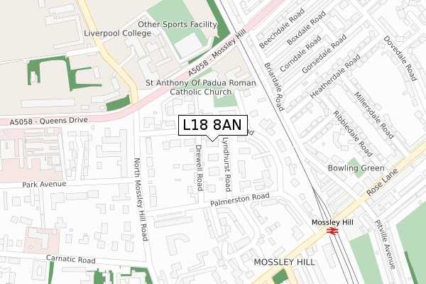
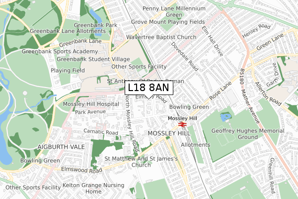
L18 8AN is located in the Greenbank Park electoral ward, within the metropolitan district of Liverpool and the English Parliamentary constituency of Liverpool, Riverside. The Sub Integrated Care Board (ICB) Location is NHS Cheshire and Merseyside ICB - 99A and the police force is Merseyside. This postcode has been in use since May 2018.


GetTheData
Source: OS Open Zoomstack (Ordnance Survey)
Licence: Open Government Licence (requires attribution)
Attribution: Contains OS data © Crown copyright and database right 2024
Source: Open Postcode Geo
Licence: Open Government Licence (requires attribution)
Attribution: Contains OS data © Crown copyright and database right 2024; Contains Royal Mail data © Royal Mail copyright and database right 2024; Source: Office for National Statistics licensed under the Open Government Licence v.3.0
| Easting | 338926 |
| Northing | 387514 |
| Latitude | 53.380944 |
| Longitude | -2.919603 |
GetTheData
Source: Open Postcode Geo
Licence: Open Government Licence
| Country | England |
| Postcode District | L18 |
| ➜ L18 open data dashboard ➜ See where L18 is on a map ➜ Where is Liverpool? | |
GetTheData
Source: Land Registry Price Paid Data
Licence: Open Government Licence
| Ward | Greenbank Park |
| Constituency | Liverpool, Riverside |
GetTheData
Source: ONS Postcode Database
Licence: Open Government Licence
| October 2023 | Burglary | On or near Lyndhurst Avenue | 251m |
| April 2023 | Anti-social behaviour | On or near Lyndhurst Avenue | 251m |
| December 2022 | Burglary | On or near Crawford Park | 315m |
| ➜ Get more crime data in our Crime section | |||
GetTheData
Source: data.police.uk
Licence: Open Government Licence
| Palmerston Close (Palmerston Road) | Mossley Hill | 146m |
| Mossley Hill Road (Queens Drive) | Mossley Hill | 173m |
| North Mossley Hill Road (Queens Drive) | Mossley Hill | 181m |
| Park Avenue (North Mossley Hill Road) | Mossley Hill | 196m |
| Park Avenue (North Mossley Hill Road) | Mossley Hill | 198m |
| Mossley Hill Station | 0.3km |
| West Allerton Station | 1.6km |
| Aigburth Station | 1.9km |
GetTheData
Source: NaPTAN
Licence: Open Government Licence
GetTheData
Source: ONS Postcode Database
Licence: Open Government Licence


➜ Get more ratings from the Food Standards Agency
GetTheData
Source: Food Standards Agency
Licence: FSA terms & conditions
| Last Collection | |||
|---|---|---|---|
| Location | Mon-Fri | Sat | Distance |
| Elmsley Road | 17:15 | 12:00 | 168m |
| Mossley Hill Delivery Office | 17:30 | 12:00 | 433m |
| Rose Lane | 17:30 | 12:00 | 439m |
GetTheData
Source: Dracos
Licence: Creative Commons Attribution-ShareAlike
| Facility | Distance |
|---|---|
| Sports Direct Fitness (Liverpool) Rose Lane, Liverpool Swimming Pool, Health and Fitness Gym, Studio | 373m |
| Liverpool College (Lc Sports) Queens Drive, Mossley Hill, Liverpool Sports Hall, Health and Fitness Gym, Artificial Grass Pitch, Studio | 374m |
| Palmerston Tennis Club Elm Hall Drive, Liverpool Outdoor Tennis Courts | 674m |
GetTheData
Source: Active Places
Licence: Open Government Licence
| School | Phase of Education | Distance |
|---|---|---|
| St Anthony of Padua Catholic Primary School Sands Road Off Elmsley Road, Mossley Hill, Liverpool, L18 8BD | Primary | 160m |
| Liverpool College Queen's Drive, Mossley Hill, Liverpool, L18 8BG | All-through | 269m |
| Dovedale Community Primary School Herondale Road, Liverpool, L18 1JX | Primary | 508m |
GetTheData
Source: Edubase
Licence: Open Government Licence
The below table lists the International Territorial Level (ITL) codes (formerly Nomenclature of Territorial Units for Statistics (NUTS) codes) and Local Administrative Units (LAU) codes for L18 8AN:
| ITL 1 Code | Name |
|---|---|
| TLD | North West (England) |
| ITL 2 Code | Name |
| TLD7 | Merseyside |
| ITL 3 Code | Name |
| TLD72 | Liverpool |
| LAU 1 Code | Name |
| E08000012 | Liverpool |
GetTheData
Source: ONS Postcode Directory
Licence: Open Government Licence
The below table lists the Census Output Area (OA), Lower Layer Super Output Area (LSOA), and Middle Layer Super Output Area (MSOA) for L18 8AN:
| Code | Name | |
|---|---|---|
| OA | E00033076 | |
| LSOA | E01006524 | Liverpool 048B |
| MSOA | E02001394 | Liverpool 048 |
GetTheData
Source: ONS Postcode Directory
Licence: Open Government Licence
| L18 8AZ | Elmsley Road | 82m |
| L18 8AT | Drewell Road | 91m |
| L18 8AU | Lyndhurst Road | 94m |
| L18 8AF | Lyndhurst Road | 108m |
| L18 8DS | Mosslea Park | 120m |
| L18 8BA | Elmsley Court | 120m |
| L18 8AY | Elmsley Road | 137m |
| L18 8BD | Sands Road | 141m |
| L18 8AP | Palmerston Court | 152m |
| L18 8BJ | North Mossley Hill Road | 153m |
GetTheData
Source: Open Postcode Geo; Land Registry Price Paid Data
Licence: Open Government Licence