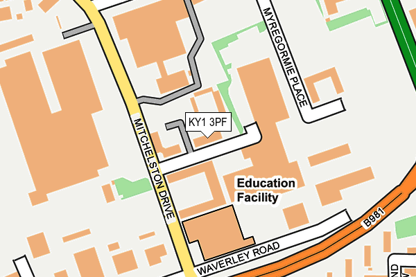
KY1 3PF is located in the Kirkcaldy East electoral ward, within the council area of Fife and the Scottish Parliamentary constituency of Kirkcaldy and Cowdenbeath. The Community Health Partnership is Kirkcaldy & Levenmouth Community Health Partnership and the police force is Scotland. This postcode has been in use since February 2012.


GetTheData
Source: OS OpenMap – Local (Ordnance Survey)
Source: OS VectorMap District (Ordnance Survey)
Licence: Open Government Licence (requires attribution)
| Easting | 329351 |
| Northing | 694382 |
| Latitude | 56.136898 |
| Longitude | -3.138382 |
GetTheData
Source: Open Postcode Geo
Licence: Open Government Licence
| Country | Scotland |
| Postcode District | KY1 |
| ➜ KY1 open data dashboard ➜ See where KY1 is on a map ➜ Where is Kirkcaldy? | |
GetTheData
Source: Land Registry Price Paid Data
Licence: Open Government Licence
| Ward | Kirkcaldy East |
| Constituency | Kirkcaldy And Cowdenbeath |
GetTheData
Source: ONS Postcode Database
Licence: Open Government Licence
| Mitchelston Estate (Dunnikier Way) | Dunnikier Estate | 200m |
| Mitchelston Estate (Dunnikier Way) | Dunnikier Estate | 235m |
| Merchant Place (Mitchelston Dr) | Mitchelston | 258m |
| Merchant Place (Mitchelston Drive) | Mitchelston | 275m |
| Pottery Street (Oswald Road) | Gallatown | 279m |
| Glenrothes with Thornton Station | 2.8km |
| Kirkcaldy Station | 3.3km |
GetTheData
Source: NaPTAN
Licence: Open Government Licence
GetTheData
Source: ONS Postcode Database
Licence: Open Government Licence


➜ Get more ratings from the Food Standards Agency
GetTheData
Source: Food Standards Agency
Licence: FSA terms & conditions
| Last Collection | |||
|---|---|---|---|
| Location | Mon-Fri | Sat | Distance |
| Pathhead Post Office | 16:00 | 12:15 | 1,691m |
| Victoria Hosptial | 16:30 | 11:15 | 1,831m |
| Overton Mains | 16:15 | 11:30 | 2,177m |
GetTheData
Source: Dracos
Licence: Creative Commons Attribution-ShareAlike
The below table lists the International Territorial Level (ITL) codes (formerly Nomenclature of Territorial Units for Statistics (NUTS) codes) and Local Administrative Units (LAU) codes for KY1 3PF:
| ITL 1 Code | Name |
|---|---|
| TLM | Scotland |
| ITL 2 Code | Name |
| TLM7 | Eastern Scotland |
| ITL 3 Code | Name |
| TLM72 | Clackmannanshire and Fife |
| LAU 1 Code | Name |
| S30000042 | Fife |
GetTheData
Source: ONS Postcode Directory
Licence: Open Government Licence
The below table lists the Census Output Area (OA), Lower Layer Super Output Area (LSOA), and Middle Layer Super Output Area (MSOA) for KY1 3PF:
| Code | Name | |
|---|---|---|
| OA | S00111338 | |
| LSOA | S01009531 | Mitchelston and Randolph |
| MSOA | S02001795 | Kirkcaldy Gallatown and Sinclairtown |
GetTheData
Source: ONS Postcode Directory
Licence: Open Government Licence