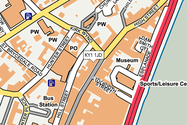
KY1 1JD is located in the Kirkcaldy Central electoral ward, within the council area of Fife and the Scottish Parliamentary constituency of Kirkcaldy and Cowdenbeath. The Community Health Partnership is Kirkcaldy & Levenmouth Community Health Partnership and the police force is Scotland. This postcode has been in use since January 1980.


GetTheData
Source: OS OpenMap – Local (Ordnance Survey)
Source: OS VectorMap District (Ordnance Survey)
Licence: Open Government Licence (requires attribution)
| Easting | 328078 |
| Northing | 691565 |
| Latitude | 56.111398 |
| Longitude | -3.158101 |
GetTheData
Source: Open Postcode Geo
Licence: Open Government Licence
| Country | Scotland |
| Postcode District | KY1 |
| ➜ KY1 open data dashboard ➜ See where KY1 is on a map ➜ Where is Kirkcaldy? | |
GetTheData
Source: Land Registry Price Paid Data
Licence: Open Government Licence
| Ward | Kirkcaldy Central |
| Constituency | Kirkcaldy And Cowdenbeath |
GetTheData
Source: ONS Postcode Database
Licence: Open Government Licence
| St Peter's Church (St Brycedale Avenue) | Kirkcaldy | 232m |
| St Brycedale Campus (Carlyle Road) | Kirkcaldy | 261m |
| Car Drop-off Point (Hunter St) | Kirkcaldy | 269m |
| Oswald's Wynd (Townsend Place) | Kirkcaldy | 287m |
| Whytescauseway (High Street) | Linktown | 330m |
| Kirkcaldy Station | 0.6km |
| Kinghorn Station | 4.8km |
GetTheData
Source: NaPTAN
Licence: Open Government Licence
| Median download speed | 22.4Mbps |
| Average download speed | 19.7Mbps |
| Maximum download speed | 23.44Mbps |
| Median upload speed | 1.2Mbps |
| Average upload speed | 1.2Mbps |
| Maximum upload speed | 1.28Mbps |
GetTheData
Source: Ofcom
Licence: Ofcom Terms of Use (requires attribution)
GetTheData
Source: ONS Postcode Database
Licence: Open Government Licence


➜ Get more ratings from the Food Standards Agency
GetTheData
Source: Food Standards Agency
Licence: FSA terms & conditions
| Last Collection | |||
|---|---|---|---|
| Location | Mon-Fri | Sat | Distance |
| Kirk Wynd | 17:15 | 12:00 | 31m |
| Townsend Place | 17:15 | 11:45 | 215m |
| Hunter Place | 18:30 | 12:15 | 283m |
GetTheData
Source: Dracos
Licence: Creative Commons Attribution-ShareAlike
The below table lists the International Territorial Level (ITL) codes (formerly Nomenclature of Territorial Units for Statistics (NUTS) codes) and Local Administrative Units (LAU) codes for KY1 1JD:
| ITL 1 Code | Name |
|---|---|
| TLM | Scotland |
| ITL 2 Code | Name |
| TLM7 | Eastern Scotland |
| ITL 3 Code | Name |
| TLM72 | Clackmannanshire and Fife |
| LAU 1 Code | Name |
| S30000042 | Fife |
GetTheData
Source: ONS Postcode Directory
Licence: Open Government Licence
The below table lists the Census Output Area (OA), Lower Layer Super Output Area (LSOA), and Middle Layer Super Output Area (MSOA) for KY1 1JD:
| Code | Name | |
|---|---|---|
| OA | S00109950 | |
| LSOA | S01009479 | Kirkcaldy Central |
| MSOA | S02001784 | Kirkcaldy Central |
GetTheData
Source: ONS Postcode Directory
Licence: Open Government Licence