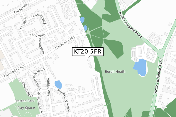
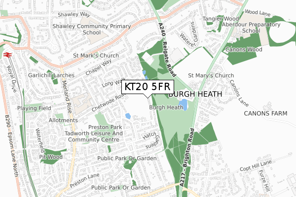
KT20 5FR is located in the Tattenham Corner & Preston electoral ward, within the local authority district of Reigate and Banstead and the English Parliamentary constituency of Reigate. The Sub Integrated Care Board (ICB) Location is NHS Surrey Heartlands ICB - 92A and the police force is Surrey. This postcode has been in use since November 2019.


GetTheData
Source: OS Open Zoomstack (Ordnance Survey)
Licence: Open Government Licence (requires attribution)
Attribution: Contains OS data © Crown copyright and database right 2024
Source: Open Postcode Geo
Licence: Open Government Licence (requires attribution)
Attribution: Contains OS data © Crown copyright and database right 2024; Contains Royal Mail data © Royal Mail copyright and database right 2024; Source: Office for National Statistics licensed under the Open Government Licence v.3.0
| Easting | 523730 |
| Northing | 157736 |
| Latitude | 51.305302 |
| Longitude | -0.226377 |
GetTheData
Source: Open Postcode Geo
Licence: Open Government Licence
| Country | England |
| Postcode District | KT20 |
| ➜ KT20 open data dashboard ➜ See where KT20 is on a map ➜ Where is Tadworth? | |
GetTheData
Source: Land Registry Price Paid Data
Licence: Open Government Licence
| Ward | Tattenham Corner & Preston |
| Constituency | Reigate |
GetTheData
Source: ONS Postcode Database
Licence: Open Government Licence
14, BEATRICE SQUARE, TADWORTH, KT20 5FR 2021 17 DEC £610,000 |
11, BEATRICE SQUARE, TADWORTH, KT20 5FR 2021 23 SEP £650,000 |
32, BEATRICE SQUARE, TADWORTH, KT20 5FR 2020 6 NOV £595,000 |
GetTheData
Source: HM Land Registry Price Paid Data
Licence: Contains HM Land Registry data © Crown copyright and database right 2024. This data is licensed under the Open Government Licence v3.0.
| September 2023 | Violence and sexual offences | On or near Ferriers Way | 353m |
| May 2023 | Violence and sexual offences | On or near Ferriers Way | 353m |
| March 2023 | Anti-social behaviour | On or near Ferriers Way | 353m |
| ➜ Get more crime data in our Crime section | |||
GetTheData
Source: data.police.uk
Licence: Open Government Licence
| Longmere Gardens (Marbles Way) | Burgh Heath | 195m |
| Merefield Gardens (Marbles Way) | Burgh Heath | 200m |
| Longmere Gardens (Marbles Way) | Burgh Heath | 207m |
| Merefield Gardens (Marbles Way) | Burgh Heath | 224m |
| Hatch Gardens (Marbles Way) | Burgh Heath | 351m |
| Tattenham Corner Station | 1.2km |
| Kingswood Station | 1.6km |
| Tadworth Station | 1.7km |
GetTheData
Source: NaPTAN
Licence: Open Government Licence
GetTheData
Source: ONS Postcode Database
Licence: Open Government Licence


➜ Get more ratings from the Food Standards Agency
GetTheData
Source: Food Standards Agency
Licence: FSA terms & conditions
| Last Collection | |||
|---|---|---|---|
| Location | Mon-Fri | Sat | Distance |
| Broad Walk | 17:15 | 12:00 | 257m |
| Burgh Heath Post Office | 17:15 | 12:30 | 511m |
| Chapel Way | 17:15 | 12:15 | 554m |
GetTheData
Source: Dracos
Licence: Creative Commons Attribution-ShareAlike
| Facility | Distance |
|---|---|
| Banstead Athletic Fc Merland Rise, Tadworth Grass Pitches | 578m |
| Banstead Sports Centre (Closed) Merland Rise, Tadworth Swimming Pool, Health and Fitness Gym, Studio, Squash Courts | 578m |
| Tadworth Leisure And Community Centre Preston Manor Road, Tadworth Health and Fitness Gym, Swimming Pool, Studio, Sports Hall, Artificial Grass Pitch | 579m |
GetTheData
Source: Active Places
Licence: Open Government Licence
| School | Phase of Education | Distance |
|---|---|---|
| Epsom Downs Community School & Early Years Centres St Leonard's Road, Epsom Downs, KT18 5RJ | Primary | 467m |
| Shawley Community Primary Academy Shawley Way, Tattenham Corner, Epsom Downs, Epsom, KT18 5PD | Primary | 807m |
| Aberdour Preparatory School Brighton Road, Burgh Heath, Tadworth, KT20 6AJ | Not applicable | 1km |
GetTheData
Source: Edubase
Licence: Open Government Licence
The below table lists the International Territorial Level (ITL) codes (formerly Nomenclature of Territorial Units for Statistics (NUTS) codes) and Local Administrative Units (LAU) codes for KT20 5FR:
| ITL 1 Code | Name |
|---|---|
| TLJ | South East (England) |
| ITL 2 Code | Name |
| TLJ2 | Surrey, East and West Sussex |
| ITL 3 Code | Name |
| TLJ26 | East Surrey |
| LAU 1 Code | Name |
| E07000211 | Reigate and Banstead |
GetTheData
Source: ONS Postcode Directory
Licence: Open Government Licence
The below table lists the Census Output Area (OA), Lower Layer Super Output Area (LSOA), and Middle Layer Super Output Area (MSOA) for KT20 5FR:
| Code | Name | |
|---|---|---|
| OA | E00156105 | |
| LSOA | E01030609 | Reigate and Banstead 005B |
| MSOA | E02006379 | Reigate and Banstead 005 |
GetTheData
Source: ONS Postcode Directory
Licence: Open Government Licence
| KT20 5LU | De Burgh Gardens | 132m |
| KT20 5PL | Chetwode Road | 138m |
| KT20 5LL | Marbles Way | 156m |
| KT20 5PH | Chetwode Road | 191m |
| KT20 5LW | Marbles Way | 198m |
| KT18 5TR | Broad Walk | 216m |
| KT20 5LH | De Burgh Gardens | 220m |
| KT18 5TP | Long Walk | 234m |
| KT18 5TW | Long Walk | 234m |
| KT20 5LJ | Merton Gardens | 237m |
GetTheData
Source: Open Postcode Geo; Land Registry Price Paid Data
Licence: Open Government Licence