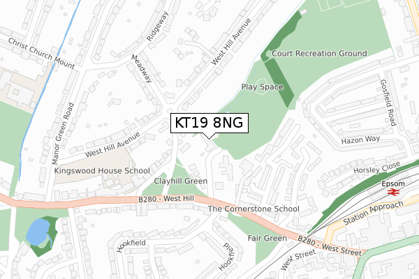
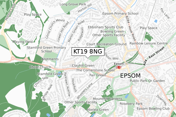
KT19 8NG is located in the Town electoral ward, within the local authority district of Epsom and Ewell and the English Parliamentary constituency of Epsom and Ewell. The Sub Integrated Care Board (ICB) Location is NHS Surrey Heartlands ICB - 92A and the police force is Surrey. This postcode has been in use since January 2019.


GetTheData
Source: OS Open Zoomstack (Ordnance Survey)
Licence: Open Government Licence (requires attribution)
Attribution: Contains OS data © Crown copyright and database right 2024
Source: Open Postcode Geo
Licence: Open Government Licence (requires attribution)
Attribution: Contains OS data © Crown copyright and database right 2024; Contains Royal Mail data © Royal Mail copyright and database right 2024; Source: Office for National Statistics licensed under the Open Government Licence v.3.0
| Easting | 520225 |
| Northing | 161009 |
| Latitude | 51.335470 |
| Longitude | -0.275532 |
GetTheData
Source: Open Postcode Geo
Licence: Open Government Licence
| Country | England |
| Postcode District | KT19 |
| ➜ KT19 open data dashboard ➜ See where KT19 is on a map ➜ Where is Epsom? | |
GetTheData
Source: Land Registry Price Paid Data
Licence: Open Government Licence
| Ward | Town |
| Constituency | Epsom And Ewell |
GetTheData
Source: ONS Postcode Database
Licence: Open Government Licence
| January 2024 | Public order | On or near Parking Area | 490m |
| January 2024 | Violence and sexual offences | On or near Parking Area | 490m |
| January 2024 | Other theft | On or near Parking Area | 490m |
| ➜ Get more crime data in our Crime section | |||
GetTheData
Source: data.police.uk
Licence: Open Government Licence
| Meadway (West Hill) | Epsom | 237m |
| Meadway (West Hill) | Epsom | 247m |
| Manor House Court (West Street) | Epsom | 391m |
| West Street | Epsom | 404m |
| Clock Tower (High Street) | Epsom | 478m |
| Epsom Station | 0.5km |
| Ewell West Station | 2.1km |
| Ewell East Station | 2.6km |
GetTheData
Source: NaPTAN
Licence: Open Government Licence
| Percentage of properties with Next Generation Access | 100.0% |
| Percentage of properties with Superfast Broadband | 100.0% |
| Percentage of properties with Ultrafast Broadband | 100.0% |
| Percentage of properties with Full Fibre Broadband | 0.0% |
Superfast Broadband is between 30Mbps and 300Mbps
Ultrafast Broadband is > 300Mbps
| Percentage of properties unable to receive 2Mbps | 0.0% |
| Percentage of properties unable to receive 5Mbps | 0.0% |
| Percentage of properties unable to receive 10Mbps | 0.0% |
| Percentage of properties unable to receive 30Mbps | 0.0% |
GetTheData
Source: Ofcom
Licence: Ofcom Terms of Use (requires attribution)
GetTheData
Source: ONS Postcode Database
Licence: Open Government Licence


➜ Get more ratings from the Food Standards Agency
GetTheData
Source: Food Standards Agency
Licence: FSA terms & conditions
| Last Collection | |||
|---|---|---|---|
| Location | Mon-Fri | Sat | Distance |
| Hookfield | 17:00 | 12:00 | 203m |
| Parklawn Avenue | 17:00 | 12:00 | 358m |
| Gosfield Road | 18:30 | 12:30 | 436m |
GetTheData
Source: Dracos
Licence: Creative Commons Attribution-ShareAlike
| Facility | Distance |
|---|---|
| Kingswood House School West Hill, Epsom Grass Pitches, Sports Hall, Artificial Grass Pitch | 226m |
| Gym In The Park (Closed) Pound Lane, Epsom Health and Fitness Gym | 381m |
| Puregym (Epsom) High Street, Epsom Studio, Health and Fitness Gym | 462m |
GetTheData
Source: Active Places
Licence: Open Government Licence
| School | Phase of Education | Distance |
|---|---|---|
| Kingswood House School 56 West Hill, Epsom, KT19 8LG | Not applicable | 226m |
| Stamford Green Primary School and Nursery Christ Church Mount, Epsom, KT19 8LU | Primary | 455m |
| St Joseph's Catholic Primary School Rosebank, West Street, Epsom, KT18 7RT | Primary | 590m |
GetTheData
Source: Edubase
Licence: Open Government Licence
The below table lists the International Territorial Level (ITL) codes (formerly Nomenclature of Territorial Units for Statistics (NUTS) codes) and Local Administrative Units (LAU) codes for KT19 8NG:
| ITL 1 Code | Name |
|---|---|
| TLJ | South East (England) |
| ITL 2 Code | Name |
| TLJ2 | Surrey, East and West Sussex |
| ITL 3 Code | Name |
| TLJ26 | East Surrey |
| LAU 1 Code | Name |
| E07000208 | Epsom and Ewell |
GetTheData
Source: ONS Postcode Directory
Licence: Open Government Licence
The below table lists the Census Output Area (OA), Lower Layer Super Output Area (LSOA), and Middle Layer Super Output Area (MSOA) for KT19 8NG:
| Code | Name | |
|---|---|---|
| OA | E00155080 | |
| LSOA | E01030404 | Epsom and Ewell 007D |
| MSOA | E02006341 | Epsom and Ewell 007 |
GetTheData
Source: ONS Postcode Directory
Licence: Open Government Licence
| KT19 8JR | Meadway | 64m |
| KT19 8JP | West Hill | 77m |
| KT19 8JD | West Hill | 138m |
| KT19 8JL | Sheraton Drive | 162m |
| KT19 8HY | Sharon Close | 176m |
| KT19 8HZ | Marshalls Close | 194m |
| KT19 8LE | West Hill Avenue | 210m |
| KT19 8HU | Burnet Grove | 212m |
| KT19 8LG | West Hill | 226m |
| KT19 8HX | Hunters Close | 231m |
GetTheData
Source: Open Postcode Geo; Land Registry Price Paid Data
Licence: Open Government Licence