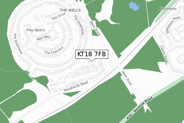
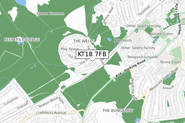
KT18 7FB is located in the Stamford electoral ward, within the local authority district of Epsom and Ewell and the English Parliamentary constituency of Epsom and Ewell. The Sub Integrated Care Board (ICB) Location is NHS Surrey Heartlands ICB - 92A and the police force is Surrey. This postcode has been in use since May 2018.


GetTheData
Source: OS Open Zoomstack (Ordnance Survey)
Licence: Open Government Licence (requires attribution)
Attribution: Contains OS data © Crown copyright and database right 2024
Source: Open Postcode Geo
Licence: Open Government Licence (requires attribution)
Attribution: Contains OS data © Crown copyright and database right 2024; Contains Royal Mail data © Royal Mail copyright and database right 2024; Source: Office for National Statistics licensed under the Open Government Licence v.3.0
| Easting | 519415 |
| Northing | 159900 |
| Latitude | 51.325673 |
| Longitude | -0.287525 |
GetTheData
Source: Open Postcode Geo
Licence: Open Government Licence
| Country | England |
| Postcode District | KT18 |
| ➜ KT18 open data dashboard ➜ See where KT18 is on a map ➜ Where is Epsom? | |
GetTheData
Source: Land Registry Price Paid Data
Licence: Open Government Licence
| Ward | Stamford |
| Constituency | Epsom And Ewell |
GetTheData
Source: ONS Postcode Database
Licence: Open Government Licence
2022 29 APR £850,000 |
2019 14 JUN £730,000 |
1, HENRIETTA CLOSE, EPSOM, KT18 7FB 2018 17 MAY £790,000 |
GetTheData
Source: HM Land Registry Price Paid Data
Licence: Contains HM Land Registry data © Crown copyright and database right 2024. This data is licensed under the Open Government Licence v3.0.
| January 2024 | Violence and sexual offences | On or near The Crescent | 326m |
| October 2023 | Violence and sexual offences | On or near Well Way | 311m |
| June 2023 | Vehicle crime | On or near The Crescent | 326m |
| ➜ Get more crime data in our Crime section | |||
GetTheData
Source: data.police.uk
Licence: Open Government Licence
| The Greenway | The Wells | 79m |
| Woodlands Road (Wells Road) | Epsom | 134m |
| Woodlands Road (Wells Road) | Epsom | 192m |
| Wells Estate Shops (The Greenway) | The Wells | 275m |
| The Crescent | The Wells | 302m |
| Epsom Station | 1.6km |
| Ashtead Station | 1.6km |
| Epsom Downs Station | 3.4km |
GetTheData
Source: NaPTAN
Licence: Open Government Licence
| Percentage of properties with Next Generation Access | 100.0% |
| Percentage of properties with Superfast Broadband | 100.0% |
| Percentage of properties with Ultrafast Broadband | 100.0% |
| Percentage of properties with Full Fibre Broadband | 0.0% |
Superfast Broadband is between 30Mbps and 300Mbps
Ultrafast Broadband is > 300Mbps
| Percentage of properties unable to receive 2Mbps | 0.0% |
| Percentage of properties unable to receive 5Mbps | 0.0% |
| Percentage of properties unable to receive 10Mbps | 0.0% |
| Percentage of properties unable to receive 30Mbps | 0.0% |
GetTheData
Source: Ofcom
Licence: Ofcom Terms of Use (requires attribution)
GetTheData
Source: ONS Postcode Database
Licence: Open Government Licence


➜ Get more ratings from the Food Standards Agency
GetTheData
Source: Food Standards Agency
Licence: FSA terms & conditions
| Last Collection | |||
|---|---|---|---|
| Location | Mon-Fri | Sat | Distance |
| Wells Road | 17:00 | 12:00 | 131m |
| The Wells Post Office | 17:00 | 12:00 | 288m |
| Well Way | 17:00 | 12:00 | 363m |
GetTheData
Source: Dracos
Licence: Creative Commons Attribution-ShareAlike
| Facility | Distance |
|---|---|
| Rosebery School Whitehorse Drive, Epsom Swimming Pool, Artificial Grass Pitch, Sports Hall, Health and Fitness Gym, Studio | 718m |
| St Joseph's Catholic Primary School Rosebank, Epsom Swimming Pool, Grass Pitches | 1km |
| Francis Schnadhorst Memorial Ground Woodcote Road, Epsom Grass Pitches, Outdoor Tennis Courts | 1.2km |
GetTheData
Source: Active Places
Licence: Open Government Licence
| School | Phase of Education | Distance |
|---|---|---|
| Rosebery School White Horse Drive, Epsom, KT18 7NQ | Secondary | 718m |
| St Joseph's Catholic Primary School Rosebank, West Street, Epsom, KT18 7RT | Primary | 1km |
| Kingswood House School 56 West Hill, Epsom, KT19 8LG | Not applicable | 1.2km |
GetTheData
Source: Edubase
Licence: Open Government Licence
The below table lists the International Territorial Level (ITL) codes (formerly Nomenclature of Territorial Units for Statistics (NUTS) codes) and Local Administrative Units (LAU) codes for KT18 7FB:
| ITL 1 Code | Name |
|---|---|
| TLJ | South East (England) |
| ITL 2 Code | Name |
| TLJ2 | Surrey, East and West Sussex |
| ITL 3 Code | Name |
| TLJ26 | East Surrey |
| LAU 1 Code | Name |
| E07000208 | Epsom and Ewell |
GetTheData
Source: ONS Postcode Directory
Licence: Open Government Licence
The below table lists the Census Output Area (OA), Lower Layer Super Output Area (LSOA), and Middle Layer Super Output Area (MSOA) for KT18 7FB:
| Code | Name | |
|---|---|---|
| OA | E00155074 | |
| LSOA | E01030405 | Epsom and Ewell 009C |
| MSOA | E02006343 | Epsom and Ewell 009 |
GetTheData
Source: ONS Postcode Directory
Licence: Open Government Licence
| KT18 7HT | Commonside | 38m |
| KT18 7HW | Woodlands Road | 99m |
| KT18 7HP | Woodlands Road | 104m |
| KT18 7HZ | The Greenway | 126m |
| KT18 7HX | The Greenway | 129m |
| KT18 7LJ | The Crescent | 158m |
| KT18 7LL | The Crescent | 187m |
| KT18 7HR | Marneys Close | 206m |
| KT18 7JA | The Greenway | 230m |
| KT18 7HY | The Greenway | 237m |
GetTheData
Source: Open Postcode Geo; Land Registry Price Paid Data
Licence: Open Government Licence