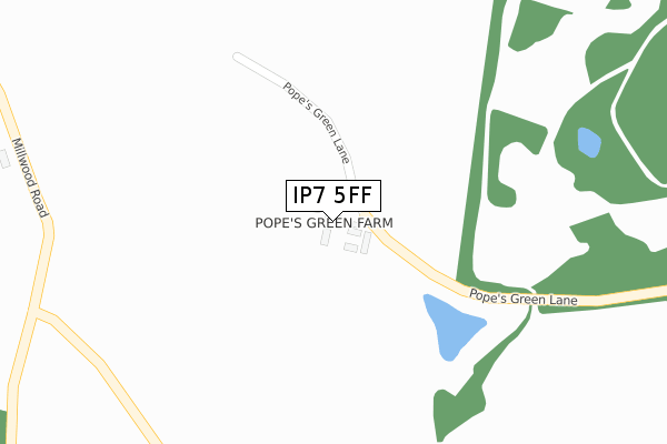
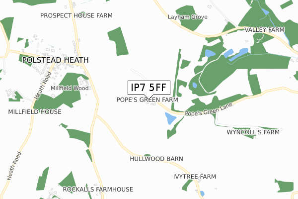
IP7 5FF is located in the Brett Vale electoral ward, within the local authority district of Babergh and the English Parliamentary constituency of South Suffolk. The Sub Integrated Care Board (ICB) Location is NHS Suffolk and North East Essex ICB - 06L and the police force is Suffolk. This postcode has been in use since November 2017.


GetTheData
Source: OS Open Zoomstack (Ordnance Survey)
Licence: Open Government Licence (requires attribution)
Attribution: Contains OS data © Crown copyright and database right 2024
Source: Open Postcode Geo
Licence: Open Government Licence (requires attribution)
Attribution: Contains OS data © Crown copyright and database right 2024; Contains Royal Mail data © Royal Mail copyright and database right 2024; Source: Office for National Statistics licensed under the Open Government Licence v.3.0
| Easting | 600632 |
| Northing | 239728 |
| Latitude | 52.019697 |
| Longitude | 0.922634 |
GetTheData
Source: Open Postcode Geo
Licence: Open Government Licence
| Country | England |
| Postcode District | IP7 |
| ➜ IP7 open data dashboard ➜ See where IP7 is on a map | |
GetTheData
Source: Land Registry Price Paid Data
Licence: Open Government Licence
| Ward | Brett Vale |
| Constituency | South Suffolk |
GetTheData
Source: ONS Postcode Database
Licence: Open Government Licence
| Shoulder Of Mutton (Stackwood Road) | Polstead Heath | 635m |
| Shoulder Of Mutton (Stackwood Road) | Polstead Heath | 658m |
| Telephone Box (Straight Road) | Polstead Heath | 833m |
| Telephone Box (Straight Road) | Polstead Heath | 841m |
| The Cock (Heath Road) | Polstead | 1,962m |
GetTheData
Source: NaPTAN
Licence: Open Government Licence
| Percentage of properties with Next Generation Access | 100.0% |
| Percentage of properties with Superfast Broadband | 0.0% |
| Percentage of properties with Ultrafast Broadband | 0.0% |
| Percentage of properties with Full Fibre Broadband | 0.0% |
Superfast Broadband is between 30Mbps and 300Mbps
Ultrafast Broadband is > 300Mbps
| Percentage of properties unable to receive 2Mbps | 100.0% |
| Percentage of properties unable to receive 5Mbps | 100.0% |
| Percentage of properties unable to receive 10Mbps | 100.0% |
| Percentage of properties unable to receive 30Mbps | 100.0% |
GetTheData
Source: Ofcom
Licence: Ofcom Terms of Use (requires attribution)
GetTheData
Source: ONS Postcode Database
Licence: Open Government Licence


➜ Get more ratings from the Food Standards Agency
GetTheData
Source: Food Standards Agency
Licence: FSA terms & conditions
| Last Collection | |||
|---|---|---|---|
| Location | Mon-Fri | Sat | Distance |
| The Priory | 15:00 | 08:15 | 2,996m |
| Stoke By Nayland Post Office | 17:15 | 11:00 | 3,878m |
| Crossfields Butt Road | 16:30 | 10:30 | 3,928m |
GetTheData
Source: Dracos
Licence: Creative Commons Attribution-ShareAlike
| Facility | Distance |
|---|---|
| Layham Road Sports Ground Layham Road, Hadleigh Grass Pitches, Outdoor Tennis Courts | 2.9km |
| Hadleigh United Football Club Tinkers Lane, Duke Street, Hadleigh, Ipswich Grass Pitches | 3.1km |
| Hadleigh Cricket Club Friars Road, Hadleigh Grass Pitches | 3.6km |
GetTheData
Source: Active Places
Licence: Open Government Licence
| School | Phase of Education | Distance |
|---|---|---|
| Hadleigh Community Primary School Station Road, Hadleigh, IP7 5HQ | Primary | 3.4km |
| St Mary's Church of England Primary School, Hadleigh Stonehouse Road, Hadleigh, Ipswich, IP7 5BH | Primary | 3.8km |
| Hadleigh High School Highlands Road, Hadleigh, Ipswich, IP7 5HU | Secondary | 3.9km |
GetTheData
Source: Edubase
Licence: Open Government Licence
The below table lists the International Territorial Level (ITL) codes (formerly Nomenclature of Territorial Units for Statistics (NUTS) codes) and Local Administrative Units (LAU) codes for IP7 5FF:
| ITL 1 Code | Name |
|---|---|
| TLH | East |
| ITL 2 Code | Name |
| TLH1 | East Anglia |
| ITL 3 Code | Name |
| TLH14 | Suffolk CC |
| LAU 1 Code | Name |
| E07000200 | Babergh |
GetTheData
Source: ONS Postcode Directory
Licence: Open Government Licence
The below table lists the Census Output Area (OA), Lower Layer Super Output Area (LSOA), and Middle Layer Super Output Area (MSOA) for IP7 5FF:
| Code | Name | |
|---|---|---|
| OA | E00152383 | |
| LSOA | E01029902 | Babergh 009C |
| MSOA | E02006235 | Babergh 009 |
GetTheData
Source: ONS Postcode Directory
Licence: Open Government Licence
| CO6 5AY | Millwood Road | 538m |
| CO6 5BB | Straight Road | 744m |
| CO6 5BG | Heath Road | 856m |
| CO6 5AX | Millwood Road | 862m |
| CO6 5AU | Millwood Road | 880m |
| CO6 5BA | Stackwood Road | 947m |
| CO6 5BE | Heath Close | 948m |
| CO6 5BD | Straight Road | 971m |
| CO6 5AT | 1172m | |
| IP7 5RW | Rands Road | 1244m |
GetTheData
Source: Open Postcode Geo; Land Registry Price Paid Data
Licence: Open Government Licence