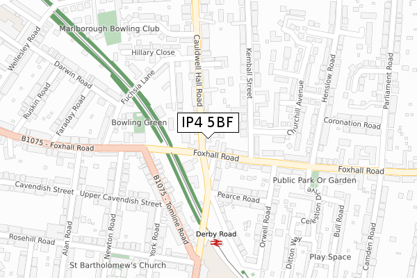
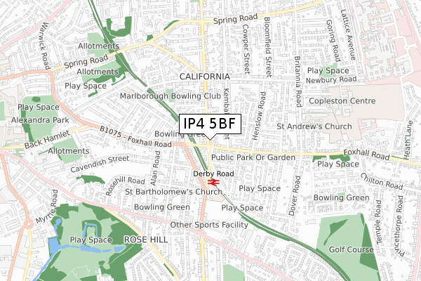
IP4 5BF is located in the Alexandra electoral ward, within the local authority district of Ipswich and the English Parliamentary constituency of Ipswich. The Sub Integrated Care Board (ICB) Location is NHS Suffolk and North East Essex ICB - 06L and the police force is Suffolk. This postcode has been in use since May 2018.


GetTheData
Source: OS Open Zoomstack (Ordnance Survey)
Licence: Open Government Licence (requires attribution)
Attribution: Contains OS data © Crown copyright and database right 2024
Source: Open Postcode Geo
Licence: Open Government Licence (requires attribution)
Attribution: Contains OS data © Crown copyright and database right 2024; Contains Royal Mail data © Royal Mail copyright and database right 2024; Source: Office for National Statistics licensed under the Open Government Licence v.3.0
| Easting | 618310 |
| Northing | 244151 |
| Latitude | 52.052735 |
| Longitude | 1.182682 |
GetTheData
Source: Open Postcode Geo
Licence: Open Government Licence
| Country | England |
| Postcode District | IP4 |
| ➜ IP4 open data dashboard ➜ See where IP4 is on a map ➜ Where is Ipswich? | |
GetTheData
Source: Land Registry Price Paid Data
Licence: Open Government Licence
| Ward | Alexandra |
| Constituency | Ipswich |
GetTheData
Source: ONS Postcode Database
Licence: Open Government Licence
| December 2023 | Violence and sexual offences | On or near Celestion Drive | 268m |
| December 2023 | Criminal damage and arson | On or near Celestion Drive | 268m |
| December 2023 | Other theft | On or near Bull Road | 384m |
| ➜ Get more crime data in our Crime section | |||
GetTheData
Source: data.police.uk
Licence: Open Government Licence
| The Railway (Foxhall Road) | California | 37m |
| The Railway (Foxhall Road) | California | 68m |
| Pearce Road (Derby Road) | California | 74m |
| Pearce Road (Derby Road) | California | 84m |
| Orwell Road (Foxhall Road) | California | 162m |
| Derby Road (Ipswich) Station | 0.2km |
| Ipswich Station | 2.6km |
| Westerfield Station | 3.3km |
GetTheData
Source: NaPTAN
Licence: Open Government Licence
➜ Broadband speed and availability dashboard for IP4 5BF
| Percentage of properties with Next Generation Access | 100.0% |
| Percentage of properties with Superfast Broadband | 100.0% |
| Percentage of properties with Ultrafast Broadband | 0.0% |
| Percentage of properties with Full Fibre Broadband | 0.0% |
Superfast Broadband is between 30Mbps and 300Mbps
Ultrafast Broadband is > 300Mbps
| Median download speed | 55.0Mbps |
| Average download speed | 51.1Mbps |
| Maximum download speed | 79.98Mbps |
| Median upload speed | 16.6Mbps |
| Average upload speed | 12.6Mbps |
| Maximum upload speed | 20.00Mbps |
| Percentage of properties unable to receive 2Mbps | 0.0% |
| Percentage of properties unable to receive 5Mbps | 0.0% |
| Percentage of properties unable to receive 10Mbps | 0.0% |
| Percentage of properties unable to receive 30Mbps | 0.0% |
➜ Broadband speed and availability dashboard for IP4 5BF
GetTheData
Source: Ofcom
Licence: Ofcom Terms of Use (requires attribution)
GetTheData
Source: ONS Postcode Database
Licence: Open Government Licence


➜ Get more ratings from the Food Standards Agency
GetTheData
Source: Food Standards Agency
Licence: FSA terms & conditions
| Last Collection | |||
|---|---|---|---|
| Location | Mon-Fri | Sat | Distance |
| 64 Chilton Road | 17:30 | 12:20 | 46m |
| 201 Cauldwell Hall Road | 17:30 | 12:10 | 376m |
| Ruskin Road | 17:30 | 12:15 | 449m |
GetTheData
Source: Dracos
Licence: Creative Commons Attribution-ShareAlike
| Facility | Distance |
|---|---|
| Energie Fitness (Ipswich) Felixstowe Road, Ipswich Health and Fitness Gym | 578m |
| Foxhall Community Centre Foxhall Road, Ipswich Grass Pitches, Squash Courts, Studio | 771m |
| Copleston Centre Copleston Road, Ipswich Sports Hall, Health and Fitness Gym, Artificial Grass Pitch, Grass Pitches, Studio | 813m |
GetTheData
Source: Active Places
Licence: Open Government Licence
| School | Phase of Education | Distance |
|---|---|---|
| Rose Hill Primary Derby Road, Ipswich, IP3 8DL | Primary | 326m |
| Clifford Road Primary School & Nursery Clifford Road, Ipswich, IP4 1PJ | Primary | 566m |
| Britannia Primary School and Nursery Britannia Road, Ipswich, IP4 5HE | Primary | 569m |
GetTheData
Source: Edubase
Licence: Open Government Licence
The below table lists the International Territorial Level (ITL) codes (formerly Nomenclature of Territorial Units for Statistics (NUTS) codes) and Local Administrative Units (LAU) codes for IP4 5BF:
| ITL 1 Code | Name |
|---|---|
| TLH | East |
| ITL 2 Code | Name |
| TLH1 | East Anglia |
| ITL 3 Code | Name |
| TLH14 | Suffolk CC |
| LAU 1 Code | Name |
| E07000202 | Ipswich |
GetTheData
Source: ONS Postcode Directory
Licence: Open Government Licence
The below table lists the Census Output Area (OA), Lower Layer Super Output Area (LSOA), and Middle Layer Super Output Area (MSOA) for IP4 5BF:
| Code | Name | |
|---|---|---|
| OA | E00152690 | |
| LSOA | E01029961 | Ipswich 007D |
| MSOA | E02006251 | Ipswich 007 |
GetTheData
Source: ONS Postcode Directory
Licence: Open Government Licence
| IP3 8LF | Foxhall Road | 54m |
| IP3 8LG | Foxhall Road | 69m |
| IP4 5AH | Cauldwell Hall Road | 70m |
| IP4 5AQ | Cauldwell Hall Road | 89m |
| IP3 8DE | Derby Road | 108m |
| IP4 5DP | Kemball Street | 117m |
| IP4 5EA | Kemball Street | 119m |
| IP3 8HT | Foxhall Road | 123m |
| IP4 5AB | Geralds Avenue | 134m |
| IP3 8BZ | Tomline Road | 143m |
GetTheData
Source: Open Postcode Geo; Land Registry Price Paid Data
Licence: Open Government Licence