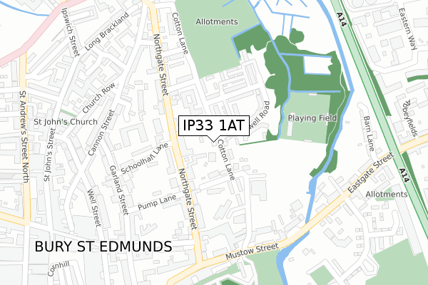
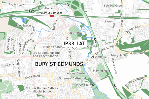
IP33 1AT is located in the Eastgate electoral ward, within the local authority district of West Suffolk and the English Parliamentary constituency of Bury St Edmunds. The Sub Integrated Care Board (ICB) Location is NHS Suffolk and North East Essex ICB - 07K and the police force is Suffolk. This postcode has been in use since October 2019.


GetTheData
Source: OS Open Zoomstack (Ordnance Survey)
Licence: Open Government Licence (requires attribution)
Attribution: Contains OS data © Crown copyright and database right 2024
Source: Open Postcode Geo
Licence: Open Government Licence (requires attribution)
Attribution: Contains OS data © Crown copyright and database right 2024; Contains Royal Mail data © Royal Mail copyright and database right 2024; Source: Office for National Statistics licensed under the Open Government Licence v.3.0
| Easting | 586032 |
| Northing | 264720 |
| Latitude | 52.249221 |
| Longitude | 0.723783 |
GetTheData
Source: Open Postcode Geo
Licence: Open Government Licence
| Country | England |
| Postcode District | IP33 |
| ➜ IP33 open data dashboard ➜ See where IP33 is on a map ➜ Where is Bury St Edmunds? | |
GetTheData
Source: Land Registry Price Paid Data
Licence: Open Government Licence
| Ward | Eastgate |
| Constituency | Bury St Edmunds |
GetTheData
Source: ONS Postcode Database
Licence: Open Government Licence
| January 2024 | Anti-social behaviour | On or near The Vinefields | 371m |
| January 2024 | Criminal damage and arson | On or near The Vinefields | 371m |
| December 2023 | Criminal damage and arson | On or near The Vinefields | 371m |
| ➜ Get more crime data in our Crime section | |||
GetTheData
Source: data.police.uk
Licence: Open Government Licence
| Mount Place (Eastgate) | Bury St Edmunds | 147m |
| The Greyhound (Eastgate) | Bury St Edmunds | 192m |
| The Greyhound (Eastgate) | Bury St Edmunds | 214m |
| Mount Place (Eastgate) | Bury St Edmunds | 220m |
| St Nicholas Close (Hollow Road) | Bury St Edmunds | 392m |
| Bury St Edmunds Station | 0.9km |
GetTheData
Source: NaPTAN
Licence: Open Government Licence
GetTheData
Source: ONS Postcode Database
Licence: Open Government Licence


➜ Get more ratings from the Food Standards Agency
GetTheData
Source: Food Standards Agency
Licence: FSA terms & conditions
| Last Collection | |||
|---|---|---|---|
| Location | Mon-Fri | Sat | Distance |
| Post Office, Eastgate Street | 17:30 | 11:30 | 250m |
| 6 Hollow Road | 17:00 | 11:30 | 389m |
| Alandale, Cotton Lane | 17:30 | 11:30 | 405m |
GetTheData
Source: Dracos
Licence: Creative Commons Attribution-ShareAlike
| Facility | Distance |
|---|---|
| Bury Town Football Club Cotton Lane, Bury St Edmunds Grass Pitches | 242m |
| Priory School Mount Road, Bury St. Edmunds Sports Hall, Grass Pitches | 417m |
| St James Ce Va Middle School (Closed) Vinefields, Bury St Edmunds Grass Pitches | 573m |
GetTheData
Source: Active Places
Licence: Open Government Licence
| School | Phase of Education | Distance |
|---|---|---|
| Priory School Mount Road, Bury St Edmunds, IP32 7BH | Not applicable | 298m |
| Learning Support, Western Area Education Office New Shire Hall, Raingate Street, Bury St Edmunds, IP33 2AR | Not applicable | 939m |
| Guildhall Feoffment Community Primary School Bridewell Lane, Bury St Edmunds, IP33 1RE | Primary | 983m |
GetTheData
Source: Edubase
Licence: Open Government Licence
The below table lists the International Territorial Level (ITL) codes (formerly Nomenclature of Territorial Units for Statistics (NUTS) codes) and Local Administrative Units (LAU) codes for IP33 1AT:
| ITL 1 Code | Name |
|---|---|
| TLH | East |
| ITL 2 Code | Name |
| TLH1 | East Anglia |
| ITL 3 Code | Name |
| TLH14 | Suffolk CC |
| LAU 1 Code | Name |
| E07000245 | West Suffolk |
GetTheData
Source: ONS Postcode Directory
Licence: Open Government Licence
The below table lists the Census Output Area (OA), Lower Layer Super Output Area (LSOA), and Middle Layer Super Output Area (MSOA) for IP33 1AT:
| Code | Name | |
|---|---|---|
| OA | E00153453 | |
| LSOA | E01033048 | St Edmundsbury 009F |
| MSOA | E02006281 | St Edmundsbury 009 |
GetTheData
Source: ONS Postcode Directory
Licence: Open Government Licence
| IP33 1AQ | Abbeyfields | 61m |
| IP32 7AJ | Eastern Way | 73m |
| IP33 1YH | Barn Lane | 94m |
| IP33 1YW | Eastgate Street | 113m |
| IP33 1YP | Unicorn Place | 169m |
| IP33 1YQ | Eastgate Street | 212m |
| IP33 1YR | Eastgate Street | 222m |
| IP33 1AR | The Daubentons | 237m |
| IP33 1UQ | East Close | 244m |
| IP33 1YG | The Vinefields | 262m |
GetTheData
Source: Open Postcode Geo; Land Registry Price Paid Data
Licence: Open Government Licence