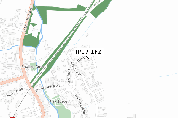
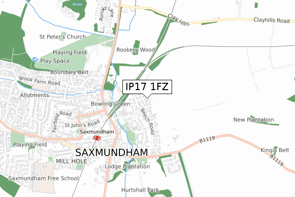
IP17 1FZ is located in the Saxmundham electoral ward, within the local authority district of East Suffolk and the English Parliamentary constituency of Suffolk Coastal. The Sub Integrated Care Board (ICB) Location is NHS Suffolk and North East Essex ICB - 06L and the police force is Suffolk. This postcode has been in use since April 2020.


GetTheData
Source: OS Open Zoomstack (Ordnance Survey)
Licence: Open Government Licence (requires attribution)
Attribution: Contains OS data © Crown copyright and database right 2024
Source: Open Postcode Geo
Licence: Open Government Licence (requires attribution)
Attribution: Contains OS data © Crown copyright and database right 2024; Contains Royal Mail data © Royal Mail copyright and database right 2024; Source: Office for National Statistics licensed under the Open Government Licence v.3.0
| Easting | 638961 |
| Northing | 263440 |
| Latitude | 52.217325 |
| Longitude | 1.496844 |
GetTheData
Source: Open Postcode Geo
Licence: Open Government Licence
| Country | England |
| Postcode District | IP17 |
| ➜ IP17 open data dashboard ➜ See where IP17 is on a map ➜ Where is Saxmundham? | |
GetTheData
Source: Land Registry Price Paid Data
Licence: Open Government Licence
| Ward | Saxmundham |
| Constituency | Suffolk Coastal |
GetTheData
Source: ONS Postcode Database
Licence: Open Government Licence
9, HORNBEAM ROAD, SAXMUNDHAM, IP17 1FZ 2021 23 NOV £475,000 |
7, HORNBEAM ROAD, SAXMUNDHAM, IP17 1FZ 2021 12 NOV £565,000 |
25, HORNBEAM ROAD, SAXMUNDHAM, IP17 1FZ 2021 23 SEP £400,000 |
19, HORNBEAM ROAD, SAXMUNDHAM, IP17 1FZ 2021 13 AUG £325,000 |
HAVEN HOUSE, 21, HORNBEAM ROAD, SAXMUNDHAM, IP17 1FZ 2021 30 JUL £327,500 |
23, HORNBEAM ROAD, SAXMUNDHAM, IP17 1FZ 2021 23 JUL £395,000 |
29, HORNBEAM ROAD, SAXMUNDHAM, IP17 1FZ 2021 9 JUL £400,000 |
27, HORNBEAM ROAD, SAXMUNDHAM, IP17 1FZ 2021 30 JUN £550,000 |
31, HORNBEAM ROAD, SAXMUNDHAM, IP17 1FZ 2021 1 APR £260,000 |
28, HORNBEAM ROAD, SAXMUNDHAM, IP17 1FZ 2021 26 MAR £315,000 |
GetTheData
Source: HM Land Registry Price Paid Data
Licence: Contains HM Land Registry data © Crown copyright and database right 2024. This data is licensed under the Open Government Licence v3.0.
| January 2024 | Anti-social behaviour | On or near Lambsale Meadow | 395m |
| September 2023 | Anti-social behaviour | On or near Lambsale Meadow | 395m |
| August 2023 | Violence and sexual offences | On or near Lambsale Meadow | 395m |
| ➜ Get more crime data in our Crime section | |||
GetTheData
Source: data.police.uk
Licence: Open Government Licence
| Street Farm Road (High Street) | Saxmundham | 361m |
| Street Farm Road (High Street) | Saxmundham | 370m |
| Lambsale Meadow | Saxmundham | 399m |
| Lambsale Meadow | Saxmundham | 416m |
| Manor Gardens (Church Hill) | Saxmundham | 467m |
| Saxmundham Station | 0.5km |
GetTheData
Source: NaPTAN
Licence: Open Government Licence
GetTheData
Source: ONS Postcode Database
Licence: Open Government Licence


➜ Get more ratings from the Food Standards Agency
GetTheData
Source: Food Standards Agency
Licence: FSA terms & conditions
| Last Collection | |||
|---|---|---|---|
| Location | Mon-Fri | Sat | Distance |
| Church Hill | 09:30 | 09:30 | 484m |
| Co-op, 7 High Street | 17:30 | 12:15 | 508m |
| Railway Station | 17:00 | 11:30 | 534m |
GetTheData
Source: Dracos
Licence: Creative Commons Attribution-ShareAlike
| Facility | Distance |
|---|---|
| Saxmundham Sports & Recreation Club North Entrance, Saxmundham Grass Pitches, Outdoor Tennis Courts | 728m |
| Saxmundham School Seaman Avenue, Saxmundham Grass Pitches, Sports Hall, Outdoor Tennis Courts | 1.1km |
| Kelsale Park Kelsale, Saxmundham Grass Pitches | 1.6km |
GetTheData
Source: Active Places
Licence: Open Government Licence
| School | Phase of Education | Distance |
|---|---|---|
| Saxmundham Primary School Brook Farm Road, Saxmundham, IP17 1XQ | Primary | 844m |
| Kelsale Church of England Voluntary Controlled Primary School Carlton Road, Kelsale, Saxmundham, IP17 2NP | Primary | 1km |
| Set Saxmundham School Seaman Avenue, Saxmundham, IP17 1DZ | Secondary | 1.1km |
GetTheData
Source: Edubase
Licence: Open Government Licence
The below table lists the International Territorial Level (ITL) codes (formerly Nomenclature of Territorial Units for Statistics (NUTS) codes) and Local Administrative Units (LAU) codes for IP17 1FZ:
| ITL 1 Code | Name |
|---|---|
| TLH | East |
| ITL 2 Code | Name |
| TLH1 | East Anglia |
| ITL 3 Code | Name |
| TLH14 | Suffolk CC |
| LAU 1 Code | Name |
| E07000244 | East Suffolk |
GetTheData
Source: ONS Postcode Directory
Licence: Open Government Licence
The below table lists the Census Output Area (OA), Lower Layer Super Output Area (LSOA), and Middle Layer Super Output Area (MSOA) for IP17 1FZ:
| Code | Name | |
|---|---|---|
| OA | E00154052 | |
| LSOA | E01030209 | Suffolk Coastal 003C |
| MSOA | E02006289 | Suffolk Coastal 003 |
GetTheData
Source: ONS Postcode Directory
Licence: Open Government Licence
| IP17 1GL | Warren Avenue | 177m |
| IP17 1GN | Warren Avenue | 202m |
| IP17 1AL | Street Farm Road | 239m |
| IP17 1GG | Fromus Walk | 329m |
| IP17 1GF | Warren Avenue | 339m |
| IP17 1DY | Lambsale Meadow | 352m |
| IP17 1AB | High Street | 367m |
| IP17 1AP | North Entrance | 371m |
| IP17 1EU | Church Hill | 382m |
| IP17 1AJ | High Street | 387m |
GetTheData
Source: Open Postcode Geo; Land Registry Price Paid Data
Licence: Open Government Licence