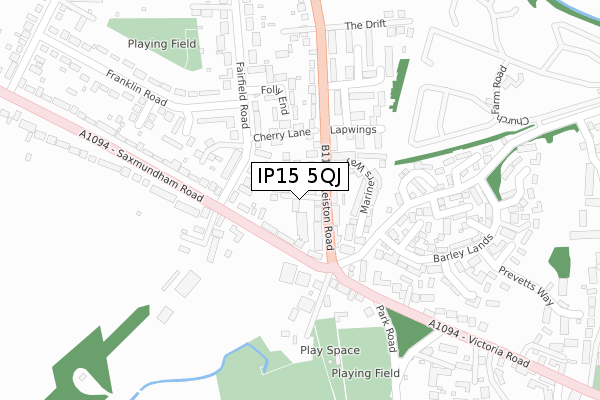
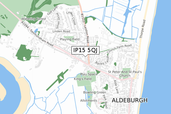
IP15 5QJ is located in the Aldeburgh & Leiston electoral ward, within the local authority district of East Suffolk and the English Parliamentary constituency of Suffolk Coastal. The Sub Integrated Care Board (ICB) Location is NHS Suffolk and North East Essex ICB - 06L and the police force is Suffolk. This postcode has been in use since April 2018.


GetTheData
Source: OS Open Zoomstack (Ordnance Survey)
Licence: Open Government Licence (requires attribution)
Attribution: Contains OS data © Crown copyright and database right 2024
Source: Open Postcode Geo
Licence: Open Government Licence (requires attribution)
Attribution: Contains OS data © Crown copyright and database right 2024; Contains Royal Mail data © Royal Mail copyright and database right 2024; Source: Office for National Statistics licensed under the Open Government Licence v.3.0
| Easting | 645808 |
| Northing | 257161 |
| Latitude | 52.157975 |
| Longitude | 1.592321 |
GetTheData
Source: Open Postcode Geo
Licence: Open Government Licence
| Country | England |
| Postcode District | IP15 |
| ➜ IP15 open data dashboard ➜ See where IP15 is on a map ➜ Where is Aldeburgh? | |
GetTheData
Source: Land Registry Price Paid Data
Licence: Open Government Licence
| Ward | Aldeburgh & Leiston |
| Constituency | Suffolk Coastal |
GetTheData
Source: ONS Postcode Database
Licence: Open Government Licence
2, OLD LAUNDRY YARD, ALDEBURGH, IP15 5QJ 2018 19 DEC £455,000 |
1, OLD LAUNDRY YARD, ALDEBURGH, IP15 5QJ 2018 27 APR £456,000 |
3, OLD LAUNDRY YARD, ALDEBURGH, IP15 5QJ 2018 4 APR £470,000 |
GetTheData
Source: HM Land Registry Price Paid Data
Licence: Contains HM Land Registry data © Crown copyright and database right 2024. This data is licensed under the Open Government Licence v3.0.
| May 2022 | Other theft | On or near Mariners Way | 115m |
| May 2022 | Violence and sexual offences | On or near Folly End | 197m |
| May 2022 | Violence and sexual offences | On or near Folly End | 197m |
| ➜ Get more crime data in our Crime section | |||
GetTheData
Source: data.police.uk
Licence: Open Government Licence
| Police Station (B1122) | Aldeburgh | 140m |
| Police Station (B1122) | Aldeburgh | 171m |
| Linden Close (Linden Road) | Aldeburgh | 395m |
| Linden Road (Leiston Road) | Aldeburgh | 402m |
| Linden Road (Leiston Road) | Aldeburgh | 402m |
GetTheData
Source: NaPTAN
Licence: Open Government Licence
| Percentage of properties with Next Generation Access | 100.0% |
| Percentage of properties with Superfast Broadband | 100.0% |
| Percentage of properties with Ultrafast Broadband | 0.0% |
| Percentage of properties with Full Fibre Broadband | 0.0% |
Superfast Broadband is between 30Mbps and 300Mbps
Ultrafast Broadband is > 300Mbps
| Percentage of properties unable to receive 2Mbps | 0.0% |
| Percentage of properties unable to receive 5Mbps | 0.0% |
| Percentage of properties unable to receive 10Mbps | 0.0% |
| Percentage of properties unable to receive 30Mbps | 0.0% |
GetTheData
Source: Ofcom
Licence: Ofcom Terms of Use (requires attribution)
GetTheData
Source: ONS Postcode Database
Licence: Open Government Licence


➜ Get more ratings from the Food Standards Agency
GetTheData
Source: Food Standards Agency
Licence: FSA terms & conditions
| Last Collection | |||
|---|---|---|---|
| Location | Mon-Fri | Sat | Distance |
| Post Office, Fairfield Road | 16:15 | 11:45 | 104m |
| Victoria Road | 16:15 | 10:30 | 229m |
| Leiston Road | 16:30 | 11:00 | 532m |
GetTheData
Source: Dracos
Licence: Creative Commons Attribution-ShareAlike
| Facility | Distance |
|---|---|
| Kings Field Recreation Ground Victoria Road, Aldeburgh Grass Pitches | 328m |
| Aldeburgh Golf Club Saxmundham Road, Aldeburgh Golf | 1.2km |
| Thorpeness Golf Club And Hotel Lakeside Avenue, Thorpeness, Aldringham Cum Thorpe Golf | 2.8km |
GetTheData
Source: Active Places
Licence: Open Government Licence
| School | Phase of Education | Distance |
|---|---|---|
| Aldeburgh Primary School Park Road, Aldeburgh, IP15 5EU | Primary | 997m |
| Coldfair Green Community Primary School Judith Avenue, Knodishall, Saxmundham, IP17 1UY | Primary | 4.1km |
GetTheData
Source: Edubase
Licence: Open Government Licence
The below table lists the International Territorial Level (ITL) codes (formerly Nomenclature of Territorial Units for Statistics (NUTS) codes) and Local Administrative Units (LAU) codes for IP15 5QJ:
| ITL 1 Code | Name |
|---|---|
| TLH | East |
| ITL 2 Code | Name |
| TLH1 | East Anglia |
| ITL 3 Code | Name |
| TLH14 | Suffolk CC |
| LAU 1 Code | Name |
| E07000244 | East Suffolk |
GetTheData
Source: ONS Postcode Directory
Licence: Open Government Licence
The below table lists the Census Output Area (OA), Lower Layer Super Output Area (LSOA), and Middle Layer Super Output Area (MSOA) for IP15 5QJ:
| Code | Name | |
|---|---|---|
| OA | E00153731 | |
| LSOA | E01030153 | Suffolk Coastal 004B |
| MSOA | E02006290 | Suffolk Coastal 004 |
GetTheData
Source: ONS Postcode Directory
Licence: Open Government Licence
| IP15 5PW | Leiston Road | 43m |
| IP15 5PR | Leiston Road | 52m |
| IP15 5JA | Saxmundham Road | 60m |
| IP15 5PP | Leiston Road | 65m |
| IP15 5JS | Fairfield Road | 90m |
| IP15 5QH | Mariners Way | 107m |
| IP15 5JD | Saxmundham Road | 115m |
| IP15 5JR | Cherry Lane | 125m |
| IP15 5ND | Saxmundham Road | 131m |
| IP15 5JP | Fairfield Road | 148m |
GetTheData
Source: Open Postcode Geo; Land Registry Price Paid Data
Licence: Open Government Licence