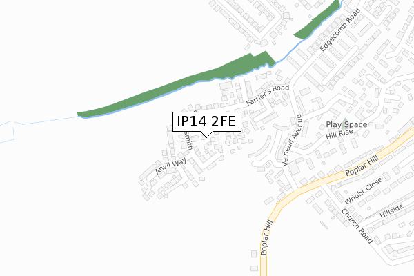
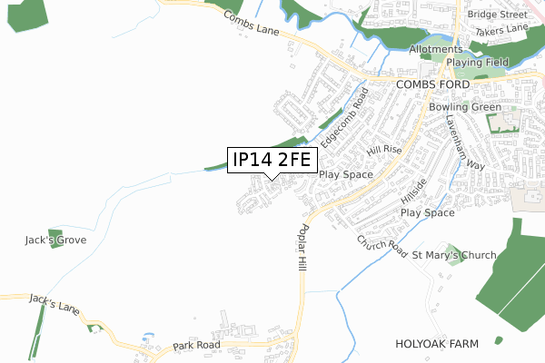
IP14 2FE is located in the Combs Ford electoral ward, within the local authority district of Mid Suffolk and the English Parliamentary constituency of Bury St Edmunds. The Sub Integrated Care Board (ICB) Location is NHS Suffolk and North East Essex ICB - 06L and the police force is Suffolk. This postcode has been in use since February 2018.


GetTheData
Source: OS Open Zoomstack (Ordnance Survey)
Licence: Open Government Licence (requires attribution)
Attribution: Contains OS data © Crown copyright and database right 2024
Source: Open Postcode Geo
Licence: Open Government Licence (requires attribution)
Attribution: Contains OS data © Crown copyright and database right 2024; Contains Royal Mail data © Royal Mail copyright and database right 2024; Source: Office for National Statistics licensed under the Open Government Licence v.3.0
| Easting | 604292 |
| Northing | 257280 |
| Latitude | 52.175954 |
| Longitude | 0.986412 |
GetTheData
Source: Open Postcode Geo
Licence: Open Government Licence
| Country | England |
| Postcode District | IP14 |
| ➜ IP14 open data dashboard ➜ See where IP14 is on a map ➜ Where is Stowmarket? | |
GetTheData
Source: Land Registry Price Paid Data
Licence: Open Government Licence
| Ward | Combs Ford |
| Constituency | Bury St Edmunds |
GetTheData
Source: ONS Postcode Database
Licence: Open Government Licence
| June 2022 | Violence and sexual offences | On or near Verneuil Avenue | 207m |
| June 2022 | Violence and sexual offences | On or near Verneuil Avenue | 207m |
| June 2022 | Anti-social behaviour | On or near Normandy Close | 270m |
| ➜ Get more crime data in our Crime section | |||
GetTheData
Source: data.police.uk
Licence: Open Government Licence
| Poplar Hill Junction (Verneuil Avenue) | Combs Ford | 220m |
| Thatchers Walk (Verneuil Avenue) | Combs Ford | 273m |
| Church Road (Poplar Hill) | Combs Ford | 321m |
| Church Road (Poplar Hill) | Combs Ford | 331m |
| Chandlers Walk | Combs Ford | 407m |
| Stowmarket Station | 1.8km |
| Needham Market Station | 5.4km |
GetTheData
Source: NaPTAN
Licence: Open Government Licence
➜ Broadband speed and availability dashboard for IP14 2FE
| Percentage of properties with Next Generation Access | 100.0% |
| Percentage of properties with Superfast Broadband | 100.0% |
| Percentage of properties with Ultrafast Broadband | 0.0% |
| Percentage of properties with Full Fibre Broadband | 0.0% |
Superfast Broadband is between 30Mbps and 300Mbps
Ultrafast Broadband is > 300Mbps
| Median download speed | 24.4Mbps |
| Average download speed | 23.3Mbps |
| Maximum download speed | 38.16Mbps |
| Median upload speed | 4.6Mbps |
| Average upload speed | 4.4Mbps |
| Maximum upload speed | 9.76Mbps |
| Percentage of properties unable to receive 2Mbps | 0.0% |
| Percentage of properties unable to receive 5Mbps | 0.0% |
| Percentage of properties unable to receive 10Mbps | 0.0% |
| Percentage of properties unable to receive 30Mbps | 0.0% |
➜ Broadband speed and availability dashboard for IP14 2FE
GetTheData
Source: Ofcom
Licence: Ofcom Terms of Use (requires attribution)
GetTheData
Source: ONS Postcode Database
Licence: Open Government Licence


➜ Get more ratings from the Food Standards Agency
GetTheData
Source: Food Standards Agency
Licence: FSA terms & conditions
| Last Collection | |||
|---|---|---|---|
| Location | Mon-Fri | Sat | Distance |
| Edgecomb Road | 17:00 | 11:00 | 332m |
| Royal Mail 62 Ipswich Street | 17:45 | 13:00 | 1,395m |
| Stow Lodge | 16:15 | 11:00 | 1,971m |
GetTheData
Source: Dracos
Licence: Creative Commons Attribution-ShareAlike
| Facility | Distance |
|---|---|
| Combs Ford Primary School Glemsford Road, Stowmarket Grass Pitches | 1.1km |
| Trinity Church Of England Voluntary Aided Primary School Lavenham Way, Stowmarket Grass Pitches, Sports Hall, Outdoor Tennis Courts | 1.2km |
| Stowmarket Lawn Tennis Club Finborough Road, Stowmarket Outdoor Tennis Courts | 1.3km |
GetTheData
Source: Active Places
Licence: Open Government Licence
| School | Phase of Education | Distance |
|---|---|---|
| Abbot's Hall Community Primary School Danescourt Avenue, Stowmarket, IP14 1QF | Primary | 1.1km |
| Combs Ford Primary School Glemsford Road, Stowmarket, IP14 2PN | Primary | 1.1km |
| Trinity Church of England Voluntary Aided Primary School Lavenham Way, Combs, Stowmarket, IP14 2BZ | Primary | 1.2km |
GetTheData
Source: Edubase
Licence: Open Government Licence
The below table lists the International Territorial Level (ITL) codes (formerly Nomenclature of Territorial Units for Statistics (NUTS) codes) and Local Administrative Units (LAU) codes for IP14 2FE:
| ITL 1 Code | Name |
|---|---|
| TLH | East |
| ITL 2 Code | Name |
| TLH1 | East Anglia |
| ITL 3 Code | Name |
| TLH14 | Suffolk CC |
| LAU 1 Code | Name |
| E07000203 | Mid Suffolk |
GetTheData
Source: ONS Postcode Directory
Licence: Open Government Licence
The below table lists the Census Output Area (OA), Lower Layer Super Output Area (LSOA), and Middle Layer Super Output Area (MSOA) for IP14 2FE:
| Code | Name | |
|---|---|---|
| OA | E00153262 | |
| LSOA | E01030069 | Mid Suffolk 009B |
| MSOA | E02006269 | Mid Suffolk 009 |
GetTheData
Source: ONS Postcode Directory
Licence: Open Government Licence
| IP14 2NR | Millers Close | 85m |
| IP14 2QF | The Twinnings | 141m |
| IP14 2NW | Weavers Close | 147m |
| IP14 2NS | Farriers Road | 151m |
| IP14 2EG | Verneuil Avenue | 201m |
| IP14 2DP | Maltsters Walk | 278m |
| IP14 2EQ | Normandy Close | 286m |
| IP14 2DR | Thatchers Walk | 289m |
| IP14 2AY | Poplar Hill | 293m |
| IP14 2DQ | Campion Crescent | 317m |
GetTheData
Source: Open Postcode Geo; Land Registry Price Paid Data
Licence: Open Government Licence