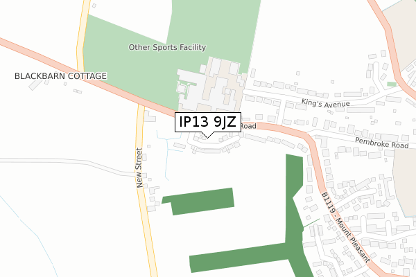
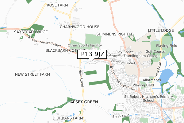
IP13 9JZ is located in the Framlingham electoral ward, within the local authority district of East Suffolk and the English Parliamentary constituency of Central Suffolk and North Ipswich. The Sub Integrated Care Board (ICB) Location is NHS Suffolk and North East Essex ICB - 06L and the police force is Suffolk. This postcode has been in use since July 2019.


GetTheData
Source: OS Open Zoomstack (Ordnance Survey)
Licence: Open Government Licence (requires attribution)
Attribution: Contains OS data © Crown copyright and database right 2024
Source: Open Postcode Geo
Licence: Open Government Licence (requires attribution)
Attribution: Contains OS data © Crown copyright and database right 2024; Contains Royal Mail data © Royal Mail copyright and database right 2024; Source: Office for National Statistics licensed under the Open Government Licence v.3.0
| Easting | 627368 |
| Northing | 263983 |
| Latitude | 52.227099 |
| Longitude | 1.327812 |
GetTheData
Source: Open Postcode Geo
Licence: Open Government Licence
| Country | England |
| Postcode District | IP13 |
| ➜ IP13 open data dashboard ➜ See where IP13 is on a map ➜ Where is Framlingham? | |
GetTheData
Source: Land Registry Price Paid Data
Licence: Open Government Licence
| Ward | Framlingham |
| Constituency | Central Suffolk And North Ipswich |
GetTheData
Source: ONS Postcode Database
Licence: Open Government Licence
1, BRISCOE WAY, FRAMLINGHAM, WOODBRIDGE, IP13 9JZ 2020 23 OCT £325,000 |
2, BRISCOE WAY, FRAMLINGHAM, WOODBRIDGE, IP13 9JZ 2020 19 JUN £350,000 |
GetTheData
Source: HM Land Registry Price Paid Data
Licence: Contains HM Land Registry data © Crown copyright and database right 2024. This data is licensed under the Open Government Licence v3.0.
| June 2022 | Drugs | On or near King'S Avenue | 353m |
| June 2022 | Criminal damage and arson | On or near Mount Pleasant | 484m |
| June 2022 | Violence and sexual offences | On or near Mount Pleasant | 484m |
| ➜ Get more crime data in our Crime section | |||
GetTheData
Source: data.police.uk
Licence: Open Government Licence
| Thomas Mills School (B1119) | Framlingham | 96m |
| Mount Pleasant (Saxtead Road) | Framlingham | 271m |
| Mount Pleasant (Pembroke Road) | Framlingham | 305m |
| College (Dennington Road) | Framlingham | 622m |
| College (Dennington Road) | Framlingham | 626m |
GetTheData
Source: NaPTAN
Licence: Open Government Licence
GetTheData
Source: ONS Postcode Database
Licence: Open Government Licence


➜ Get more ratings from the Food Standards Agency
GetTheData
Source: Food Standards Agency
Licence: FSA terms & conditions
| Last Collection | |||
|---|---|---|---|
| Location | Mon-Fri | Sat | Distance |
| Pembroke Road | 16:45 | 08:45 | 302m |
| College Road | 16:30 | 09:00 | 797m |
| Vyces Road | 16:30 | 09:30 | 831m |
GetTheData
Source: Dracos
Licence: Creative Commons Attribution-ShareAlike
| Facility | Distance |
|---|---|
| Thomas Mills High School Saxtead Road, Framlingham, Woodbridge Sports Hall, Grass Pitches, Studio, Outdoor Tennis Courts | 133m |
| Framlingham College College Road, Framlingham, Woodbridge Artificial Grass Pitch, Health and Fitness Gym, Grass Pitches, Sports Hall, Swimming Pool, Squash Courts, Golf | 783m |
| Framlingham Sports Ground Badingham Road, Framlingham Grass Pitches, Outdoor Tennis Courts | 1.7km |
GetTheData
Source: Active Places
Licence: Open Government Licence
| School | Phase of Education | Distance |
|---|---|---|
| Thomas Mills High School Saxtead Road, Framlingham, Woodbridge, IP13 9HE | Secondary | 129m |
| Framlingham College College Road, Framlingham, Woodbridge, IP13 9EY | Not applicable | 820m |
| Framlingham Sir Robert Hitcham's Church of England Voluntary Aided Primary School College Road, Framlingham, Framlingham, Woodbridge, IP13 9EP | Primary | 937m |
GetTheData
Source: Edubase
Licence: Open Government Licence
The below table lists the International Territorial Level (ITL) codes (formerly Nomenclature of Territorial Units for Statistics (NUTS) codes) and Local Administrative Units (LAU) codes for IP13 9JZ:
| ITL 1 Code | Name |
|---|---|
| TLH | East |
| ITL 2 Code | Name |
| TLH1 | East Anglia |
| ITL 3 Code | Name |
| TLH14 | Suffolk CC |
| LAU 1 Code | Name |
| E07000244 | East Suffolk |
GetTheData
Source: ONS Postcode Directory
Licence: Open Government Licence
The below table lists the Census Output Area (OA), Lower Layer Super Output Area (LSOA), and Middle Layer Super Output Area (MSOA) for IP13 9JZ:
| Code | Name | |
|---|---|---|
| OA | E00153851 | |
| LSOA | E01030172 | Suffolk Coastal 002B |
| MSOA | E02006288 | Suffolk Coastal 002 |
GetTheData
Source: ONS Postcode Directory
Licence: Open Government Licence
| IP13 9RE | Saxtead Road | 105m |
| IP13 9RF | New Street | 119m |
| IP13 9HE | Saxtead Road | 161m |
| IP13 9HF | Saxtead Road | 210m |
| IP13 9HB | Saxtead Road | 284m |
| IP13 9HD | Kings Avenue | 347m |
| IP13 9HG | Mount Pleasant | 348m |
| IP13 9PU | Saxtead Road | 354m |
| IP13 9HQ | Mount Pleasant | 385m |
| IP13 9HA | Pembroke Road | 441m |
GetTheData
Source: Open Postcode Geo; Land Registry Price Paid Data
Licence: Open Government Licence