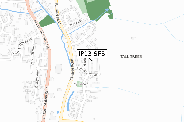
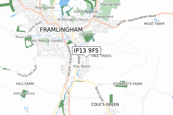
IP13 9FS is located in the Framlingham electoral ward, within the local authority district of East Suffolk and the English Parliamentary constituency of Central Suffolk and North Ipswich. The Sub Integrated Care Board (ICB) Location is NHS Suffolk and North East Essex ICB - 06L and the police force is Suffolk. This postcode has been in use since December 2018.


GetTheData
Source: OS Open Zoomstack (Ordnance Survey)
Licence: Open Government Licence (requires attribution)
Attribution: Contains OS data © Crown copyright and database right 2024
Source: Open Postcode Geo
Licence: Open Government Licence (requires attribution)
Attribution: Contains OS data © Crown copyright and database right 2024; Contains Royal Mail data © Royal Mail copyright and database right 2024; Source: Office for National Statistics licensed under the Open Government Licence v.3.0
| Easting | 628730 |
| Northing | 262958 |
| Latitude | 52.217336 |
| Longitude | 1.347026 |
GetTheData
Source: Open Postcode Geo
Licence: Open Government Licence
| Country | England |
| Postcode District | IP13 |
| ➜ IP13 open data dashboard ➜ See where IP13 is on a map ➜ Where is Framlingham? | |
GetTheData
Source: Land Registry Price Paid Data
Licence: Open Government Licence
| Ward | Framlingham |
| Constituency | Central Suffolk And North Ipswich |
GetTheData
Source: ONS Postcode Database
Licence: Open Government Licence
| November 2023 | Anti-social behaviour | On or near Parking Area | 491m |
| July 2023 | Possession of weapons | On or near Parking Area | 491m |
| May 2023 | Public order | On or near Parking Area | 491m |
| ➜ Get more crime data in our Crime section | |||
GetTheData
Source: data.police.uk
Licence: Open Government Licence
| Victoria Mill Road (Station Road) | Framlingham | 301m |
| Victoria Mill Road (Station Road) | Framlingham | 316m |
| Shelter (Bridge Street) | Framlingham | 664m |
| White Horse (College Road) | Framlingham | 681m |
| School Entrance (New Road) | Framlingham | 774m |
GetTheData
Source: NaPTAN
Licence: Open Government Licence
| Percentage of properties with Next Generation Access | 100.0% |
| Percentage of properties with Superfast Broadband | 100.0% |
| Percentage of properties with Ultrafast Broadband | 100.0% |
| Percentage of properties with Full Fibre Broadband | 100.0% |
Superfast Broadband is between 30Mbps and 300Mbps
Ultrafast Broadband is > 300Mbps
| Percentage of properties unable to receive 2Mbps | 0.0% |
| Percentage of properties unable to receive 5Mbps | 0.0% |
| Percentage of properties unable to receive 10Mbps | 0.0% |
| Percentage of properties unable to receive 30Mbps | 0.0% |
GetTheData
Source: Ofcom
Licence: Ofcom Terms of Use (requires attribution)
GetTheData
Source: ONS Postcode Database
Licence: Open Government Licence


➜ Get more ratings from the Food Standards Agency
GetTheData
Source: Food Standards Agency
Licence: FSA terms & conditions
| Last Collection | |||
|---|---|---|---|
| Location | Mon-Fri | Sat | Distance |
| Double Street | 14:30 | 07:30 | 569m |
| Market Hill | 14:30 | 07:15 | 577m |
| Riverside Post Office | 17:00 | 10:15 | 607m |
GetTheData
Source: Dracos
Licence: Creative Commons Attribution-ShareAlike
| Facility | Distance |
|---|---|
| Framlingham Sports Ground Badingham Road, Framlingham Grass Pitches, Outdoor Tennis Courts | 877m |
| Framlingham College College Road, Framlingham, Woodbridge Artificial Grass Pitch, Health and Fitness Gym, Grass Pitches, Sports Hall, Swimming Pool, Squash Courts, Golf | 1.2km |
| Thomas Mills High School Saxtead Road, Framlingham, Woodbridge Sports Hall, Grass Pitches, Studio, Outdoor Tennis Courts | 1.7km |
GetTheData
Source: Active Places
Licence: Open Government Licence
| School | Phase of Education | Distance |
|---|---|---|
| Framlingham Sir Robert Hitcham's Church of England Voluntary Aided Primary School College Road, Framlingham, Framlingham, Woodbridge, IP13 9EP | Primary | 784m |
| Framlingham College College Road, Framlingham, Woodbridge, IP13 9EY | Not applicable | 1.2km |
| Thomas Mills High School Saxtead Road, Framlingham, Woodbridge, IP13 9HE | Secondary | 1.8km |
GetTheData
Source: Edubase
Licence: Open Government Licence
The below table lists the International Territorial Level (ITL) codes (formerly Nomenclature of Territorial Units for Statistics (NUTS) codes) and Local Administrative Units (LAU) codes for IP13 9FS:
| ITL 1 Code | Name |
|---|---|
| TLH | East |
| ITL 2 Code | Name |
| TLH1 | East Anglia |
| ITL 3 Code | Name |
| TLH14 | Suffolk CC |
| LAU 1 Code | Name |
| E07000244 | East Suffolk |
GetTheData
Source: ONS Postcode Directory
Licence: Open Government Licence
The below table lists the Census Output Area (OA), Lower Layer Super Output Area (LSOA), and Middle Layer Super Output Area (MSOA) for IP13 9FS:
| Code | Name | |
|---|---|---|
| OA | E00153849 | |
| LSOA | E01030173 | Suffolk Coastal 002C |
| MSOA | E02006288 | Suffolk Coastal 002 |
GetTheData
Source: ONS Postcode Directory
Licence: Open Government Licence
| IP13 9LB | Fairfield Crescent | 139m |
| IP13 9LE | Fairfield Road | 200m |
| IP13 9DH | The Knoll | 246m |
| IP13 9DE | Fore Street | 251m |
| IP13 9EE | Station Road | 308m |
| IP13 9EF | Station Terrace | 313m |
| IP13 9DW | Sitwell Gardens | 362m |
| IP13 9ED | Station Road | 409m |
| IP13 9DQ | Fairfield Road | 427m |
| IP13 9DF | Fore Street | 439m |
GetTheData
Source: Open Postcode Geo; Land Registry Price Paid Data
Licence: Open Government Licence