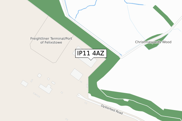
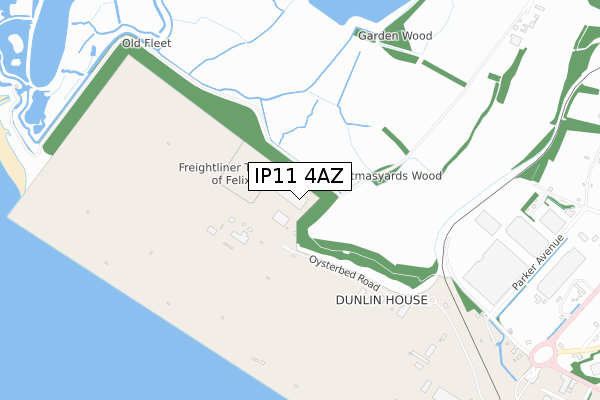
IP11 4AZ is located in the Orwell & Villages electoral ward, within the local authority district of East Suffolk and the English Parliamentary constituency of Suffolk Coastal. The Sub Integrated Care Board (ICB) Location is NHS Suffolk and North East Essex ICB - 06L and the police force is Suffolk. This postcode has been in use since April 2020.


GetTheData
Source: OS Open Zoomstack (Ordnance Survey)
Licence: Open Government Licence (requires attribution)
Attribution: Contains OS data © Crown copyright and database right 2024
Source: Open Postcode Geo
Licence: Open Government Licence (requires attribution)
Attribution: Contains OS data © Crown copyright and database right 2024; Contains Royal Mail data © Royal Mail copyright and database right 2024; Source: Office for National Statistics licensed under the Open Government Licence v.3.0
| Easting | 626816 |
| Northing | 234892 |
| Latitude | 51.966215 |
| Longitude | 1.300398 |
GetTheData
Source: Open Postcode Geo
Licence: Open Government Licence
| Country | England |
| Postcode District | IP11 |
| ➜ IP11 open data dashboard ➜ See where IP11 is on a map ➜ Where is Felixstowe? | |
GetTheData
Source: Land Registry Price Paid Data
Licence: Open Government Licence
| Ward | Orwell & Villages |
| Constituency | Suffolk Coastal |
GetTheData
Source: ONS Postcode Database
Licence: Open Government Licence
| The Drift (High Road) | Trimley St Mary | 1,967m |
| The Drift (High Road) | Trimley St Mary | 1,981m |
| Trimley Station | 1.7km |
| Harwich Town Station | 2.6km |
| Dovercourt Station | 3.3km |
GetTheData
Source: NaPTAN
Licence: Open Government Licence
GetTheData
Source: ONS Postcode Database
Licence: Open Government Licence


➜ Get more ratings from the Food Standards Agency
GetTheData
Source: Food Standards Agency
Licence: FSA terms & conditions
| Last Collection | |||
|---|---|---|---|
| Location | Mon-Fri | Sat | Distance |
| Town Hall Harwich Quay | 17:15 | 11:30 | 2,237m |
| Langstons, Faulkeners Way | 17:00 | 07:00 | 2,320m |
| Church Street Post Office | 17:15 | 11:30 | 2,397m |
GetTheData
Source: Dracos
Licence: Creative Commons Attribution-ShareAlike
| Facility | Distance |
|---|---|
| Anytime Fitness (Felixstowe) Ferry Lane, Ferry Lane, Felixstowe Health and Fitness Gym | 1.4km |
| Stennetts Playing Field Stennetts Close, Trimley St. Mary, Felixstowe Grass Pitches | 2km |
| Coronation Sports Ground Mill Lane, Felixstowe Grass Pitches | 2.2km |
GetTheData
Source: Active Places
Licence: Open Government Licence
| School | Phase of Education | Distance |
|---|---|---|
| Grange Community Primary School Grange Road, Felixstowe, IP11 2LA | Primary | 2km |
| Trimley St Mary Primary School High Road, Trimley St Mary, Felixstowe, IP11 0ST | Primary | 2km |
| Felixstowe School High Street, Felixstowe, IP11 9QR | Secondary | 2.3km |
GetTheData
Source: Edubase
Licence: Open Government Licence
The below table lists the International Territorial Level (ITL) codes (formerly Nomenclature of Territorial Units for Statistics (NUTS) codes) and Local Administrative Units (LAU) codes for IP11 4AZ:
| ITL 1 Code | Name |
|---|---|
| TLH | East |
| ITL 2 Code | Name |
| TLH1 | East Anglia |
| ITL 3 Code | Name |
| TLH14 | Suffolk CC |
| LAU 1 Code | Name |
| E07000244 | East Suffolk |
GetTheData
Source: ONS Postcode Directory
Licence: Open Government Licence
The below table lists the Census Output Area (OA), Lower Layer Super Output Area (LSOA), and Middle Layer Super Output Area (MSOA) for IP11 4AZ:
| Code | Name | |
|---|---|---|
| OA | E00154101 | |
| LSOA | E01030216 | Suffolk Coastal 012D |
| MSOA | E02006298 | Suffolk Coastal 012 |
GetTheData
Source: ONS Postcode Directory
Licence: Open Government Licence
| IP11 0UD | Cordys Lane | 1455m |
| IP11 2YE | Thurston Court | 1567m |
| IP11 2YD | Euston Court | 1574m |
| IP11 2XU | Brandon Road | 1586m |
| IP11 2XY | Wickhambrook Court | 1612m |
| IP11 2XR | Nayland Road | 1615m |
| IP11 2YA | Sudbury Road | 1620m |
| IP11 2FW | Blyford Way | 1624m |
| IP11 2XP | Nayland Road | 1626m |
| IP11 2YB | Sudbury Road | 1635m |
GetTheData
Source: Open Postcode Geo; Land Registry Price Paid Data
Licence: Open Government Licence