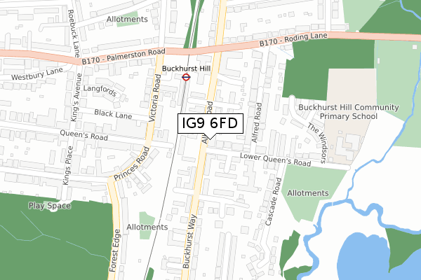
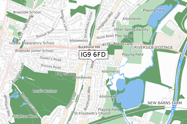
IG9 6FD is located in the Buckhurst Hill East electoral ward, within the local authority district of Epping Forest and the English Parliamentary constituency of Epping Forest. The Sub Integrated Care Board (ICB) Location is NHS Hertfordshire and West Essex ICB - 07H and the police force is Essex. This postcode has been in use since April 2018.


GetTheData
Source: OS Open Zoomstack (Ordnance Survey)
Licence: Open Government Licence (requires attribution)
Attribution: Contains OS data © Crown copyright and database right 2024
Source: Open Postcode Geo
Licence: Open Government Licence (requires attribution)
Attribution: Contains OS data © Crown copyright and database right 2024; Contains Royal Mail data © Royal Mail copyright and database right 2024; Source: Office for National Statistics licensed under the Open Government Licence v.3.0
| Easting | 541854 |
| Northing | 193796 |
| Latitude | 51.625110 |
| Longitude | 0.047915 |
GetTheData
Source: Open Postcode Geo
Licence: Open Government Licence
| Country | England |
| Postcode District | IG9 |
| ➜ IG9 open data dashboard ➜ See where IG9 is on a map ➜ Where is Buckhurst Hill? | |
GetTheData
Source: Land Registry Price Paid Data
Licence: Open Government Licence
| Ward | Buckhurst Hill East |
| Constituency | Epping Forest |
GetTheData
Source: ONS Postcode Database
Licence: Open Government Licence
| January 2024 | Burglary | On or near King'S Avenue | 339m |
| December 2023 | Burglary | On or near King'S Avenue | 339m |
| November 2023 | Violence and sexual offences | On or near King'S Avenue | 339m |
| ➜ Get more crime data in our Crime section | |||
GetTheData
Source: data.police.uk
Licence: Open Government Licence
| Cedar Close (Albert Road) | Buckhurst Hill | 56m |
| Beatrice Court (Albert Road) | Buckhurst Hill | 72m |
| Cedar Close (Buckhurst Way) | Buckhurst Hill | 163m |
| Beatrice Court (Albert Road) | Buckhurst Hill | 175m |
| Railway Station (Station Forecourt) | Buckhurst Hill | 194m |
| Buckhurst Hill Underground Station | Buckhurst Hill | 184m |
| Roding Valley Underground Station | Woodford | 928m |
| Chingford Station | 2.8km |
| Highams Park Station | 3.8km |
| Wood Street Station | 5.5km |
GetTheData
Source: NaPTAN
Licence: Open Government Licence
GetTheData
Source: ONS Postcode Database
Licence: Open Government Licence


➜ Get more ratings from the Food Standards Agency
GetTheData
Source: Food Standards Agency
Licence: FSA terms & conditions
| Last Collection | |||
|---|---|---|---|
| Location | Mon-Fri | Sat | Distance |
| Queens Road Post Office | 17:15 | 12:00 | 130m |
| River Road | 17:00 | 12:00 | 539m |
| Palmerston Road | 17:15 | 12:00 | 665m |
GetTheData
Source: Dracos
Licence: Creative Commons Attribution-ShareAlike
| Facility | Distance |
|---|---|
| Roding Valley Recreation Ground (South) Roding Lane, Buckhurst Hill Grass Pitches | 531m |
| Buckhurst Hill Football Club Roding Lane, Buckhurst Hill Grass Pitches | 536m |
| Buckhurst Hill Cricket And Lacrosse Club Roding Lane, Buckhurst Hill Grass Pitches | 682m |
GetTheData
Source: Active Places
Licence: Open Government Licence
| School | Phase of Education | Distance |
|---|---|---|
| Buckhurst Hill Community Primary School Lower Queen's Road, Buckhurst Hill, IG9 6DS | Primary | 324m |
| Daiglen School 68 Palmerston Road, Buckhurst Hill, Esses, IG9 5LG | Not applicable | 768m |
| Loyola Preparatory School 103 Palmerston Road, BUCKHURST HILL, IG9 5NH | Not applicable | 867m |
GetTheData
Source: Edubase
Licence: Open Government Licence
The below table lists the International Territorial Level (ITL) codes (formerly Nomenclature of Territorial Units for Statistics (NUTS) codes) and Local Administrative Units (LAU) codes for IG9 6FD:
| ITL 1 Code | Name |
|---|---|
| TLH | East |
| ITL 2 Code | Name |
| TLH3 | Essex |
| ITL 3 Code | Name |
| TLH35 | West Essex |
| LAU 1 Code | Name |
| E07000072 | Epping Forest |
GetTheData
Source: ONS Postcode Directory
Licence: Open Government Licence
The below table lists the Census Output Area (OA), Lower Layer Super Output Area (LSOA), and Middle Layer Super Output Area (MSOA) for IG9 6FD:
| Code | Name | |
|---|---|---|
| OA | E00110446 | |
| LSOA | E01021743 | Epping Forest 015B |
| MSOA | E02004541 | Epping Forest 015 |
GetTheData
Source: ONS Postcode Directory
Licence: Open Government Licence
| IG9 6DN | Lower Queens Road | 46m |
| IG9 6BQ | Albert Road | 49m |
| IG9 6EA | Beatrice Court | 50m |
| IG9 6DF | Lower Queens Road | 51m |
| IG9 6BA | Albert Road | 59m |
| IG9 6DH | Mountbatten Court | 62m |
| IG9 6DL | Lower Queens Road | 78m |
| IG9 6BB | Yew Close | 92m |
| IG9 6BF | Beatrice Court | 106m |
| IG9 5BZ | Queens Road | 131m |
GetTheData
Source: Open Postcode Geo; Land Registry Price Paid Data
Licence: Open Government Licence