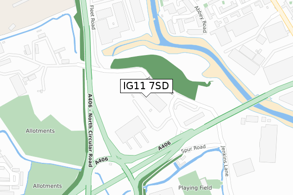
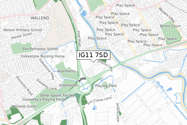
IG11 7SD is located in the East Ham South electoral ward, within the London borough of Newham and the English Parliamentary constituency of East Ham. The Sub Integrated Care Board (ICB) Location is NHS North East London ICB - A3A8R and the police force is Metropolitan Police. This postcode has been in use since March 2019.


GetTheData
Source: OS Open Zoomstack (Ordnance Survey)
Licence: Open Government Licence (requires attribution)
Attribution: Contains OS data © Crown copyright and database right 2024
Source: Open Postcode Geo
Licence: Open Government Licence (requires attribution)
Attribution: Contains OS data © Crown copyright and database right 2024; Contains Royal Mail data © Royal Mail copyright and database right 2024; Source: Office for National Statistics licensed under the Open Government Licence v.3.0
| Easting | 544053 |
| Northing | 183037 |
| Latitude | 51.527877 |
| Longitude | 0.075253 |
GetTheData
Source: Open Postcode Geo
Licence: Open Government Licence
| Country | England |
| Postcode District | IG11 |
| ➜ IG11 open data dashboard ➜ See where IG11 is on a map ➜ Where is East Ham? | |
GetTheData
Source: Land Registry Price Paid Data
Licence: Open Government Licence
| Ward | East Ham South |
| Constituency | East Ham |
GetTheData
Source: ONS Postcode Database
Licence: Open Government Licence
| June 2022 | Vehicle crime | On or near Sports/Recreation Area | 289m |
| June 2022 | Vehicle crime | On or near Sports/Recreation Area | 289m |
| June 2022 | Vehicle crime | On or near Sports/Recreation Area | 289m |
| ➜ Get more crime data in our Crime section | |||
GetTheData
Source: data.police.uk
Licence: Open Government Licence
| Jenkins Lane (Newham Way) | Wallend | 197m |
| North Circular Road Jenkins Lane (Newham Way) | Wallend | 218m |
| Quay Road | Wallend | 288m |
| Quay Road | Wallend | 335m |
| Beckton Showcase Cinema (Jenkins Lane) | Wallend | 344m |
| Barking Underground Station | Barking | 1,336m |
| Barking Station | 1.4km |
| Woodgrange Park Station | 3.2km |
| Manor Park Station | 3.4km |
GetTheData
Source: NaPTAN
Licence: Open Government Licence
GetTheData
Source: ONS Postcode Database
Licence: Open Government Licence


➜ Get more ratings from the Food Standards Agency
GetTheData
Source: Food Standards Agency
Licence: FSA terms & conditions
| Last Collection | |||
|---|---|---|---|
| Location | Mon-Fri | Sat | Distance |
| Blaney Crescent | 17:30 | 11:30 | 562m |
| Saxham Road | 17:00 | 12:45 | 718m |
| Abbey Road | 17:30 | 12:00 | 737m |
GetTheData
Source: Dracos
Licence: Creative Commons Attribution-ShareAlike
| Facility | Distance |
|---|---|
| Powerleague (Newham) Jenkins Lane, Barking Artificial Grass Pitch | 353m |
| Gascoigne Primary School Gascoigne Road, Barking Sports Hall, Artificial Grass Pitch | 658m |
| Gooseley Playing Fields St. Albans Avenue, East Ham, London Grass Pitches, Outdoor Tennis Courts, Cycling | 799m |
GetTheData
Source: Active Places
Licence: Open Government Licence
| School | Phase of Education | Distance |
|---|---|---|
| Northstar New School c/o Gascoigne Primary Annex, The Shaftesburys, Barking, IG11 7JA | Not applicable | 473m |
| Langdon Academy Sussex Road, East Ham, London, E6 2PS | All-through | 645m |
| Gascoigne Primary School Gascoigne Road, Barking, IG11 7DR | Primary | 658m |
GetTheData
Source: Edubase
Licence: Open Government Licence
The below table lists the International Territorial Level (ITL) codes (formerly Nomenclature of Territorial Units for Statistics (NUTS) codes) and Local Administrative Units (LAU) codes for IG11 7SD:
| ITL 1 Code | Name |
|---|---|
| TLI | London |
| ITL 2 Code | Name |
| TLI4 | Inner London - East |
| ITL 3 Code | Name |
| TLI41 | Hackney and Newham |
| LAU 1 Code | Name |
| E09000025 | Newham |
GetTheData
Source: ONS Postcode Directory
Licence: Open Government Licence
The below table lists the Census Output Area (OA), Lower Layer Super Output Area (LSOA), and Middle Layer Super Output Area (MSOA) for IG11 7SD:
| Code | Name | |
|---|---|---|
| OA | E00017858 | |
| LSOA | E01003535 | Newham 023A |
| MSOA | E02000736 | Newham 023 |
GetTheData
Source: ONS Postcode Directory
Licence: Open Government Licence
| IG11 7GN | Spring Place | 255m |
| IG11 7GJ | Spring Place | 271m |
| IG11 7GH | Spring Place | 276m |
| IG11 7GL | Spring Place | 302m |
| IG11 7GP | Dock Road | 313m |
| IG11 7GF | Spring Place | 315m |
| IG11 7JS | The Clarksons | 395m |
| IG11 7BT | Abbey Road | 405m |
| IG11 7JR | Boundary Road | 405m |
| IG11 7JW | The Shaftesburys | 431m |
GetTheData
Source: Open Postcode Geo; Land Registry Price Paid Data
Licence: Open Government Licence