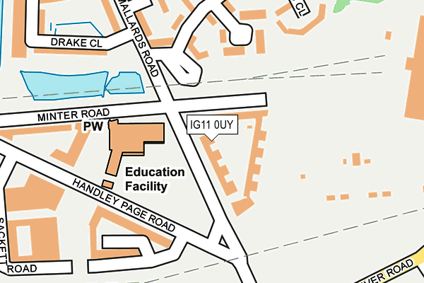
IG11 0UY is located in the Barking Riverside electoral ward, within the London borough of Barking and Dagenham and the English Parliamentary constituency of Barking. The Sub Integrated Care Board (ICB) Location is NHS North East London ICB - A3A8R and the police force is Metropolitan Police. This postcode has been in use since April 2017.


GetTheData
Source: OS OpenMap – Local (Ordnance Survey)
Source: OS VectorMap District (Ordnance Survey)
Licence: Open Government Licence (requires attribution)
| Easting | 546287 |
| Northing | 182233 |
| Latitude | 51.520079 |
| Longitude | 0.107101 |
GetTheData
Source: Open Postcode Geo
Licence: Open Government Licence
| Country | England |
| Postcode District | IG11 |
➜ See where IG11 is on a map ➜ Where is Barking? | |
GetTheData
Source: Land Registry Price Paid Data
Licence: Open Government Licence
| Ward | Barking Riverside |
| Constituency | Barking |
GetTheData
Source: ONS Postcode Database
Licence: Open Government Licence
| Rivergate Centre | Creekmouth | 242m |
| Barking Riverside | Creekmouth | 242m |
| Shearwater Close | Creekmouth | 329m |
| Dagenham Sunday Market | Creekmouth | 331m |
| Shearwater Close | Creekmouth | 355m |
| Dagenham Dock Station | 2.8km |
| Barking Station | 2.8km |
| Abbey Wood (London) Station | 3.4km |
GetTheData
Source: NaPTAN
Licence: Open Government Licence
| Percentage of properties with Next Generation Access | 100.0% |
| Percentage of properties with Superfast Broadband | 100.0% |
| Percentage of properties with Ultrafast Broadband | 100.0% |
| Percentage of properties with Full Fibre Broadband | 100.0% |
Superfast Broadband is between 30Mbps and 300Mbps
Ultrafast Broadband is > 300Mbps
| Median download speed | 100.0Mbps |
| Average download speed | 137.5Mbps |
| Maximum download speed | 200.00Mbps |
Ofcom does not currently provide upload speed data for IG11 0UY. This is because there are less than four broadband connections in this postcode.
| Percentage of properties unable to receive 2Mbps | 0.0% |
| Percentage of properties unable to receive 5Mbps | 0.0% |
| Percentage of properties unable to receive 10Mbps | 0.0% |
| Percentage of properties unable to receive 30Mbps | 0.0% |
GetTheData
Source: Ofcom
Licence: Ofcom Terms of Use (requires attribution)
GetTheData
Source: ONS Postcode Database
Licence: Open Government Licence


➜ Get more ratings from the Food Standards Agency
GetTheData
Source: Food Standards Agency
Licence: FSA terms & conditions
| Last Collection | |||
|---|---|---|---|
| Location | Mon-Fri | Sat | Distance |
| River Road | 18:30 | 12:30 | 835m |
| Thames View Post Office | 17:30 | 12:15 | 969m |
| Julia Gardens | 16:45 | 12:00 | 1,142m |
GetTheData
Source: Dracos
Licence: Creative Commons Attribution-ShareAlike
| Risk of IG11 0UY flooding from rivers and sea | Very Low |
| ➜ IG11 0UY flood map | |
GetTheData
Source: Open Flood Risk by Postcode
Licence: Open Government Licence
The below table lists the International Territorial Level (ITL) codes (formerly Nomenclature of Territorial Units for Statistics (NUTS) codes) and Local Administrative Units (LAU) codes for IG11 0UY:
| ITL 1 Code | Name |
|---|---|
| TLI | London |
| ITL 2 Code | Name |
| TLI5 | Outer London - East and North East |
| ITL 3 Code | Name |
| TLI52 | Barking & Dagenham and Havering |
| LAU 1 Code | Name |
| E09000002 | Barking and Dagenham |
GetTheData
Source: ONS Postcode Directory
Licence: Open Government Licence
The below table lists the Census Output Area (OA), Lower Layer Super Output Area (LSOA), and Middle Layer Super Output Area (MSOA) for IG11 0UY:
| Code | Name | |
|---|---|---|
| OA | E00175116 | |
| LSOA | E01000092 | Barking and Dagenham 019E |
| MSOA | E02000020 | Barking and Dagenham 019 |
GetTheData
Source: ONS Postcode Directory
Licence: Open Government Licence
| IG11 0TH | Minter Road | 71m |
| IG11 0TN | Minter Road | 95m |
| IG11 0FH | Drake Close | 194m |
| IG11 0FX | Harlequin Close | 229m |
| IG11 0FG | Harlequin Close | 229m |
| IG11 0FL | Chilworth Place | 231m |
| IG11 0FB | Davey Gardens | 254m |
| IG11 0GE | Marine Drive | 282m |
| IG11 0GY | Mallards Road | 291m |
| IG11 0FQ | De Pass Gardens | 311m |
GetTheData
Source: Open Postcode Geo; Land Registry Price Paid Data
Licence: Open Government Licence