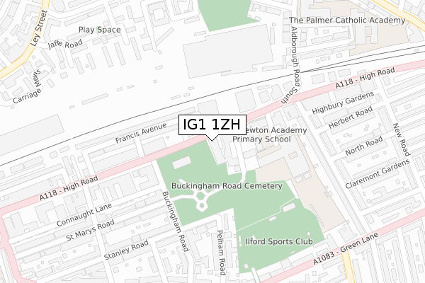
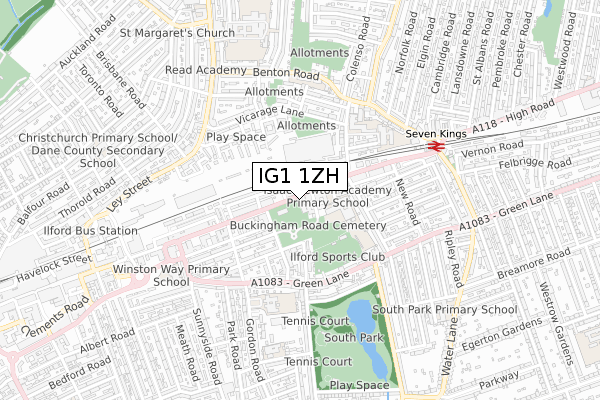
IG1 1ZH is located in the Ilford Town electoral ward, within the London borough of Redbridge and the English Parliamentary constituency of Ilford South. The Sub Integrated Care Board (ICB) Location is NHS North East London ICB - A3A8R and the police force is Metropolitan Police. This postcode has been in use since April 2020.


GetTheData
Source: OS Open Zoomstack (Ordnance Survey)
Licence: Open Government Licence (requires attribution)
Attribution: Contains OS data © Crown copyright and database right 2024
Source: Open Postcode Geo
Licence: Open Government Licence (requires attribution)
Attribution: Contains OS data © Crown copyright and database right 2024; Contains Royal Mail data © Royal Mail copyright and database right 2024; Source: Office for National Statistics licensed under the Open Government Licence v.3.0
| Easting | 544894 |
| Northing | 186864 |
| Latitude | 51.562049 |
| Longitude | 0.088942 |
GetTheData
Source: Open Postcode Geo
Licence: Open Government Licence
| Country | England |
| Postcode District | IG1 |
| ➜ IG1 open data dashboard ➜ See where IG1 is on a map ➜ Where is Ilford? | |
GetTheData
Source: Land Registry Price Paid Data
Licence: Open Government Licence
| Ward | Ilford Town |
| Constituency | Ilford South |
GetTheData
Source: ONS Postcode Database
Licence: Open Government Licence
| January 2024 | Anti-social behaviour | On or near Jaffe Road | 417m |
| January 2024 | Public order | On or near Jaffe Road | 417m |
| January 2024 | Violence and sexual offences | On or near Jaffe Road | 417m |
| ➜ Get more crime data in our Crime section | |||
GetTheData
Source: data.police.uk
Licence: Open Government Licence
| Ilford Fire Station (High Road) | Ilford | 48m |
| Ilford County Court | Ilford | 100m |
| Aldborough Road South Seven Kings (High Road) | Seven Kings | 154m |
| Connaught Road Seven Kings | Ilford | 263m |
| Buckingham Road Ilford | Ilford | 344m |
| Seven Kings Station | 0.6km |
| Ilford Station | 1.4km |
| Goodmayes Station | 1.6km |
GetTheData
Source: NaPTAN
Licence: Open Government Licence
GetTheData
Source: ONS Postcode Database
Licence: Open Government Licence


➜ Get more ratings from the Food Standards Agency
GetTheData
Source: Food Standards Agency
Licence: FSA terms & conditions
| Last Collection | |||
|---|---|---|---|
| Location | Mon-Fri | Sat | Distance |
| Cauliflower | 18:30 | 12:45 | 236m |
| Seven Kings Library | 17:15 | 12:00 | 245m |
| South Park Road | 17:30 | 12:45 | 414m |
GetTheData
Source: Dracos
Licence: Creative Commons Attribution-ShareAlike
| Facility | Distance |
|---|---|
| Ark Isaac Newton Academy Cricklefield Place, Ilford Sports Hall, Artificial Grass Pitch, Studio | 186m |
| Fort Galaxy Gym Connaught Lane, Ilford Health and Fitness Gym, Studio | 196m |
| Cricklefields Athletic Ground (Closed) High Road, Ilford Athletics, Grass Pitches, Swimming Pool, Health and Fitness Gym, Studio | 238m |
GetTheData
Source: Active Places
Licence: Open Government Licence
| School | Phase of Education | Distance |
|---|---|---|
| Ark Isaac Newton Academy 1 Cricklefield Place, Ilford, IG1 1FY | All-through | 227m |
| SS Peter and Paul's Catholic Primary School Gordon Road, Ilford, IG1 1SA | Primary | 452m |
| The Palmer Catholic Academy Aldborough Road South, Seven Kings, Ilford, IG3 8EU | Secondary | 463m |
GetTheData
Source: Edubase
Licence: Open Government Licence
The below table lists the International Territorial Level (ITL) codes (formerly Nomenclature of Territorial Units for Statistics (NUTS) codes) and Local Administrative Units (LAU) codes for IG1 1ZH:
| ITL 1 Code | Name |
|---|---|
| TLI | London |
| ITL 2 Code | Name |
| TLI5 | Outer London - East and North East |
| ITL 3 Code | Name |
| TLI53 | Redbridge and Waltham Forest |
| LAU 1 Code | Name |
| E09000026 | Redbridge |
GetTheData
Source: ONS Postcode Directory
Licence: Open Government Licence
The below table lists the Census Output Area (OA), Lower Layer Super Output Area (LSOA), and Middle Layer Super Output Area (MSOA) for IG1 1ZH:
| Code | Name | |
|---|---|---|
| OA | E00018543 | |
| LSOA | E01033591 | Redbridge 030I |
| MSOA | E02000780 | Redbridge 030 |
GetTheData
Source: ONS Postcode Directory
Licence: Open Government Licence
| IG1 1TZ | High Road | 52m |
| IG1 1TU | Elizabeth Avenue | 66m |
| IG1 1TT | Francis Avenue | 130m |
| IG1 1TX | High Road | 139m |
| IG1 1RE | Pelham Road | 176m |
| IG1 1TW | High Road | 184m |
| IG1 1UE | High Road | 188m |
| IG1 1RB | Stanley Road | 205m |
| IG1 1FS | High Road | 216m |
| IG1 1TR | High Road | 230m |
GetTheData
Source: Open Postcode Geo; Land Registry Price Paid Data
Licence: Open Government Licence