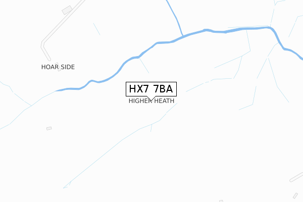
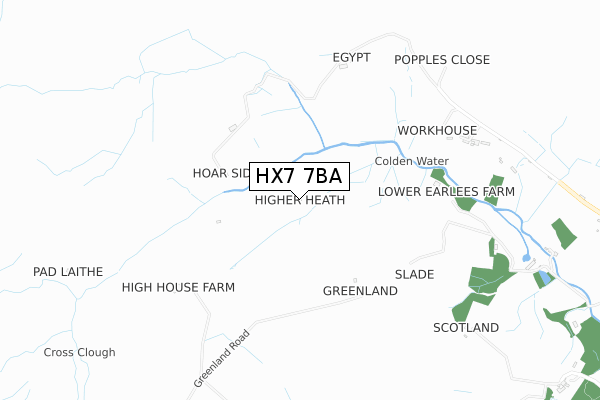
HX7 7BA is located in the Calder electoral ward, within the metropolitan district of Calderdale and the English Parliamentary constituency of Calder Valley. The Sub Integrated Care Board (ICB) Location is NHS West Yorkshire ICB - 02T and the police force is West Yorkshire. This postcode has been in use since September 2019.


GetTheData
Source: OS Open Zoomstack (Ordnance Survey)
Licence: Open Government Licence (requires attribution)
Attribution: Contains OS data © Crown copyright and database right 2024
Source: Open Postcode Geo
Licence: Open Government Licence (requires attribution)
Attribution: Contains OS data © Crown copyright and database right 2024; Contains Royal Mail data © Royal Mail copyright and database right 2024; Source: Office for National Statistics licensed under the Open Government Licence v.3.0
| Easting | 394299 |
| Northing | 429382 |
| Latitude | 53.760776 |
| Longitude | -2.087955 |
GetTheData
Source: Open Postcode Geo
Licence: Open Government Licence
| Country | England |
| Postcode District | HX7 |
| ➜ HX7 open data dashboard ➜ See where HX7 is on a map | |
GetTheData
Source: Land Registry Price Paid Data
Licence: Open Government Licence
| Ward | Calder |
| Constituency | Calder Valley |
GetTheData
Source: ONS Postcode Database
Licence: Open Government Licence
GetTheData
Source: ONS Postcode Database
Licence: Open Government Licence
| Last Collection | |||
|---|---|---|---|
| Location | Mon-Fri | Sat | Distance |
| Edge Hey Green | 16:15 | 11:15 | 2,561m |
| Charlestown | 16:45 | 10:30 | 4,081m |
| Lydgate P.o. | 17:15 | 11:30 | 4,322m |
GetTheData
Source: Dracos
Licence: Creative Commons Attribution-ShareAlike
| Facility | Distance |
|---|---|
| Todmorden Golf Club Cross Stone Road, Todmorden Golf | 4.4km |
| Hebden Royd C Of E Primary School Church Lane, Hebden Bridge Grass Pitches | 4.6km |
| Todmorden Lawn Tennis Club Stansfield Hall Road, Burnthouse Lane, Todmorden Outdoor Tennis Courts | 4.6km |
GetTheData
Source: Active Places
Licence: Open Government Licence
| School | Phase of Education | Distance |
|---|---|---|
| Colden Junior and Infant School Smithy Lane, Colden, Hebden Bridge, HX7 7HW | Primary | 2.1km |
| Heptonstall Junior Infant and Nursery School Smithwell Lane, Heptonstall, Hebden Bridge, HX7 7NX | Primary | 4.4km |
| Ferney Lee Primary School Ferney Lee Road, Todmorden, OL14 5NR | Primary | 4.5km |
GetTheData
Source: Edubase
Licence: Open Government Licence
The below table lists the International Territorial Level (ITL) codes (formerly Nomenclature of Territorial Units for Statistics (NUTS) codes) and Local Administrative Units (LAU) codes for HX7 7BA:
| ITL 1 Code | Name |
|---|---|
| TLE | Yorkshire and The Humber |
| ITL 2 Code | Name |
| TLE4 | West Yorkshire |
| ITL 3 Code | Name |
| TLE44 | Calderdale and Kirklees |
| LAU 1 Code | Name |
| E08000033 | Calderdale |
GetTheData
Source: ONS Postcode Directory
Licence: Open Government Licence
The below table lists the Census Output Area (OA), Lower Layer Super Output Area (LSOA), and Middle Layer Super Output Area (MSOA) for HX7 7BA:
| Code | Name | |
|---|---|---|
| OA | E00054846 | |
| LSOA | E01010883 | Calderdale 004C |
| MSOA | E02002247 | Calderdale 004 |
GetTheData
Source: ONS Postcode Directory
Licence: Open Government Licence
| HX7 7PJ | 839m | |
| HX7 7PG | Edge Lane | 904m |
| HX7 7JA | 1142m | |
| HX7 7HR | 1346m | |
| HX7 7PH | 1771m | |
| HX7 7JB | Long Causeway | 1881m |
| HX7 7PE | Halstead Green | 1905m |
| HX7 7AU | Gorple Cottages | 1910m |
| HX7 7PQ | 2004m | |
| HX7 7PF | Sunny View | 2149m |
GetTheData
Source: Open Postcode Geo; Land Registry Price Paid Data
Licence: Open Government Licence