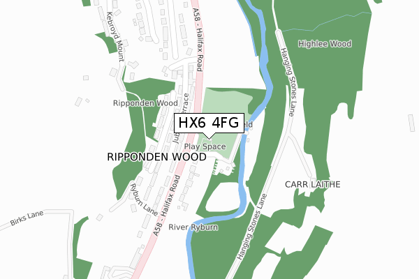
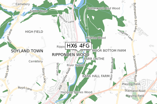
HX6 4FG is located in the Ryburn electoral ward, within the metropolitan district of Calderdale and the English Parliamentary constituency of Calder Valley. The Sub Integrated Care Board (ICB) Location is NHS West Yorkshire ICB - 02T and the police force is West Yorkshire. This postcode has been in use since December 2019.


GetTheData
Source: OS Open Zoomstack (Ordnance Survey)
Licence: Open Government Licence (requires attribution)
Attribution: Contains OS data © Crown copyright and database right 2024
Source: Open Postcode Geo
Licence: Open Government Licence (requires attribution)
Attribution: Contains OS data © Crown copyright and database right 2024; Contains Royal Mail data © Royal Mail copyright and database right 2024; Source: Office for National Statistics licensed under the Open Government Licence v.3.0
| Easting | 404441 |
| Northing | 420596 |
| Latitude | 53.681821 |
| Longitude | -1.934240 |
GetTheData
Source: Open Postcode Geo
Licence: Open Government Licence
| Country | England |
| Postcode District | HX6 |
| ➜ HX6 open data dashboard ➜ See where HX6 is on a map ➜ Where is Ripponden Wood? | |
GetTheData
Source: Land Registry Price Paid Data
Licence: Open Government Licence
| Ward | Ryburn |
| Constituency | Calder Valley |
GetTheData
Source: ONS Postcode Database
Licence: Open Government Licence
| January 2024 | Violence and sexual offences | On or near Lower Park Royd Drive | 357m |
| January 2024 | Drugs | On or near Lower Park Royd Drive | 357m |
| July 2023 | Vehicle crime | On or near Lower Park Royd Drive | 357m |
| ➜ Get more crime data in our Crime section | |||
GetTheData
Source: data.police.uk
Licence: Open Government Licence
| Halifax Rd Kenworthy Lane (Halifax Road) | Kebroyd | 70m |
| Halifax Rd Kenworthy Lane (Halifax Road) | Kebroyd | 100m |
| Halifax Road Hillside (Halifax Road) | Kebroyd | 247m |
| Halifax Road Hillside (Halifax Road) | Kebroyd | 266m |
| Halifax Rd Meadowcroft Lane (Halifax Road) | Ripponden | 413m |
| Sowerby Bridge Station | 3.4km |
GetTheData
Source: NaPTAN
Licence: Open Government Licence
GetTheData
Source: ONS Postcode Database
Licence: Open Government Licence

➜ Get more ratings from the Food Standards Agency
GetTheData
Source: Food Standards Agency
Licence: FSA terms & conditions
| Last Collection | |||
|---|---|---|---|
| Location | Mon-Fri | Sat | Distance |
| Ripponden Wood | 17:15 | 11:00 | 89m |
| Lower Kebroyd | 17:15 | 11:45 | 653m |
| Brig Royd | 17:30 | 11:30 | 732m |
GetTheData
Source: Dracos
Licence: Creative Commons Attribution-ShareAlike
| Facility | Distance |
|---|---|
| Ripponden Woods Playing Field Ripponden Wood Lane, Ripponden, Sowerby Bridge Grass Pitches | 0m |
| Barkisland Cricket Club Scammonden Road, Barkisland, Halifax Grass Pitches | 1.2km |
| St Mary's C Of E (Vc) J And I School Triangle, Sowerby Bridge Grass Pitches | 1.2km |
GetTheData
Source: Active Places
Licence: Open Government Licence
| School | Phase of Education | Distance |
|---|---|---|
| Ripponden Junior and Infant School Halifax Road, Ripponden, Sowerby Bridge, HX6 4AH | Primary | 630m |
| Riverbank Primary School Unit 2 Ripponden Mill, Ripponden, Halifax, HX6 4DH | Not applicable | 949m |
| Barkisland CofE VA Primary School Scammonden Road, Barkisland, Halifax, HX4 0BD | Primary | 1.1km |
GetTheData
Source: Edubase
Licence: Open Government Licence
The below table lists the International Territorial Level (ITL) codes (formerly Nomenclature of Territorial Units for Statistics (NUTS) codes) and Local Administrative Units (LAU) codes for HX6 4FG:
| ITL 1 Code | Name |
|---|---|
| TLE | Yorkshire and The Humber |
| ITL 2 Code | Name |
| TLE4 | West Yorkshire |
| ITL 3 Code | Name |
| TLE44 | Calderdale and Kirklees |
| LAU 1 Code | Name |
| E08000033 | Calderdale |
GetTheData
Source: ONS Postcode Directory
Licence: Open Government Licence
The below table lists the Census Output Area (OA), Lower Layer Super Output Area (LSOA), and Middle Layer Super Output Area (MSOA) for HX6 4FG:
| Code | Name | |
|---|---|---|
| OA | E00055241 | |
| LSOA | E01010957 | Calderdale 027E |
| MSOA | E02002270 | Calderdale 027 |
GetTheData
Source: ONS Postcode Directory
Licence: Open Government Licence
| HX6 4AG | Halifax Road | 84m |
| HX6 4AE | Jubilee Terrace | 94m |
| HX6 4AB | Coronation Terrace | 125m |
| HX6 4AD | Kenworthy Lane | 160m |
| HX6 4AF | Highfield Terrace | 167m |
| HX6 3HP | Hillside Avenue | 176m |
| HX6 4AQ | Ryburn Lane | 231m |
| HX6 3HW | Halifax Road | 327m |
| HX6 3HR | Lower Park Royd Drive | 357m |
| HX6 3JB | Hill Park Mount | 376m |
GetTheData
Source: Open Postcode Geo; Land Registry Price Paid Data
Licence: Open Government Licence