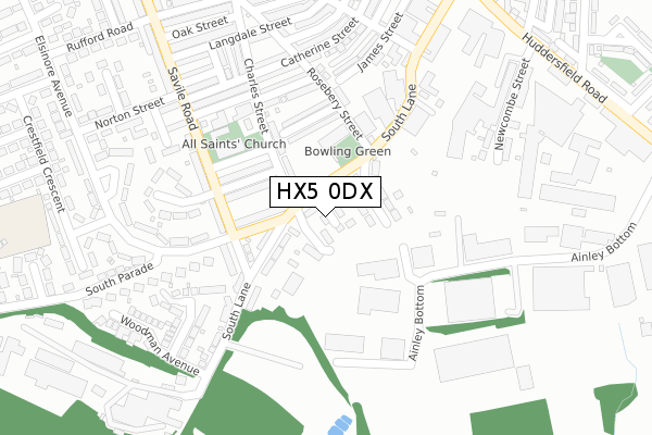
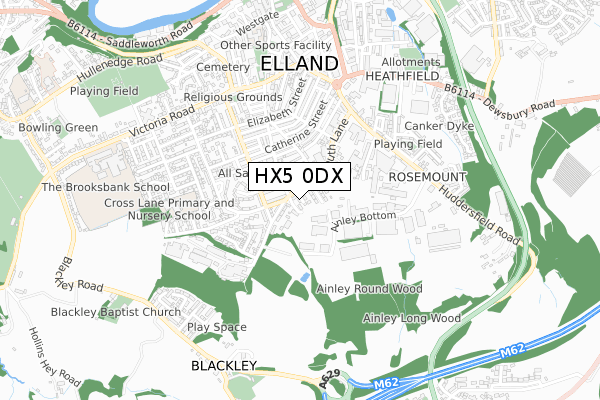
HX5 0DX is located in the Elland electoral ward, within the metropolitan district of Calderdale and the English Parliamentary constituency of Calder Valley. The Sub Integrated Care Board (ICB) Location is NHS West Yorkshire ICB - 02T and the police force is West Yorkshire. This postcode has been in use since October 2017.


GetTheData
Source: OS Open Zoomstack (Ordnance Survey)
Licence: Open Government Licence (requires attribution)
Attribution: Contains OS data © Crown copyright and database right 2024
Source: Open Postcode Geo
Licence: Open Government Licence (requires attribution)
Attribution: Contains OS data © Crown copyright and database right 2024; Contains Royal Mail data © Royal Mail copyright and database right 2024; Source: Office for National Statistics licensed under the Open Government Licence v.3.0
| Easting | 410892 |
| Northing | 420354 |
| Latitude | 53.679553 |
| Longitude | -1.836582 |
GetTheData
Source: Open Postcode Geo
Licence: Open Government Licence
| Country | England |
| Postcode District | HX5 |
| ➜ HX5 open data dashboard ➜ See where HX5 is on a map ➜ Where is Elland? | |
GetTheData
Source: Land Registry Price Paid Data
Licence: Open Government Licence
| Ward | Elland |
| Constituency | Calder Valley |
GetTheData
Source: ONS Postcode Database
Licence: Open Government Licence
| January 2024 | Violence and sexual offences | On or near Parking Area | 321m |
| August 2023 | Public order | On or near Parking Area | 321m |
| July 2023 | Violence and sexual offences | On or near Petrol Station | 451m |
| ➜ Get more crime data in our Crime section | |||
GetTheData
Source: data.police.uk
Licence: Open Government Licence
| South Parade South Lane (South Parade) | Elland | 100m |
| South Parade South Lane (South Parade) | Elland | 102m |
| South Lane Rosebery St (South Lane) | Elland | 116m |
| South Lane Rosebery St (South Lane) | Elland | 136m |
| Catherine Street Rosebery St (Catherine Street) | Elland | 251m |
| Brighouse Station | 4.3km |
| Halifax Station | 4.7km |
| Huddersfield Station | 4.9km |
GetTheData
Source: NaPTAN
Licence: Open Government Licence
➜ Broadband speed and availability dashboard for HX5 0DX
| Percentage of properties with Next Generation Access | 100.0% |
| Percentage of properties with Superfast Broadband | 100.0% |
| Percentage of properties with Ultrafast Broadband | 0.0% |
| Percentage of properties with Full Fibre Broadband | 0.0% |
Superfast Broadband is between 30Mbps and 300Mbps
Ultrafast Broadband is > 300Mbps
| Median download speed | 39.1Mbps |
| Average download speed | 39.0Mbps |
| Maximum download speed | 78.11Mbps |
| Median upload speed | 9.8Mbps |
| Average upload speed | 8.9Mbps |
| Maximum upload speed | 20.00Mbps |
| Percentage of properties unable to receive 2Mbps | 0.0% |
| Percentage of properties unable to receive 5Mbps | 0.0% |
| Percentage of properties unable to receive 10Mbps | 0.0% |
| Percentage of properties unable to receive 30Mbps | 0.0% |
➜ Broadband speed and availability dashboard for HX5 0DX
GetTheData
Source: Ofcom
Licence: Ofcom Terms of Use (requires attribution)
GetTheData
Source: ONS Postcode Database
Licence: Open Government Licence


➜ Get more ratings from the Food Standards Agency
GetTheData
Source: Food Standards Agency
Licence: FSA terms & conditions
| Last Collection | |||
|---|---|---|---|
| Location | Mon-Fri | Sat | Distance |
| Woodman | 17:15 | 11:30 | 146m |
| 12 Elsinore Avenue | 17:15 | 11:30 | 416m |
| 161 Huddersfield Road | 17:15 | 11:30 | 462m |
GetTheData
Source: Dracos
Licence: Creative Commons Attribution-ShareAlike
| Facility | Distance |
|---|---|
| Jc Health & Fitness Burley Street, Elland Health and Fitness Gym, Studio | 424m |
| Elland Fitness Centre (Closed) Town Hall Buildings, Elland Studio, Health and Fitness Gym | 545m |
| Elland Swimming Pool (Closed) Town Hall Street, Elland Swimming Pool, Health and Fitness Gym | 573m |
GetTheData
Source: Active Places
Licence: Open Government Licence
| School | Phase of Education | Distance |
|---|---|---|
| Cross Lane Primary and Nursery School Cross Lane, Elland, HX5 0LP | Primary | 518m |
| Elland Church of England (Voluntary Aided) Junior, Infant and Nursery School Westgate, Elland, HX5 0BB | Primary | 710m |
| The Brooksbank School Victoria Road, Elland, HX5 0QG | Secondary | 842m |
GetTheData
Source: Edubase
Licence: Open Government Licence
The below table lists the International Territorial Level (ITL) codes (formerly Nomenclature of Territorial Units for Statistics (NUTS) codes) and Local Administrative Units (LAU) codes for HX5 0DX:
| ITL 1 Code | Name |
|---|---|
| TLE | Yorkshire and The Humber |
| ITL 2 Code | Name |
| TLE4 | West Yorkshire |
| ITL 3 Code | Name |
| TLE44 | Calderdale and Kirklees |
| LAU 1 Code | Name |
| E08000033 | Calderdale |
GetTheData
Source: ONS Postcode Directory
Licence: Open Government Licence
The below table lists the Census Output Area (OA), Lower Layer Super Output Area (LSOA), and Middle Layer Super Output Area (MSOA) for HX5 0DX:
| Code | Name | |
|---|---|---|
| OA | E00054898 | |
| LSOA | E01010894 | Calderdale 025D |
| MSOA | E02002268 | Calderdale 025 |
GetTheData
Source: ONS Postcode Directory
Licence: Open Government Licence
| HX5 0PB | Dodgson Street | 57m |
| HX5 0HP | Charles Street | 90m |
| HX5 0HS | South Lane Gardens | 94m |
| HX5 0NL | Waverley Road | 125m |
| HX5 0NX | Savile Road | 131m |
| HX5 0NP | South Parade | 135m |
| HX5 0HU | Myrtle Road | 139m |
| HX5 0HR | The Crescent | 145m |
| HX5 0HT | Rosebery Street | 156m |
| HX5 0NN | Cobden Terrace | 166m |
GetTheData
Source: Open Postcode Geo; Land Registry Price Paid Data
Licence: Open Government Licence