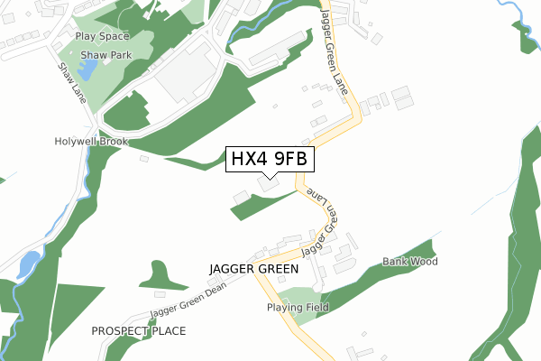
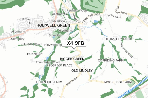
HX4 9FB is located in the Greetland and Stainland electoral ward, within the metropolitan district of Calderdale and the English Parliamentary constituency of Calder Valley. The Sub Integrated Care Board (ICB) Location is NHS West Yorkshire ICB - 02T and the police force is West Yorkshire. This postcode has been in use since January 2020.


GetTheData
Source: OS Open Zoomstack (Ordnance Survey)
Licence: Open Government Licence (requires attribution)
Attribution: Contains OS data © Crown copyright and database right 2024
Source: Open Postcode Geo
Licence: Open Government Licence (requires attribution)
Attribution: Contains OS data © Crown copyright and database right 2024; Contains Royal Mail data © Royal Mail copyright and database right 2024; Source: Office for National Statistics licensed under the Open Government Licence v.3.0
| Easting | 409176 |
| Northing | 419383 |
| Latitude | 53.670858 |
| Longitude | -1.862589 |
GetTheData
Source: Open Postcode Geo
Licence: Open Government Licence
| Country | England |
| Postcode District | HX4 |
| ➜ HX4 open data dashboard ➜ See where HX4 is on a map | |
GetTheData
Source: Land Registry Price Paid Data
Licence: Open Government Licence
| Ward | Greetland And Stainland |
| Constituency | Calder Valley |
GetTheData
Source: ONS Postcode Database
Licence: Open Government Licence
| May 2022 | Criminal damage and arson | On or near Greaves Fold | 389m |
| April 2022 | Violence and sexual offences | On or near Rock View | 448m |
| March 2022 | Anti-social behaviour | On or near Mellor Mill Lane | 433m |
| ➜ Get more crime data in our Crime section | |||
GetTheData
Source: data.police.uk
Licence: Open Government Licence
| Jagger Green Lane Carr Farm (Jagger Green Lane) | Holywell Green | 51m |
| Jagger Green Ln Benroyd Terrace (Jagger Green Lane) | Holywell Green | 97m |
| New Rd Jagger Green (New Road) | Holywell Green | 275m |
| Jagger Green Lane Greaves Farm (Jagger Green Lane) | Holywell Green | 290m |
| Station Road Shaw St (Station Road) | Holywell Green | 414m |
| Sowerby Bridge Station | 5.1km |
| Lockwood Station | 5.7km |
GetTheData
Source: NaPTAN
Licence: Open Government Licence
GetTheData
Source: ONS Postcode Database
Licence: Open Government Licence


➜ Get more ratings from the Food Standards Agency
GetTheData
Source: Food Standards Agency
Licence: FSA terms & conditions
| Last Collection | |||
|---|---|---|---|
| Location | Mon-Fri | Sat | Distance |
| Jagger Green Holywell Green | 16:30 | 10:00 | 173m |
| Brook Bridge | 16:30 | 08:00 | 437m |
| Holywell Green P.o. Box | 17:15 | 12:00 | 587m |
GetTheData
Source: Dracos
Licence: Creative Commons Attribution-ShareAlike
| Facility | Distance |
|---|---|
| Elland Golf Club Hammerstones Leach Lane, Elland Golf | 1km |
| Brooksbank Cycle Circuit And Sports Complex Hammerstones Leach Lane, Elland Grass Pitches, Cycling | 1.1km |
| Outlane Cricket Club Off Old Lindley Road, Huddersfield Grass Pitches | 1.2km |
GetTheData
Source: Active Places
Licence: Open Government Licence
| School | Phase of Education | Distance |
|---|---|---|
| Holywell Green Primary School Stainland Road, Holywell Green, Halifax, HX4 9AE | Primary | 673m |
| Moorlands Primary School Moorlands Road, Mount, Huddersfield, HD3 3UH | Primary | 1.5km |
| The Brooksbank School Victoria Road, Elland, HX5 0QG | Secondary | 1.5km |
GetTheData
Source: Edubase
Licence: Open Government Licence
The below table lists the International Territorial Level (ITL) codes (formerly Nomenclature of Territorial Units for Statistics (NUTS) codes) and Local Administrative Units (LAU) codes for HX4 9FB:
| ITL 1 Code | Name |
|---|---|
| TLE | Yorkshire and The Humber |
| ITL 2 Code | Name |
| TLE4 | West Yorkshire |
| ITL 3 Code | Name |
| TLE44 | Calderdale and Kirklees |
| LAU 1 Code | Name |
| E08000033 | Calderdale |
GetTheData
Source: ONS Postcode Directory
Licence: Open Government Licence
The below table lists the Census Output Area (OA), Lower Layer Super Output Area (LSOA), and Middle Layer Super Output Area (MSOA) for HX4 9FB:
| Code | Name | |
|---|---|---|
| OA | E00054959 | |
| LSOA | E01010896 | Calderdale 026A |
| MSOA | E02002269 | Calderdale 026 |
GetTheData
Source: ONS Postcode Directory
Licence: Open Government Licence
| HX4 9DA | Ben Royd Terrace | 157m |
| HX4 9DE | Jagger Green | 160m |
| HX4 9BZ | East View Jagger Lane | 208m |
| HX4 9DB | Jagger Green Lane | 241m |
| HX4 9BY | New Row | 320m |
| HX4 9BX | Denton Row | 343m |
| HX4 9BU | Greaves Place | 382m |
| HX4 9AP | Mellor Mill Lane | 384m |
| HX4 9DY | Greaves Fold | 405m |
| HX4 9BL | Holybrook Court | 430m |
GetTheData
Source: Open Postcode Geo; Land Registry Price Paid Data
Licence: Open Government Licence