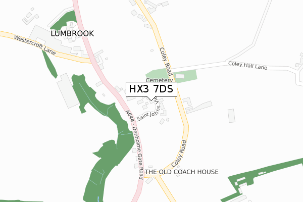
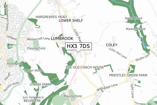
HX3 7DS is located in the Hipperholme and Lightcliffe electoral ward, within the metropolitan district of Calderdale and the English Parliamentary constituency of Calder Valley. The Sub Integrated Care Board (ICB) Location is NHS West Yorkshire ICB - 02T and the police force is West Yorkshire. This postcode has been in use since July 2018.


GetTheData
Source: OS Open Zoomstack (Ordnance Survey)
Licence: Open Government Licence (requires attribution)
Attribution: Contains OS data © Crown copyright and database right 2024
Source: Open Postcode Geo
Licence: Open Government Licence (requires attribution)
Attribution: Contains OS data © Crown copyright and database right 2024; Contains Royal Mail data © Royal Mail copyright and database right 2024; Source: Office for National Statistics licensed under the Open Government Licence v.3.0
| Easting | 412383 |
| Northing | 426844 |
| Latitude | 53.737852 |
| Longitude | -1.813754 |
GetTheData
Source: Open Postcode Geo
Licence: Open Government Licence
| Country | England |
| Postcode District | HX3 |
| ➜ HX3 open data dashboard ➜ See where HX3 is on a map ➜ Where is Lumbrook? | |
GetTheData
Source: Land Registry Price Paid Data
Licence: Open Government Licence
| Ward | Hipperholme And Lightcliffe |
| Constituency | Calder Valley |
GetTheData
Source: ONS Postcode Database
Licence: Open Government Licence
| November 2021 | Public order | On or near Denholme Gate Road | 96m |
| October 2021 | Violence and sexual offences | On or near Coley Hall Lane | 489m |
| August 2021 | Public order | On or near Coley Hall Lane | 489m |
| ➜ Get more crime data in our Crime section | |||
GetTheData
Source: data.police.uk
Licence: Open Government Licence
| The Brown Horse Inn (Denholme Gate Road) | Coley | 85m |
| St Johns Church (Coley Road) | Coley | 116m |
| St Johns Church (Coley Road) | Coley | 122m |
| The Brown Horse Inn (Denholme Gate Road) | Coley | 138m |
| Denholme Gate Road Coley Rd (Denholme Gate Road) | Coley | 214m |
| Halifax Station | 3.2km |
| Low Moor Station | 4.2km |
| Brighouse Station | 5km |
GetTheData
Source: NaPTAN
Licence: Open Government Licence
➜ Broadband speed and availability dashboard for HX3 7DS
| Percentage of properties with Next Generation Access | 100.0% |
| Percentage of properties with Superfast Broadband | 0.0% |
| Percentage of properties with Ultrafast Broadband | 0.0% |
| Percentage of properties with Full Fibre Broadband | 0.0% |
Superfast Broadband is between 30Mbps and 300Mbps
Ultrafast Broadband is > 300Mbps
| Median download speed | 18.5Mbps |
| Average download speed | 16.6Mbps |
| Maximum download speed | 20.40Mbps |
| Median upload speed | 1.2Mbps |
| Average upload speed | 1.3Mbps |
| Maximum upload speed | 2.07Mbps |
| Percentage of properties unable to receive 2Mbps | 0.0% |
| Percentage of properties unable to receive 5Mbps | 0.0% |
| Percentage of properties unable to receive 10Mbps | 0.0% |
| Percentage of properties unable to receive 30Mbps | 100.0% |
➜ Broadband speed and availability dashboard for HX3 7DS
GetTheData
Source: Ofcom
Licence: Ofcom Terms of Use (requires attribution)
GetTheData
Source: ONS Postcode Database
Licence: Open Government Licence


➜ Get more ratings from the Food Standards Agency
GetTheData
Source: Food Standards Agency
Licence: FSA terms & conditions
| Last Collection | |||
|---|---|---|---|
| Location | Mon-Fri | Sat | Distance |
| Northowram P.o. Box | 17:00 | 12:00 | 979m |
| 22 Bramley View | 17:00 | 11:45 | 1,311m |
| Southedge Close Hipperholme | 17:30 | 12:00 | 1,626m |
GetTheData
Source: Dracos
Licence: Creative Commons Attribution-ShareAlike
| Facility | Distance |
|---|---|
| Northowram Hedge Top Cricket Club Hedge Top Lane, Halifax Grass Pitches | 720m |
| Woodhead Denholme Gate Road, Halifax Grass Pitches | 740m |
| Northowram Community Sports & Activity Club Westercroft Lane, Halifax Grass Pitches | 747m |
GetTheData
Source: Active Places
Licence: Open Government Licence
| School | Phase of Education | Distance |
|---|---|---|
| Hipperholme Grammar School Bramley Lane, HX3 8JE | Not applicable | 1km |
| Northowram Primary School Baxter Lane, Northowram, Halifax, HX3 7EF | Primary | 1.3km |
| Shelf Junior and Infant School Shelf Hall Lane, Shelf, Halifax, HX3 7LT | Primary | 1.5km |
GetTheData
Source: Edubase
Licence: Open Government Licence
The below table lists the International Territorial Level (ITL) codes (formerly Nomenclature of Territorial Units for Statistics (NUTS) codes) and Local Administrative Units (LAU) codes for HX3 7DS:
| ITL 1 Code | Name |
|---|---|
| TLE | Yorkshire and The Humber |
| ITL 2 Code | Name |
| TLE4 | West Yorkshire |
| ITL 3 Code | Name |
| TLE44 | Calderdale and Kirklees |
| LAU 1 Code | Name |
| E08000033 | Calderdale |
GetTheData
Source: ONS Postcode Directory
Licence: Open Government Licence
The below table lists the Census Output Area (OA), Lower Layer Super Output Area (LSOA), and Middle Layer Super Output Area (MSOA) for HX3 7DS:
| Code | Name | |
|---|---|---|
| OA | E00054998 | |
| LSOA | E01010907 | Calderdale 011C |
| MSOA | E02002254 | Calderdale 011 |
GetTheData
Source: ONS Postcode Directory
Licence: Open Government Licence
| HX3 7SB | Denholme Gate Road | 74m |
| HX3 7LA | 197m | |
| HX3 7SD | Lane Ends | 217m |
| HX3 7UD | Lumbrook Close | 356m |
| HX3 7SA | Coley Road | 479m |
| HX3 8RD | 598m | |
| HX3 8JR | Denholme Gate Road | 665m |
| HX3 8JS | Gaythorne Terrace | 666m |
| HX3 8JT | Southfield Terrace | 673m |
| HX3 8FW | Northedge Lane | 696m |
GetTheData
Source: Open Postcode Geo; Land Registry Price Paid Data
Licence: Open Government Licence