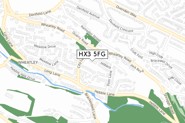
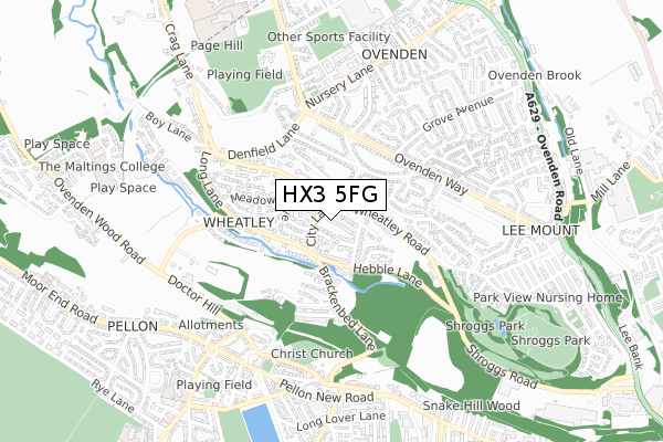
HX3 5FG is located in the Ovenden electoral ward, within the metropolitan district of Calderdale and the English Parliamentary constituency of Halifax. The Sub Integrated Care Board (ICB) Location is NHS West Yorkshire ICB - 02T and the police force is West Yorkshire. This postcode has been in use since December 2018.


GetTheData
Source: OS Open Zoomstack (Ordnance Survey)
Licence: Open Government Licence (requires attribution)
Attribution: Contains OS data © Crown copyright and database right 2024
Source: Open Postcode Geo
Licence: Open Government Licence (requires attribution)
Attribution: Contains OS data © Crown copyright and database right 2024; Contains Royal Mail data © Royal Mail copyright and database right 2024; Source: Office for National Statistics licensed under the Open Government Licence v.3.0
| Easting | 407556 |
| Northing | 426553 |
| Latitude | 53.735328 |
| Longitude | -1.886938 |
GetTheData
Source: Open Postcode Geo
Licence: Open Government Licence
| Country | England |
| Postcode District | HX3 |
| ➜ HX3 open data dashboard ➜ See where HX3 is on a map ➜ Where is Halifax? | |
GetTheData
Source: Land Registry Price Paid Data
Licence: Open Government Licence
| Ward | Ovenden |
| Constituency | Halifax |
GetTheData
Source: ONS Postcode Database
Licence: Open Government Licence
5, DONA FOLD, HALIFAX, HX3 5FG 2019 8 NOV £322,000 |
1, DONA FOLD, HALIFAX, HX3 5FG 2019 25 OCT £244,000 |
2, DONA FOLD, HALIFAX, HX3 5FG 2019 24 MAY £241,000 |
3, DONA FOLD, HALIFAX, HX3 5FG 2019 11 MAR £174,250 |
4, DONA FOLD, HALIFAX, HX3 5FG 2018 20 DEC £240,000 |
GetTheData
Source: HM Land Registry Price Paid Data
Licence: Contains HM Land Registry data © Crown copyright and database right 2024. This data is licensed under the Open Government Licence v3.0.
| January 2024 | Violence and sexual offences | On or near Vegal Crescent | 445m |
| December 2023 | Public order | On or near Vegal Crescent | 445m |
| November 2023 | Public order | On or near Vegal Crescent | 445m |
| ➜ Get more crime data in our Crime section | |||
GetTheData
Source: data.police.uk
Licence: Open Government Licence
| Wheatley Rd Dyer Lane (Wheatley Road) | Wheatley | 74m |
| Wheatley Rd Dyer Lane (Wheatley Road) | Wheatley | 76m |
| Long Lane City Ln (Long Lane) | Wheatley | 156m |
| City Lane Bottom (Long Lane) | Wheatley | 156m |
| Wheatley Road Ramsden St (Wheatley Road) | Lee Mount | 193m |
| Halifax Station | 2.7km |
| Sowerby Bridge Station | 3.3km |
GetTheData
Source: NaPTAN
Licence: Open Government Licence
GetTheData
Source: ONS Postcode Database
Licence: Open Government Licence


➜ Get more ratings from the Food Standards Agency
GetTheData
Source: Food Standards Agency
Licence: FSA terms & conditions
| Last Collection | |||
|---|---|---|---|
| Location | Mon-Fri | Sat | Distance |
| King Cross P.o. Box | 17:30 | 12:00 | 1,528m |
| 115 Haley Hill | 17:30 | 11:45 | 1,569m |
| St James Road | 18:30 | 12:00 | 1,945m |
GetTheData
Source: Dracos
Licence: Creative Commons Attribution-ShareAlike
| Facility | Distance |
|---|---|
| Pellon & District Community Centre (Closed) Church Lane, Halifax Sports Hall | 529m |
| Machines Gym (Closed) Nursery Lane, Halifax Health and Fitness Gym | 568m |
| Threeways Sports Centre (Closed) Nursery Lane, Ovenden, Halifax Sports Hall, Health and Fitness Gym, Swimming Pool | 589m |
GetTheData
Source: Active Places
Licence: Open Government Licence
| School | Phase of Education | Distance |
|---|---|---|
| Lee Mount Primary School Lee Mount Road, Lee Mount, Halifax, HX3 5EB | Primary | 707m |
| Christ Church Pellon CofE VC Primary School Sandbeds Road, Pellon, Halifax, HX2 0QQ | Primary | 872m |
| Dean Field Community Primary School Cousin Lane, Ovenden, Halifax, HX2 8DQ | Primary | 876m |
GetTheData
Source: Edubase
Licence: Open Government Licence
The below table lists the International Territorial Level (ITL) codes (formerly Nomenclature of Territorial Units for Statistics (NUTS) codes) and Local Administrative Units (LAU) codes for HX3 5FG:
| ITL 1 Code | Name |
|---|---|
| TLE | Yorkshire and The Humber |
| ITL 2 Code | Name |
| TLE4 | West Yorkshire |
| ITL 3 Code | Name |
| TLE44 | Calderdale and Kirklees |
| LAU 1 Code | Name |
| E08000033 | Calderdale |
GetTheData
Source: ONS Postcode Directory
Licence: Open Government Licence
The below table lists the Census Output Area (OA), Lower Layer Super Output Area (LSOA), and Middle Layer Super Output Area (MSOA) for HX3 5FG:
| Code | Name | |
|---|---|---|
| OA | E00055163 | |
| LSOA | E01010939 | Calderdale 005B |
| MSOA | E02002248 | Calderdale 005 |
GetTheData
Source: ONS Postcode Directory
Licence: Open Government Licence
| HX3 5LB | Woodroyd Drive | 45m |
| HX3 5LF | City Terrace | 47m |
| HX3 5LE | City Lane | 52m |
| HX3 5LU | Hillbeck | 56m |
| HX3 5LG | Wheatley City | 71m |
| HX3 5LH | White Birch Terrace | 85m |
| HX3 5LJ | Wheatley Road | 90m |
| HX3 5LQ | Hebble View | 99m |
| HX3 5HX | Heatherdale Close | 103m |
| HX3 5LP | Co Operative Buildings | 106m |
GetTheData
Source: Open Postcode Geo; Land Registry Price Paid Data
Licence: Open Government Licence