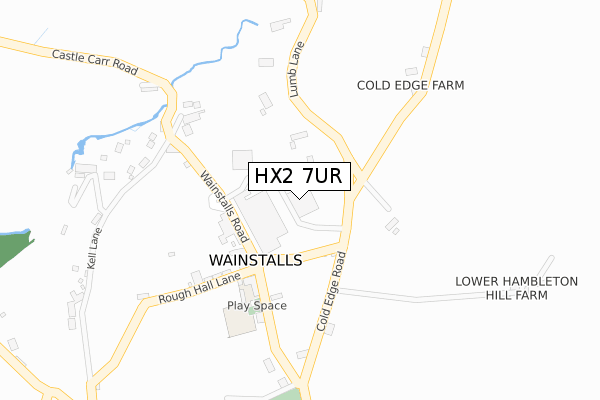
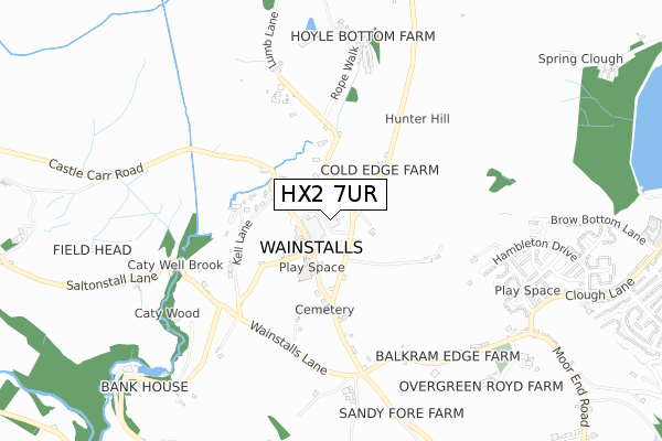
HX2 7UR is located in the Luddendenfoot electoral ward, within the metropolitan district of Calderdale and the English Parliamentary constituency of Calder Valley. The Sub Integrated Care Board (ICB) Location is NHS West Yorkshire ICB - 02T and the police force is West Yorkshire. This postcode has been in use since January 2020.


GetTheData
Source: OS Open Zoomstack (Ordnance Survey)
Licence: Open Government Licence (requires attribution)
Attribution: Contains OS data © Crown copyright and database right 2024
Source: Open Postcode Geo
Licence: Open Government Licence (requires attribution)
Attribution: Contains OS data © Crown copyright and database right 2024; Contains Royal Mail data © Royal Mail copyright and database right 2024; Source: Office for National Statistics licensed under the Open Government Licence v.3.0
| Easting | 404742 |
| Northing | 428575 |
| Latitude | 53.753534 |
| Longitude | -1.929565 |
GetTheData
Source: Open Postcode Geo
Licence: Open Government Licence
| Country | England |
| Postcode District | HX2 |
| ➜ HX2 open data dashboard ➜ See where HX2 is on a map ➜ Where is Wainstalls? | |
GetTheData
Source: Land Registry Price Paid Data
Licence: Open Government Licence
| Ward | Luddendenfoot |
| Constituency | Calder Valley |
GetTheData
Source: ONS Postcode Database
Licence: Open Government Licence
| June 2022 | Vehicle crime | On or near Wainstalls Road | 120m |
| June 2022 | Burglary | On or near Wainstalls Road | 120m |
| April 2022 | Violence and sexual offences | On or near Wainstalls Road | 120m |
| ➜ Get more crime data in our Crime section | |||
GetTheData
Source: data.police.uk
Licence: Open Government Licence
| Wainstalls Rd Tree Lane (Wainstalls Road) | Wainstalls | 110m |
| Wainstalls Rd Rough Hall Lane (Wainstalls Road) | Wainstalls | 143m |
| Terminus (Wainstalls Road ( Terminus Point)) | Wainstalls | 152m |
| Wainstalls Road | Wainstalls | 233m |
| Wainstalls Road | Wainstalls | 281m |
| Mytholmroyd Station | 4.4km |
GetTheData
Source: NaPTAN
Licence: Open Government Licence
GetTheData
Source: ONS Postcode Database
Licence: Open Government Licence


➜ Get more ratings from the Food Standards Agency
GetTheData
Source: Food Standards Agency
Licence: FSA terms & conditions
| Last Collection | |||
|---|---|---|---|
| Location | Mon-Fri | Sat | Distance |
| 36 Mount Tabor Road | 17:00 | 11:45 | 2,472m |
| Luddenden | 16:45 | 10:30 | 3,647m |
| Mytholmroyd P.o. Box | 17:15 | 12:00 | 4,357m |
GetTheData
Source: Dracos
Licence: Creative Commons Attribution-ShareAlike
| Facility | Distance |
|---|---|
| Balkram Edge Balkram Edge, Balkram Edge, Wainstalls, Halifax Grass Pitches | 529m |
| Ash Green Community Primary School (Upper Site) Clough Lane, Clough Lane, Halifax Artificial Grass Pitch | 1.2km |
| Mixenden Recreation Ground Clough Lane, Mixenden, Halifax Grass Pitches | 1.5km |
GetTheData
Source: Active Places
Licence: Open Government Licence
| School | Phase of Education | Distance |
|---|---|---|
| Wainstalls School Wainstalls, Halifax, HX2 7TE | Primary | 159m |
| Endeavour House School Old Hall, Moor End, Halifax, HX2 0TX | Not applicable | 846m |
| Ash Green Community Primary School Mixenden Road, Mixenden, Halifax, HX2 8QD | Primary | 1.5km |
GetTheData
Source: Edubase
Licence: Open Government Licence
The below table lists the International Territorial Level (ITL) codes (formerly Nomenclature of Territorial Units for Statistics (NUTS) codes) and Local Administrative Units (LAU) codes for HX2 7UR:
| ITL 1 Code | Name |
|---|---|
| TLE | Yorkshire and The Humber |
| ITL 2 Code | Name |
| TLE4 | West Yorkshire |
| ITL 3 Code | Name |
| TLE44 | Calderdale and Kirklees |
| LAU 1 Code | Name |
| E08000033 | Calderdale |
GetTheData
Source: ONS Postcode Directory
Licence: Open Government Licence
The below table lists the Census Output Area (OA), Lower Layer Super Output Area (LSOA), and Middle Layer Super Output Area (MSOA) for HX2 7UR:
| Code | Name | |
|---|---|---|
| OA | E00055042 | |
| LSOA | E01010920 | Calderdale 007D |
| MSOA | E02002250 | Calderdale 007 |
GetTheData
Source: ONS Postcode Directory
Licence: Open Government Licence
| HX2 7RH | Lower Slack | 120m |
| HX2 7TJ | Lower Slack | 121m |
| HX2 7TQ | Sun Buildings | 137m |
| HX2 7TX | 168m | |
| HX2 7TH | Rough Hall Lane | 204m |
| HX2 7TN | Upper Kell | 221m |
| HX2 7TW | Kell Butts | 233m |
| HX2 7UN | Kell Lane | 267m |
| HX2 7TY | Cold Edge Road | 267m |
| HX2 7UJ | Lumb Lane | 299m |
GetTheData
Source: Open Postcode Geo; Land Registry Price Paid Data
Licence: Open Government Licence