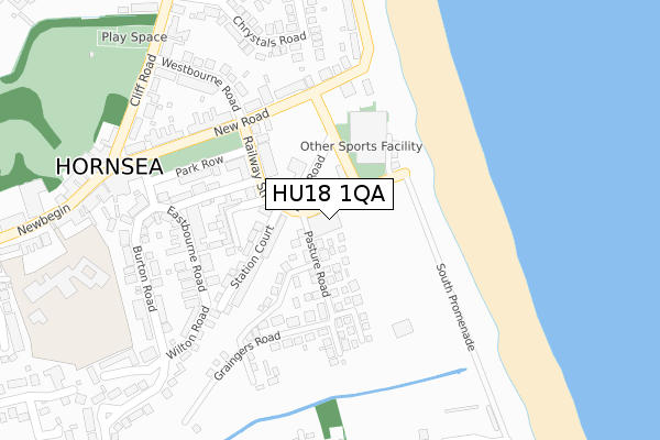
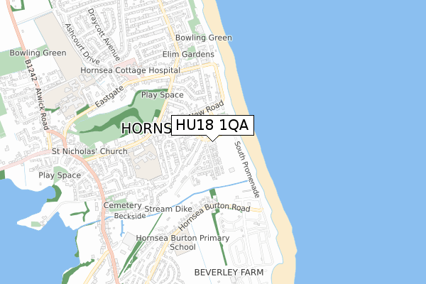
HU18 1QA lies on Sands Lane in Hornsea. HU18 1QA is located in the North Holderness electoral ward, within the unitary authority of East Riding of Yorkshire and the English Parliamentary constituency of Beverley and Holderness. The Sub Integrated Care Board (ICB) Location is NHS Humber and North Yorkshire ICB - 02Y and the police force is Humberside. This postcode has been in use since May 2019.


GetTheData
Source: OS Open Zoomstack (Ordnance Survey)
Licence: Open Government Licence (requires attribution)
Attribution: Contains OS data © Crown copyright and database right 2024
Source: Open Postcode Geo
Licence: Open Government Licence (requires attribution)
Attribution: Contains OS data © Crown copyright and database right 2024; Contains Royal Mail data © Royal Mail copyright and database right 2024; Source: Office for National Statistics licensed under the Open Government Licence v.3.0
| Easting | 520827 |
| Northing | 447704 |
| Latitude | 53.911428 |
| Longitude | -0.162064 |
GetTheData
Source: Open Postcode Geo
Licence: Open Government Licence
| Street | Sands Lane |
| Town/City | Hornsea |
| Country | England |
| Postcode District | HU18 |
| ➜ HU18 open data dashboard ➜ See where HU18 is on a map ➜ Where is Hornsea? | |
GetTheData
Source: Land Registry Price Paid Data
Licence: Open Government Licence
| Ward | North Holderness |
| Constituency | Beverley And Holderness |
GetTheData
Source: ONS Postcode Database
Licence: Open Government Licence
| December 2023 | Violence and sexual offences | On or near Grosvenor Road | 282m |
| October 2023 | Violence and sexual offences | On or near Parking Area | 175m |
| September 2023 | Violence and sexual offences | On or near Grosvenor Road | 282m |
| ➜ Get more crime data in our Crime section | |||
GetTheData
Source: data.police.uk
Licence: Open Government Licence
| Hornsea Sands Lane (Sands Lane) | Hornsea | 23m |
| Hornsea Marine Drive (Marine Drive) | Hornsea | 199m |
| Hornsea Marine Drive (Marine Drive) | Hornsea | 206m |
| Hornsea New Road (New Road) | Hornsea | 274m |
| Hornsea New Road (New Road) | Hornsea | 309m |
GetTheData
Source: NaPTAN
Licence: Open Government Licence
GetTheData
Source: ONS Postcode Database
Licence: Open Government Licence


➜ Get more ratings from the Food Standards Agency
GetTheData
Source: Food Standards Agency
Licence: FSA terms & conditions
| Last Collection | |||
|---|---|---|---|
| Location | Mon-Fri | Sat | Distance |
| Cliff Road | 16:30 | 11:30 | 444m |
| Seaton Post Office | 16:45 | 11:00 | 4,585m |
| Great Hatfield | 17:00 | 12:30 | 5,061m |
GetTheData
Source: Dracos
Licence: Creative Commons Attribution-ShareAlike
| Facility | Distance |
|---|---|
| East Riding Leisure Hornsea Broadway, Hornsea Sports Hall, Swimming Pool, Health and Fitness Gym, Squash Courts, Studio | 139m |
| Hornsea School & Language College Eastgate, Hornsea Grass Pitches, Sports Hall, Health and Fitness Gym, Artificial Grass Pitch | 833m |
| Hornsea & District Indoor Bowls Club Atwick Road, Hornsea Indoor Bowls | 1.2km |
GetTheData
Source: Active Places
Licence: Open Government Licence
| School | Phase of Education | Distance |
|---|---|---|
| Hornsea Community Primary School Newbegin, Hornsea, HU18 1PB | Primary | 452m |
| Hornsea Nursery School Willows Drive, Hornsea, HU18 1DA | Nursery | 469m |
| Hornsea Burton Primary School Hornsea Burton Road, Hornsea, HU18 1TG | Primary | 590m |
GetTheData
Source: Edubase
Licence: Open Government Licence
The below table lists the International Territorial Level (ITL) codes (formerly Nomenclature of Territorial Units for Statistics (NUTS) codes) and Local Administrative Units (LAU) codes for HU18 1QA:
| ITL 1 Code | Name |
|---|---|
| TLE | Yorkshire and The Humber |
| ITL 2 Code | Name |
| TLE1 | East Yorkshire and Northern Lincolnshire |
| ITL 3 Code | Name |
| TLE12 | East Riding of Yorkshire |
| LAU 1 Code | Name |
| E06000011 | East Riding of Yorkshire |
GetTheData
Source: ONS Postcode Directory
Licence: Open Government Licence
The below table lists the Census Output Area (OA), Lower Layer Super Output Area (LSOA), and Middle Layer Super Output Area (MSOA) for HU18 1QA:
| Code | Name | |
|---|---|---|
| OA | E00065828 | |
| LSOA | E01013049 | East Riding of Yorkshire 012C |
| MSOA | E02002695 | East Riding of Yorkshire 012 |
GetTheData
Source: ONS Postcode Directory
Licence: Open Government Licence
| HU18 1QB | Pasture Road | 113m |
| HU18 1QD | Station Court | 135m |
| HU18 1PS | Railway Street | 140m |
| HU18 1PX | Wilton Terrace | 158m |
| HU18 1PP | Shuttleworth Court | 178m |
| HU18 1PR | Railway Street | 178m |
| HU18 1QT | South Terrace | 183m |
| HU18 1PT | Park Row | 191m |
| HU18 1PH | New Road | 204m |
| HU18 1PW | New Road | 205m |
GetTheData
Source: Open Postcode Geo; Land Registry Price Paid Data
Licence: Open Government Licence