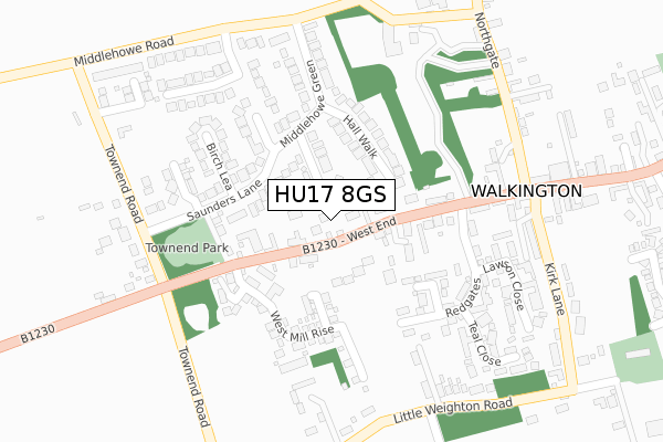
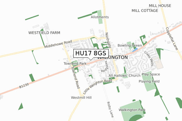
HU17 8GS is located in the Beverley Rural electoral ward, within the unitary authority of East Riding of Yorkshire and the English Parliamentary constituency of Beverley and Holderness. The Sub Integrated Care Board (ICB) Location is NHS Humber and North Yorkshire ICB - 02Y and the police force is Humberside. This postcode has been in use since August 2019.


GetTheData
Source: OS Open Zoomstack (Ordnance Survey)
Licence: Open Government Licence (requires attribution)
Attribution: Contains OS data © Crown copyright and database right 2024
Source: Open Postcode Geo
Licence: Open Government Licence (requires attribution)
Attribution: Contains OS data © Crown copyright and database right 2024; Contains Royal Mail data © Royal Mail copyright and database right 2024; Source: Office for National Statistics licensed under the Open Government Licence v.3.0
| Easting | 499380 |
| Northing | 437031 |
| Latitude | 53.820084 |
| Longitude | -0.491878 |
GetTheData
Source: Open Postcode Geo
Licence: Open Government Licence
| Country | England |
| Postcode District | HU17 |
| ➜ HU17 open data dashboard ➜ See where HU17 is on a map ➜ Where is Walkington? | |
GetTheData
Source: Land Registry Price Paid Data
Licence: Open Government Licence
| Ward | Beverley Rural |
| Constituency | Beverley And Holderness |
GetTheData
Source: ONS Postcode Database
Licence: Open Government Licence
1, APPLE TREE YARD, WALKINGTON, BEVERLEY, HU17 8GS 2019 1 NOV £415,000 |
GetTheData
Source: HM Land Registry Price Paid Data
Licence: Contains HM Land Registry data © Crown copyright and database right 2024. This data is licensed under the Open Government Licence v3.0.
| June 2022 | Violence and sexual offences | On or near Redgates | 218m |
| May 2022 | Shoplifting | On or near Taylors Close | 290m |
| April 2022 | Violence and sexual offences | On or near Kirk Lane | 359m |
| ➜ Get more crime data in our Crime section | |||
GetTheData
Source: data.police.uk
Licence: Open Government Licence
| Walkington West End (West End) | Walkington | 50m |
| Walkington West End (West End) | Walkington | 70m |
| Walkington West End (West End) | Walkington | 181m |
| Walkington Townend Road (Townend Road) | Walkington | 270m |
| Walkington Townend Road (Townend Road) | Walkington | 285m |
| Beverley Station | 5.2km |
GetTheData
Source: NaPTAN
Licence: Open Government Licence
GetTheData
Source: ONS Postcode Database
Licence: Open Government Licence


➜ Get more ratings from the Food Standards Agency
GetTheData
Source: Food Standards Agency
Licence: FSA terms & conditions
| Last Collection | |||
|---|---|---|---|
| Location | Mon-Fri | Sat | Distance |
| Bentley | 16:00 | 12:00 | 2,785m |
| Little Weighton Post Office | 16:45 | 11:15 | 3,393m |
| Normandy Avenue | 16:00 | 12:00 | 3,461m |
GetTheData
Source: Dracos
Licence: Creative Commons Attribution-ShareAlike
| Facility | Distance |
|---|---|
| Walkington Playing Field Beech View, Walkington Grass Pitches, Outdoor Tennis Courts | 866m |
| Broadgates Playing Field Broadgate, Walkington Grass Pitches | 2.5km |
| Beverley And East Riding Golf Club Westwood, Beverley Golf | 3.2km |
GetTheData
Source: Active Places
Licence: Open Government Licence
| School | Phase of Education | Distance |
|---|---|---|
| Walkington Primary School Crake Wells, Walkington, Beverley, HU17 8SB | Primary | 870m |
| Bishop Burton College York Road, Bishop Burton, Beverley, HU17 8QG | 16 plus | 3.2km |
| Little Weighton Rowley Church of England Voluntary Controlled Primary School White Gap Road, Little Weighton, Cottingham, HU20 3XE | Primary | 3.5km |
GetTheData
Source: Edubase
Licence: Open Government Licence
The below table lists the International Territorial Level (ITL) codes (formerly Nomenclature of Territorial Units for Statistics (NUTS) codes) and Local Administrative Units (LAU) codes for HU17 8GS:
| ITL 1 Code | Name |
|---|---|
| TLE | Yorkshire and The Humber |
| ITL 2 Code | Name |
| TLE1 | East Yorkshire and Northern Lincolnshire |
| ITL 3 Code | Name |
| TLE12 | East Riding of Yorkshire |
| LAU 1 Code | Name |
| E06000011 | East Riding of Yorkshire |
GetTheData
Source: ONS Postcode Directory
Licence: Open Government Licence
The below table lists the Census Output Area (OA), Lower Layer Super Output Area (LSOA), and Middle Layer Super Output Area (MSOA) for HU17 8GS:
| Code | Name | |
|---|---|---|
| OA | E00065207 | |
| LSOA | E01012921 | East Riding of Yorkshire 020B |
| MSOA | E02002703 | East Riding of Yorkshire 020 |
GetTheData
Source: ONS Postcode Directory
Licence: Open Government Licence
| HU17 8TG | Saunders Croft | 72m |
| HU17 8SX | West End | 92m |
| HU17 8TF | Hall Walk | 101m |
| HU17 8TL | Bramble Garth | 129m |
| HU17 8TQ | Saunders Lane | 155m |
| HU17 8TX | Home Farm | 163m |
| HU17 8TP | West Mill Rise | 175m |
| HU17 8TU | Spinney Way | 175m |
| HU17 8TH | Birch Lea | 194m |
| HU17 8TE | Middlehowe Green | 199m |
GetTheData
Source: Open Postcode Geo; Land Registry Price Paid Data
Licence: Open Government Licence