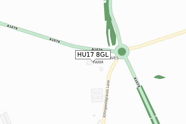
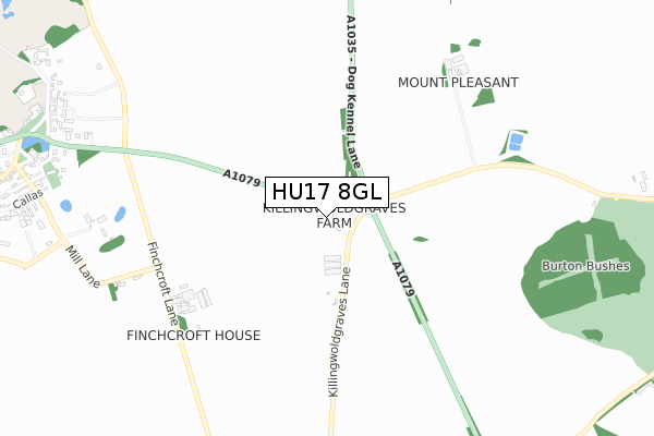
HU17 8GL is located in the Beverley Rural electoral ward, within the unitary authority of East Riding of Yorkshire and the English Parliamentary constituency of Beverley and Holderness. The Sub Integrated Care Board (ICB) Location is NHS Humber and North Yorkshire ICB - 02Y and the police force is Humberside. This postcode has been in use since June 2017.


GetTheData
Source: OS Open Zoomstack (Ordnance Survey)
Licence: Open Government Licence (requires attribution)
Attribution: Contains OS data © Crown copyright and database right 2024
Source: Open Postcode Geo
Licence: Open Government Licence (requires attribution)
Attribution: Contains OS data © Crown copyright and database right 2024; Contains Royal Mail data © Royal Mail copyright and database right 2024; Source: Office for National Statistics licensed under the Open Government Licence v.3.0
| Easting | 500107 |
| Northing | 439571 |
| Latitude | 53.842766 |
| Longitude | -0.480014 |
GetTheData
Source: Open Postcode Geo
Licence: Open Government Licence
| Country | England |
| Postcode District | HU17 |
| ➜ HU17 open data dashboard ➜ See where HU17 is on a map | |
GetTheData
Source: Land Registry Price Paid Data
Licence: Open Government Licence
| Ward | Beverley Rural |
| Constituency | Beverley And Holderness |
GetTheData
Source: ONS Postcode Database
Licence: Open Government Licence
| Bishop Burton Killingwolds (A1079) | Bishop Burton | 63m |
| Bishop Burton A1079 (A1079) | Bishop Burton | 80m |
| Bishop Burton York Road (York Road) | Bishop Burton | 1,206m |
| Bishop Burton York Road (York Road) | Bishop Burton | 1,262m |
| Beverley Station | 3.8km |
| Arram Station | 5.8km |
GetTheData
Source: NaPTAN
Licence: Open Government Licence
| Percentage of properties with Next Generation Access | 100.0% |
| Percentage of properties with Superfast Broadband | 100.0% |
| Percentage of properties with Ultrafast Broadband | 0.0% |
| Percentage of properties with Full Fibre Broadband | 0.0% |
Superfast Broadband is between 30Mbps and 300Mbps
Ultrafast Broadband is > 300Mbps
| Percentage of properties unable to receive 2Mbps | 0.0% |
| Percentage of properties unable to receive 5Mbps | 0.0% |
| Percentage of properties unable to receive 10Mbps | 0.0% |
| Percentage of properties unable to receive 30Mbps | 0.0% |
GetTheData
Source: Ofcom
Licence: Ofcom Terms of Use (requires attribution)
GetTheData
Source: ONS Postcode Database
Licence: Open Government Licence


➜ Get more ratings from the Food Standards Agency
GetTheData
Source: Food Standards Agency
Licence: FSA terms & conditions
| Last Collection | |||
|---|---|---|---|
| Location | Mon-Fri | Sat | Distance |
| Westwood Road Beverley | 17:00 | 11:45 | 2,889m |
| North Bar | 18:00 | 12:45 | 2,937m |
| Woodhall Way Post Office | 17:15 | 11:15 | 2,976m |
GetTheData
Source: Dracos
Licence: Creative Commons Attribution-ShareAlike
| Facility | Distance |
|---|---|
| Bishop Burton College (Bishop Burton Sports Village) York Road, Bishop Burton, Beverley Health and Fitness Gym, Artificial Grass Pitch, Sports Hall, Grass Pitches, Squash Courts, Studio | 1.7km |
| Broadgates Playing Field Broadgate, Walkington Grass Pitches | 2.2km |
| Longcroft School And Sixth Form College Burton Road, Beverley Sports Hall, Artificial Grass Pitch, Health and Fitness Gym, Grass Pitches | 2.3km |
GetTheData
Source: Active Places
Licence: Open Government Licence
| School | Phase of Education | Distance |
|---|---|---|
| Bishop Burton College York Road, Bishop Burton, Beverley, HU17 8QG | 16 plus | 1.7km |
| Longcroft School and Sixth Form College Burton Road, Beverley, HU17 7EJ | Secondary | 2.3km |
| Walkington Primary School Crake Wells, Walkington, Beverley, HU17 8SB | Primary | 2.5km |
GetTheData
Source: Edubase
Licence: Open Government Licence
The below table lists the International Territorial Level (ITL) codes (formerly Nomenclature of Territorial Units for Statistics (NUTS) codes) and Local Administrative Units (LAU) codes for HU17 8GL:
| ITL 1 Code | Name |
|---|---|
| TLE | Yorkshire and The Humber |
| ITL 2 Code | Name |
| TLE1 | East Yorkshire and Northern Lincolnshire |
| ITL 3 Code | Name |
| TLE12 | East Riding of Yorkshire |
| LAU 1 Code | Name |
| E06000011 | East Riding of Yorkshire |
GetTheData
Source: ONS Postcode Directory
Licence: Open Government Licence
The below table lists the Census Output Area (OA), Lower Layer Super Output Area (LSOA), and Middle Layer Super Output Area (MSOA) for HU17 8GL:
| Code | Name | |
|---|---|---|
| OA | E00065168 | |
| LSOA | E01012919 | East Riding of Yorkshire 020A |
| MSOA | E02002703 | East Riding of Yorkshire 020 |
GetTheData
Source: ONS Postcode Directory
Licence: Open Government Licence
| HU17 8QU | Finchcroft Lane | 697m |
| HU17 8QY | Beverley Road | 716m |
| HU17 8QT | Mill Lane | 838m |
| HU17 8QB | Church Side | 1062m |
| HU17 8QA | 1120m | |
| HU17 8RU | Northlands | 1147m |
| HU17 8QD | School Green | 1182m |
| HU17 8QL | Callas | 1188m |
| HU17 8QJ | Cold Harbour View | 1203m |
| HU17 8QH | Pudding Gate | 1274m |
GetTheData
Source: Open Postcode Geo; Land Registry Price Paid Data
Licence: Open Government Licence