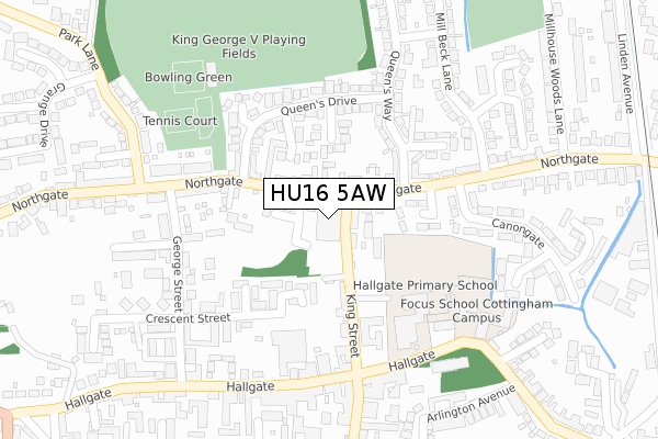
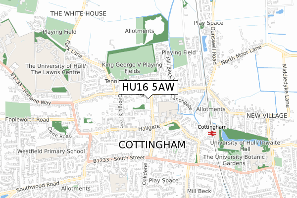
HU16 5AW is located in the Cottingham North electoral ward, within the unitary authority of East Riding of Yorkshire and the English Parliamentary constituency of Haltemprice and Howden. The Sub Integrated Care Board (ICB) Location is NHS Humber and North Yorkshire ICB - 02Y and the police force is Humberside. This postcode has been in use since January 2018.


GetTheData
Source: OS Open Zoomstack (Ordnance Survey)
Licence: Open Government Licence (requires attribution)
Attribution: Contains OS data © Crown copyright and database right 2024
Source: Open Postcode Geo
Licence: Open Government Licence (requires attribution)
Attribution: Contains OS data © Crown copyright and database right 2024; Contains Royal Mail data © Royal Mail copyright and database right 2024; Source: Office for National Statistics licensed under the Open Government Licence v.3.0
| Easting | 504574 |
| Northing | 433158 |
| Latitude | 53.784271 |
| Longitude | -0.414325 |
GetTheData
Source: Open Postcode Geo
Licence: Open Government Licence
| Country | England |
| Postcode District | HU16 |
| ➜ HU16 open data dashboard ➜ See where HU16 is on a map ➜ Where is Cottingham? | |
GetTheData
Source: Land Registry Price Paid Data
Licence: Open Government Licence
| Ward | Cottingham North |
| Constituency | Haltemprice And Howden |
GetTheData
Source: ONS Postcode Database
Licence: Open Government Licence
| January 2024 | Shoplifting | On or near Petrol Station | 60m |
| January 2024 | Other theft | On or near Petrol Station | 60m |
| January 2024 | Other theft | On or near Petrol Station | 60m |
| ➜ Get more crime data in our Crime section | |||
GetTheData
Source: data.police.uk
Licence: Open Government Licence
| Cottingham Northgate (Northgate) | Cottingham | 50m |
| Cottingham Northgate (Northgate) | Cottingham | 125m |
| Cottingham King Street (King Street) | Cottingham | 143m |
| Cottingham Northgate (Northgate) | Cottingham | 168m |
| Cottingham Northgate (Northgate) | Cottingham | 251m |
| Cottingham Station | 0.6km |
| Hull Station | 6.4km |
GetTheData
Source: NaPTAN
Licence: Open Government Licence
GetTheData
Source: ONS Postcode Database
Licence: Open Government Licence


➜ Get more ratings from the Food Standards Agency
GetTheData
Source: Food Standards Agency
Licence: FSA terms & conditions
| Last Collection | |||
|---|---|---|---|
| Location | Mon-Fri | Sat | Distance |
| Northgate | 17:00 | 12:15 | 38m |
| George Street | 17:00 | 12:15 | 279m |
| Cottingham Post Office | 17:15 | 12:00 | 387m |
GetTheData
Source: Dracos
Licence: Creative Commons Attribution-ShareAlike
| Facility | Distance |
|---|---|
| Hallgate Primary School Hallgate, Cottingham Sports Hall, Grass Pitches | 203m |
| Cottingham Sports Centre Northgate, Cottingham Sports Hall, Artificial Grass Pitch | 282m |
| King George V Playing Fields (Cottingham) Northgate, Cottingham Grass Pitches | 337m |
GetTheData
Source: Active Places
Licence: Open Government Licence
| School | Phase of Education | Distance |
|---|---|---|
| Hallgate Primary School Cottingham Hallgate Primary School, Hallgate, Cottingham, HU16 4DD | Primary | 203m |
| Bacon Garth Primary School The Garth, Cottingham, HU16 5BP | Primary | 785m |
| Westfield Primary School Westfield Primary School, Westfield Road, Cottingham, HU16 5PE | Primary | 867m |
GetTheData
Source: Edubase
Licence: Open Government Licence
The below table lists the International Territorial Level (ITL) codes (formerly Nomenclature of Territorial Units for Statistics (NUTS) codes) and Local Administrative Units (LAU) codes for HU16 5AW:
| ITL 1 Code | Name |
|---|---|
| TLE | Yorkshire and The Humber |
| ITL 2 Code | Name |
| TLE1 | East Yorkshire and Northern Lincolnshire |
| ITL 3 Code | Name |
| TLE12 | East Riding of Yorkshire |
| LAU 1 Code | Name |
| E06000011 | East Riding of Yorkshire |
GetTheData
Source: ONS Postcode Directory
Licence: Open Government Licence
The below table lists the Census Output Area (OA), Lower Layer Super Output Area (LSOA), and Middle Layer Super Output Area (MSOA) for HU16 5AW:
| Code | Name | |
|---|---|---|
| OA | E00175350 | |
| LSOA | E01012957 | East Riding of Yorkshire 025A |
| MSOA | E02002708 | East Riding of Yorkshire 025 |
GetTheData
Source: ONS Postcode Directory
Licence: Open Government Licence
| HU16 5QJ | King Street | 38m |
| HU16 5QB | Northgate House | 71m |
| HU16 4EH | Northgate | 94m |
| HU16 5RW | King Street | 96m |
| HU16 4EQ | Spencer Way | 103m |
| HU16 4EN | Tinley Close | 109m |
| HU16 5SS | Applegarth Mews | 121m |
| HU16 4HN | Wasdale Green | 139m |
| HU16 5RT | Northgate Mews | 157m |
| HU16 4EL | Queens Drive | 162m |
GetTheData
Source: Open Postcode Geo; Land Registry Price Paid Data
Licence: Open Government Licence