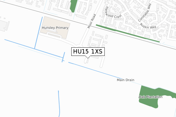
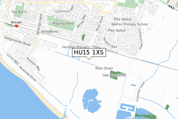
HU15 1XS is located in the Dale electoral ward, within the unitary authority of East Riding of Yorkshire and the English Parliamentary constituency of Haltemprice and Howden. The Sub Integrated Care Board (ICB) Location is NHS Humber and North Yorkshire ICB - 02Y and the police force is Humberside. This postcode has been in use since September 2019.


GetTheData
Source: OS Open Zoomstack (Ordnance Survey)
Licence: Open Government Licence (requires attribution)
Attribution: Contains OS data © Crown copyright and database right 2025
Source: Open Postcode Geo
Licence: Open Government Licence (requires attribution)
Attribution: Contains OS data © Crown copyright and database right 2025; Contains Royal Mail data © Royal Mail copyright and database right 2025; Source: Office for National Statistics licensed under the Open Government Licence v.3.0
| Easting | 494878 |
| Northing | 426089 |
| Latitude | 53.722610 |
| Longitude | -0.563600 |
GetTheData
Source: Open Postcode Geo
Licence: Open Government Licence
| Country | England |
| Postcode District | HU15 |
➜ See where HU15 is on a map ➜ Where is Brough? | |
GetTheData
Source: Land Registry Price Paid Data
Licence: Open Government Licence
| Ward | Dale |
| Constituency | Haltemprice And Howden |
GetTheData
Source: ONS Postcode Database
Licence: Open Government Licence
4, HAWK GROVE, BROUGH, HU15 1XS 2019 27 SEP £273,000 |
5, HAWK GROVE, BROUGH, HU15 1XS 2019 27 SEP £338,000 |
1, HAWK GROVE, BROUGH, HU15 1XS 2019 26 SEP £295,000 |
2, HAWK GROVE, BROUGH, HU15 1XS 2019 26 SEP £323,000 |
GetTheData
Source: HM Land Registry Price Paid Data
Licence: Contains HM Land Registry data © Crown copyright and database right 2025. This data is licensed under the Open Government Licence v3.0.
| Brough Moor Road (Moor Road) | Brough | 491m |
| Brough Myrtle Way (Myrtle Way) | Brough | 519m |
| Brough Welton Road (Welton Road) | Brough | 700m |
| Brough Welton Road (Welton Road) | Brough | 799m |
| Elloughton Welton Road (Welton Road) | Brough | 814m |
| Brough Station | 1.1km |
| Ferriby Station | 3.7km |
GetTheData
Source: NaPTAN
Licence: Open Government Licence
| Percentage of properties with Next Generation Access | 100.0% |
| Percentage of properties with Superfast Broadband | 100.0% |
| Percentage of properties with Ultrafast Broadband | 100.0% |
| Percentage of properties with Full Fibre Broadband | 100.0% |
Superfast Broadband is between 30Mbps and 300Mbps
Ultrafast Broadband is > 300Mbps
| Percentage of properties unable to receive 2Mbps | 0.0% |
| Percentage of properties unable to receive 5Mbps | 0.0% |
| Percentage of properties unable to receive 10Mbps | 0.0% |
| Percentage of properties unable to receive 30Mbps | 0.0% |
GetTheData
Source: Ofcom
Licence: Ofcom Terms of Use (requires attribution)
GetTheData
Source: ONS Postcode Database
Licence: Open Government Licence


➜ Get more ratings from the Food Standards Agency
GetTheData
Source: Food Standards Agency
Licence: FSA terms & conditions
| Last Collection | |||
|---|---|---|---|
| Location | Mon-Fri | Sat | Distance |
| Loxley Way | 16:30 | 12:00 | 721m |
| Alder Close | 16:30 | 12:00 | 772m |
| The Oval | 16:30 | 12:00 | 820m |
GetTheData
Source: Dracos
Licence: Creative Commons Attribution-ShareAlike
| Risk of HU15 1XS flooding from rivers and sea | Low |
| ➜ HU15 1XS flood map | |
GetTheData
Source: Open Flood Risk by Postcode
Licence: Open Government Licence
The below table lists the International Territorial Level (ITL) codes (formerly Nomenclature of Territorial Units for Statistics (NUTS) codes) and Local Administrative Units (LAU) codes for HU15 1XS:
| ITL 1 Code | Name |
|---|---|
| TLE | Yorkshire and The Humber |
| ITL 2 Code | Name |
| TLE1 | East Yorkshire and Northern Lincolnshire |
| ITL 3 Code | Name |
| TLE12 | East Riding of Yorkshire |
| LAU 1 Code | Name |
| E06000011 | East Riding of Yorkshire |
GetTheData
Source: ONS Postcode Directory
Licence: Open Government Licence
The below table lists the Census Output Area (OA), Lower Layer Super Output Area (LSOA), and Middle Layer Super Output Area (MSOA) for HU15 1XS:
| Code | Name | |
|---|---|---|
| OA | E00175346 | |
| LSOA | E01012973 | East Riding of Yorkshire 032D |
| MSOA | E02002715 | East Riding of Yorkshire 032 |
GetTheData
Source: ONS Postcode Directory
Licence: Open Government Licence
| HU15 1QY | Bedale Mews | 227m |
| HU15 1QX | Conisborough Mews | 229m |
| HU15 1UE | Sandringham Road | 287m |
| HU15 1TZ | Lancaster Way | 288m |
| HU15 1GY | Pickering Grange | 299m |
| HU15 1QD | Harewood Crest | 319m |
| HU15 1UF | York Drive | 321m |
| HU15 1UH | Stuart Court | 360m |
| HU15 1GW | Ruskin Way | 367m |
| HU15 1TY | Tudor Close | 370m |
GetTheData
Source: Open Postcode Geo; Land Registry Price Paid Data
Licence: Open Government Licence