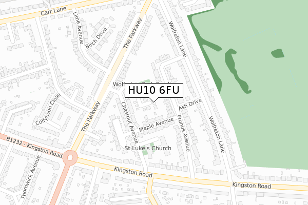
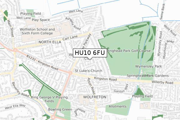
HU10 6FU is located in the Willerby and Kirk Ella electoral ward, within the unitary authority of East Riding of Yorkshire and the English Parliamentary constituency of Haltemprice and Howden. The Sub Integrated Care Board (ICB) Location is NHS Humber and North Yorkshire ICB - 02Y and the police force is Humberside. This postcode has been in use since June 2019.


GetTheData
Source: OS Open Zoomstack (Ordnance Survey)
Licence: Open Government Licence (requires attribution)
Attribution: Contains OS data © Crown copyright and database right 2024
Source: Open Postcode Geo
Licence: Open Government Licence (requires attribution)
Attribution: Contains OS data © Crown copyright and database right 2024; Contains Royal Mail data © Royal Mail copyright and database right 2024; Source: Office for National Statistics licensed under the Open Government Licence v.3.0
| Easting | 503553 |
| Northing | 429981 |
| Latitude | 53.755931 |
| Longitude | -0.430879 |
GetTheData
Source: Open Postcode Geo
Licence: Open Government Licence
| Country | England |
| Postcode District | HU10 |
| ➜ HU10 open data dashboard ➜ See where HU10 is on a map ➜ Where is Willerby? | |
GetTheData
Source: Land Registry Price Paid Data
Licence: Open Government Licence
| Ward | Willerby And Kirk Ella |
| Constituency | Haltemprice And Howden |
GetTheData
Source: ONS Postcode Database
Licence: Open Government Licence
9, BRAMBLE CLOSE, WILLERBY, HULL, HU10 6FU 2020 9 SEP £275,000 |
6, BRAMBLE CLOSE, WILLERBY, HULL, HU10 6FU 2020 24 JUL £345,000 |
5, BRAMBLE CLOSE, WILLERBY, HULL, HU10 6FU 2020 26 MAR £340,000 |
4, BRAMBLE CLOSE, WILLERBY, HULL, HU10 6FU 2020 24 JAN £330,000 |
3, BRAMBLE CLOSE, WILLERBY, HULL, HU10 6FU 2019 16 AUG £345,000 |
GetTheData
Source: HM Land Registry Price Paid Data
Licence: Contains HM Land Registry data © Crown copyright and database right 2024. This data is licensed under the Open Government Licence v3.0.
| January 2024 | Violence and sexual offences | On or near Chestnut Avenue | 108m |
| September 2023 | Violence and sexual offences | On or near The Parkway | 291m |
| August 2023 | Other theft | On or near The Parkway | 291m |
| ➜ Get more crime data in our Crime section | |||
GetTheData
Source: data.police.uk
Licence: Open Government Licence
| Willerby The Parkway (The Parkway) | Willerby | 158m |
| Willerby Kingston Road (Kingston Road) | Willerby | 225m |
| Willerby The Park Way (The Parkway) | Willerby | 260m |
| Willerby Kingston Road (Kingston Road) | Willerby | 262m |
| Willerby Kingston Road (Kingston Road) | Willerby | 270m |
| Cottingham Station | 3.3km |
| Hessle Station | 4.3km |
| Ferriby Station | 6.7km |
GetTheData
Source: NaPTAN
Licence: Open Government Licence
| Percentage of properties with Next Generation Access | 100.0% |
| Percentage of properties with Superfast Broadband | 100.0% |
| Percentage of properties with Ultrafast Broadband | 100.0% |
| Percentage of properties with Full Fibre Broadband | 100.0% |
Superfast Broadband is between 30Mbps and 300Mbps
Ultrafast Broadband is > 300Mbps
| Percentage of properties unable to receive 2Mbps | 0.0% |
| Percentage of properties unable to receive 5Mbps | 0.0% |
| Percentage of properties unable to receive 10Mbps | 0.0% |
| Percentage of properties unable to receive 30Mbps | 0.0% |
GetTheData
Source: Ofcom
Licence: Ofcom Terms of Use (requires attribution)
GetTheData
Source: ONS Postcode Database
Licence: Open Government Licence

➜ Get more ratings from the Food Standards Agency
GetTheData
Source: Food Standards Agency
Licence: FSA terms & conditions
| Last Collection | |||
|---|---|---|---|
| Location | Mon-Fri | Sat | Distance |
| Carr Lane Willerby | 17:00 | 12:00 | 304m |
| Wolfreton Lane Willerby | 17:00 | 12:30 | 347m |
| Springhead | 16:45 | 12:00 | 357m |
GetTheData
Source: Dracos
Licence: Creative Commons Attribution-ShareAlike
| Facility | Distance |
|---|---|
| Springhead Primary School Forty Steps, Anlaby, Hull Grass Pitches | 591m |
| Willerby Carr Lane Primary School Carr Lane, Willerby, Hull Grass Pitches | 596m |
| Wolfreton School (Lower School) (Closed) Carr Lane, Willerby, Hull Grass Pitches, Sports Hall | 745m |
GetTheData
Source: Active Places
Licence: Open Government Licence
| School | Phase of Education | Distance |
|---|---|---|
| Willerby Carr Lane Primary School Carr Lane, Willerby, Hull, HU10 6JT | Primary | 541m |
| Springhead Primary School Forty Steps, Anlaby, Hull, HU10 6TW | Primary | 585m |
| Wolfreton School and Sixth Form College Wolfreton School and Sixth Form College, Well Lane, Willerby, Hull, HU10 6HB | Secondary | 841m |
GetTheData
Source: Edubase
Licence: Open Government Licence
The below table lists the International Territorial Level (ITL) codes (formerly Nomenclature of Territorial Units for Statistics (NUTS) codes) and Local Administrative Units (LAU) codes for HU10 6FU:
| ITL 1 Code | Name |
|---|---|
| TLE | Yorkshire and The Humber |
| ITL 2 Code | Name |
| TLE1 | East Yorkshire and Northern Lincolnshire |
| ITL 3 Code | Name |
| TLE12 | East Riding of Yorkshire |
| LAU 1 Code | Name |
| E06000011 | East Riding of Yorkshire |
GetTheData
Source: ONS Postcode Directory
Licence: Open Government Licence
The below table lists the Census Output Area (OA), Lower Layer Super Output Area (LSOA), and Middle Layer Super Output Area (MSOA) for HU10 6FU:
| Code | Name | |
|---|---|---|
| OA | E00066171 | |
| LSOA | E01013111 | East Riding of Yorkshire 027C |
| MSOA | E02002710 | East Riding of Yorkshire 027 |
GetTheData
Source: ONS Postcode Directory
Licence: Open Government Licence
| HU10 6PJ | Prunus Avenue | 58m |
| HU10 6PD | Chestnut Avenue | 78m |
| HU10 6PF | Maple Avenue | 88m |
| HU10 6PR | Ash Drive | 108m |
| HU10 6PQ | St Lukes Court | 146m |
| HU10 6PA | Chestnut Avenue | 156m |
| HU10 6PH | Prunus Avenue | 163m |
| HU10 6PB | The Oval | 171m |
| HU10 6PS | Wolfreton Lane | 180m |
| HU10 6AX | The Parkway | 196m |
GetTheData
Source: Open Postcode Geo; Land Registry Price Paid Data
Licence: Open Government Licence