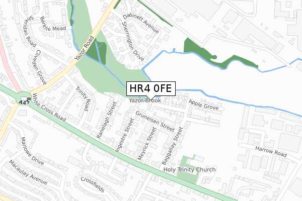
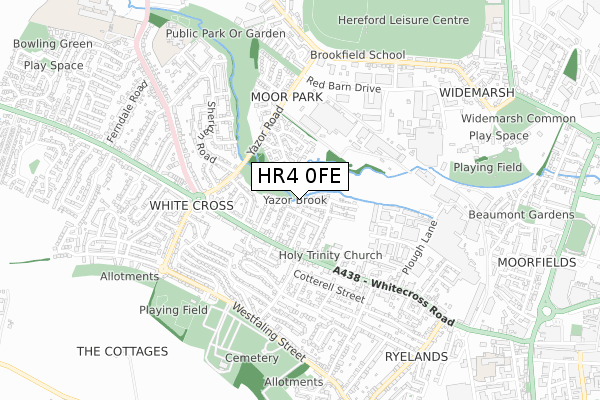
HR4 0FE is located in the Widemarsh electoral ward, within the unitary authority of Herefordshire, County of and the English Parliamentary constituency of Hereford and South Herefordshire. The Sub Integrated Care Board (ICB) Location is NHS Herefordshire and Worcestershire ICB - 18C and the police force is West Mercia. This postcode has been in use since January 2019.


GetTheData
Source: OS Open Zoomstack (Ordnance Survey)
Licence: Open Government Licence (requires attribution)
Attribution: Contains OS data © Crown copyright and database right 2024
Source: Open Postcode Geo
Licence: Open Government Licence (requires attribution)
Attribution: Contains OS data © Crown copyright and database right 2024; Contains Royal Mail data © Royal Mail copyright and database right 2024; Source: Office for National Statistics licensed under the Open Government Licence v.3.0
| Easting | 349729 |
| Northing | 240652 |
| Latitude | 52.061960 |
| Longitude | -2.734684 |
GetTheData
Source: Open Postcode Geo
Licence: Open Government Licence
| Country | England |
| Postcode District | HR4 |
| ➜ HR4 open data dashboard ➜ See where HR4 is on a map ➜ Where is Hereford? | |
GetTheData
Source: Land Registry Price Paid Data
Licence: Open Government Licence
| Ward | Widemarsh |
| Constituency | Hereford And South Herefordshire |
GetTheData
Source: ONS Postcode Database
Licence: Open Government Licence
| January 2024 | Criminal damage and arson | On or near Gruneisen Street | 75m |
| December 2023 | Violence and sexual offences | On or near Gruneisen Street | 75m |
| December 2023 | Violence and sexual offences | On or near Marlowe Drive | 444m |
| ➜ Get more crime data in our Crime section | |||
GetTheData
Source: data.police.uk
Licence: Open Government Licence
| Ingestre Street (Whitecross Road) | Whitecross | 210m |
| Holmer Street (Whitecross Road) | Whitecross | 215m |
| Holmer Street (Whitecross Road) | Whitecross | 227m |
| Cliveden Grove (Sherdian Road) | Moor Farm | 341m |
| Cliveden Grove (Sheridan Road.hereford) | Moor Farm | 345m |
| Hereford Station | 1.8km |
GetTheData
Source: NaPTAN
Licence: Open Government Licence
| Percentage of properties with Next Generation Access | 100.0% |
| Percentage of properties with Superfast Broadband | 100.0% |
| Percentage of properties with Ultrafast Broadband | 0.0% |
| Percentage of properties with Full Fibre Broadband | 0.0% |
Superfast Broadband is between 30Mbps and 300Mbps
Ultrafast Broadband is > 300Mbps
| Percentage of properties unable to receive 2Mbps | 0.0% |
| Percentage of properties unable to receive 5Mbps | 0.0% |
| Percentage of properties unable to receive 10Mbps | 0.0% |
| Percentage of properties unable to receive 30Mbps | 0.0% |
GetTheData
Source: Ofcom
Licence: Ofcom Terms of Use (requires attribution)
GetTheData
Source: ONS Postcode Database
Licence: Open Government Licence


➜ Get more ratings from the Food Standards Agency
GetTheData
Source: Food Standards Agency
Licence: FSA terms & conditions
| Last Collection | |||
|---|---|---|---|
| Location | Mon-Fri | Sat | Distance |
| Ryelands Street | 16:30 | 11:30 | 807m |
| Eign Gate | 17:15 | 11:30 | 1,156m |
| Sandown Drive | 18:30 | 11:45 | 1,381m |
GetTheData
Source: Dracos
Licence: Creative Commons Attribution-ShareAlike
| Facility | Distance |
|---|---|
| Hereford Squash Tennis And Racketball Centre Sollars Close, Hereford Squash Courts, Outdoor Tennis Courts | 328m |
| Westfaling Street Park Westfaling Street, Hereford Cycling, Grass Pitches | 632m |
| The Brookfield School Grandstand Road, Hereford Sports Hall | 661m |
GetTheData
Source: Active Places
Licence: Open Government Licence
| School | Phase of Education | Distance |
|---|---|---|
| The Brookfield School Grandstand Road, Hereford, HR4 9NG | Not applicable | 663m |
| G.E.M Hereford Trinity House, 31 Barricombe Drive, Hereford, HR4 0NU | Not applicable | 745m |
| Whitecross Hereford Three Elms Road, Hereford, HR4 0RN | Secondary | 835m |
GetTheData
Source: Edubase
Licence: Open Government Licence
The below table lists the International Territorial Level (ITL) codes (formerly Nomenclature of Territorial Units for Statistics (NUTS) codes) and Local Administrative Units (LAU) codes for HR4 0FE:
| ITL 1 Code | Name |
|---|---|
| TLG | West Midlands (England) |
| ITL 2 Code | Name |
| TLG1 | Herefordshire, Worcestershire and Warwickshire |
| ITL 3 Code | Name |
| TLG11 | Herefordshire, County of |
| LAU 1 Code | Name |
| E06000019 | Herefordshire, County of |
GetTheData
Source: ONS Postcode Directory
Licence: Open Government Licence
The below table lists the Census Output Area (OA), Lower Layer Super Output Area (LSOA), and Middle Layer Super Output Area (MSOA) for HR4 0FE:
| Code | Name | |
|---|---|---|
| OA | E00071120 | |
| LSOA | E01014085 | Herefordshire 010C |
| MSOA | E02002914 | Herefordshire 010 |
GetTheData
Source: ONS Postcode Directory
Licence: Open Government Licence
| HR4 0DX | Gruneisen Street | 84m |
| HR4 0DU | Ingestre Street | 115m |
| HR4 0DY | Meyrick Street | 119m |
| HR4 0DZ | Baggallay Street | 137m |
| HR4 0DT | Ranelagh Street | 159m |
| HR4 9XF | Chisel Close | 173m |
| HR4 9XJ | Tremlett Close | 184m |
| HR4 0DJ | Whitecross Road | 185m |
| HR4 9XD | Sherrington Drive | 206m |
| HR4 0RS | Trinity Road | 221m |
GetTheData
Source: Open Postcode Geo; Land Registry Price Paid Data
Licence: Open Government Licence