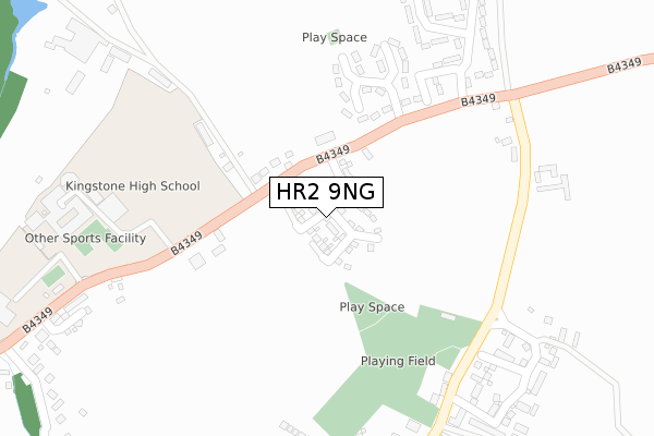
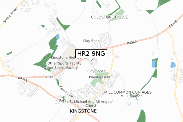
HR2 9NG is located in the Wormside electoral ward, within the unitary authority of Herefordshire, County of and the English Parliamentary constituency of Hereford and South Herefordshire. The Sub Integrated Care Board (ICB) Location is NHS Herefordshire and Worcestershire ICB - 18C and the police force is West Mercia. This postcode has been in use since June 2019.


GetTheData
Source: OS Open Zoomstack (Ordnance Survey)
Licence: Open Government Licence (requires attribution)
Attribution: Contains OS data © Crown copyright and database right 2024
Source: Open Postcode Geo
Licence: Open Government Licence (requires attribution)
Attribution: Contains OS data © Crown copyright and database right 2024; Contains Royal Mail data © Royal Mail copyright and database right 2024; Source: Office for National Statistics licensed under the Open Government Licence v.3.0
| Easting | 342423 |
| Northing | 236296 |
| Latitude | 52.022088 |
| Longitude | -2.840507 |
GetTheData
Source: Open Postcode Geo
Licence: Open Government Licence
| Country | England |
| Postcode District | HR2 |
| ➜ HR2 open data dashboard ➜ See where HR2 is on a map ➜ Where is Kingstone? | |
GetTheData
Source: Land Registry Price Paid Data
Licence: Open Government Licence
| Ward | Wormside |
| Constituency | Hereford And South Herefordshire |
GetTheData
Source: ONS Postcode Database
Licence: Open Government Licence
2021 12 AUG £243,000 |
2020 24 NOV £250,000 |
2019 6 DEC £230,000 |
7, CHEVIOT DRIVE, KINGSTONE, HEREFORD, HR2 9NG 2019 8 NOV £265,000 |
2, CHEVIOT DRIVE, KINGSTONE, HEREFORD, HR2 9NG 2019 18 OCT £230,000 |
14, CHEVIOT DRIVE, KINGSTONE, HEREFORD, HR2 9NG 2019 5 SEP £310,000 |
2019 23 AUG £255,000 |
16, CHEVIOT DRIVE, KINGSTONE, HEREFORD, HR2 9NG 2019 13 AUG £280,000 |
4, CHEVIOT DRIVE, KINGSTONE, HEREFORD, HR2 9NG 2019 12 JUL £255,000 |
20, CHEVIOT DRIVE, HEREFORD, HR2 9NG 2019 24 JUN £305,000 |
GetTheData
Source: HM Land Registry Price Paid Data
Licence: Contains HM Land Registry data © Crown copyright and database right 2024. This data is licensed under the Open Government Licence v3.0.
| June 2022 | Violence and sexual offences | On or near Chandler'S Close | 186m |
| June 2022 | Violence and sexual offences | On or near Chandler'S Close | 186m |
| June 2022 | Vehicle crime | On or near Chandler'S Close | 186m |
| ➜ Get more crime data in our Crime section | |||
GetTheData
Source: data.police.uk
Licence: Open Government Licence
| Surgery (B4349) | Kingstone | 64m |
| Surgery (B4349) | Kingstone | 81m |
| Coldstone Cross (B4349) | Kingstone | 271m |
| Coldstone Cross (B4349) | Kingstone | 297m |
| High School (B4349) | Kingstone | 331m |
GetTheData
Source: NaPTAN
Licence: Open Government Licence
| Percentage of properties with Next Generation Access | 100.0% |
| Percentage of properties with Superfast Broadband | 100.0% |
| Percentage of properties with Ultrafast Broadband | 100.0% |
| Percentage of properties with Full Fibre Broadband | 100.0% |
Superfast Broadband is between 30Mbps and 300Mbps
Ultrafast Broadband is > 300Mbps
| Percentage of properties unable to receive 2Mbps | 0.0% |
| Percentage of properties unable to receive 5Mbps | 0.0% |
| Percentage of properties unable to receive 10Mbps | 0.0% |
| Percentage of properties unable to receive 30Mbps | 0.0% |
GetTheData
Source: Ofcom
Licence: Ofcom Terms of Use (requires attribution)
GetTheData
Source: ONS Postcode Database
Licence: Open Government Licence


➜ Get more ratings from the Food Standards Agency
GetTheData
Source: Food Standards Agency
Licence: FSA terms & conditions
| Last Collection | |||
|---|---|---|---|
| Location | Mon-Fri | Sat | Distance |
| Highland View | 16:00 | 09:00 | 88m |
| Dews Corner | 16:15 | 10:30 | 401m |
| Kingstone P.o. | 16:30 | 12:15 | 621m |
GetTheData
Source: Dracos
Licence: Creative Commons Attribution-ShareAlike
| Facility | Distance |
|---|---|
| Seven Site Kingstone, Hereford Grass Pitches | 272m |
| Kingstone Academy Kingstone, Hereford Grass Pitches, Sports Hall | 381m |
| Kingstone And Thruxton Primary School Kingstone, Hereford Grass Pitches | 506m |
GetTheData
Source: Active Places
Licence: Open Government Licence
| School | Phase of Education | Distance |
|---|---|---|
| Kingstone and Thruxton Primary School Kingstone, Hereford, HR2 9HJ | Primary | 324m |
| Kingstone High School Kingstone, Hereford, HR2 9HJ | Secondary | 387m |
| Madley Primary School Madley, Hereford, HR2 9PH | Primary | 2.6km |
GetTheData
Source: Edubase
Licence: Open Government Licence
The below table lists the International Territorial Level (ITL) codes (formerly Nomenclature of Territorial Units for Statistics (NUTS) codes) and Local Administrative Units (LAU) codes for HR2 9NG:
| ITL 1 Code | Name |
|---|---|
| TLG | West Midlands (England) |
| ITL 2 Code | Name |
| TLG1 | Herefordshire, Worcestershire and Warwickshire |
| ITL 3 Code | Name |
| TLG11 | Herefordshire, County of |
| LAU 1 Code | Name |
| E06000019 | Herefordshire, County of |
GetTheData
Source: ONS Postcode Directory
Licence: Open Government Licence
The below table lists the Census Output Area (OA), Lower Layer Super Output Area (LSOA), and Middle Layer Super Output Area (MSOA) for HR2 9NG:
| Code | Name | |
|---|---|---|
| OA | E00071204 | |
| LSOA | E01014098 | Herefordshire 021E |
| MSOA | E02002925 | Herefordshire 021 |
GetTheData
Source: ONS Postcode Directory
Licence: Open Government Licence
| HR2 9HN | 93m | |
| HR2 9HL | Huff Cap | 114m |
| HR2 9HP | 117m | |
| HR2 9HR | Coldstone Cross | 325m |
| HR2 9ES | 329m | |
| HR2 9FB | Woodfield Close | 395m |
| HR2 9HS | Coldstone Cross | 400m |
| HR2 9EW | Cottons Meadow | 402m |
| HR2 9HW | Tippetts Meadow | 414m |
| HR2 9ER | White House Drive | 423m |
GetTheData
Source: Open Postcode Geo; Land Registry Price Paid Data
Licence: Open Government Licence