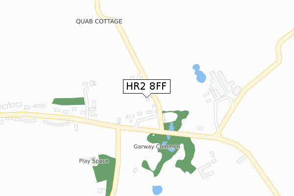
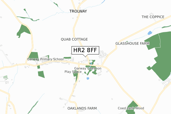
HR2 8FF is located in the Birch electoral ward, within the unitary authority of Herefordshire, County of and the English Parliamentary constituency of Hereford and South Herefordshire. The Sub Integrated Care Board (ICB) Location is NHS Herefordshire and Worcestershire ICB - 18C and the police force is West Mercia. This postcode has been in use since April 2020.


GetTheData
Source: OS Open Zoomstack (Ordnance Survey)
Licence: Open Government Licence (requires attribution)
Attribution: Contains OS data © Crown copyright and database right 2024
Source: Open Postcode Geo
Licence: Open Government Licence (requires attribution)
Attribution: Contains OS data © Crown copyright and database right 2024; Contains Royal Mail data © Royal Mail copyright and database right 2024; Source: Office for National Statistics licensed under the Open Government Licence v.3.0
| Easting | 346648 |
| Northing | 222819 |
| Latitude | 51.901353 |
| Longitude | -2.776843 |
GetTheData
Source: Open Postcode Geo
Licence: Open Government Licence
| Country | England |
| Postcode District | HR2 |
| ➜ HR2 open data dashboard ➜ See where HR2 is on a map ➜ Where is Garway? | |
GetTheData
Source: Land Registry Price Paid Data
Licence: Open Government Licence
| Ward | Birch |
| Constituency | Hereford And South Herefordshire |
GetTheData
Source: ONS Postcode Database
Licence: Open Government Licence
| June 2022 | Violence and sexual offences | On or near Moon Wood Close | 244m |
| May 2022 | Violence and sexual offences | On or near Moon Wood Close | 244m |
| May 2022 | Violence and sexual offences | On or near Moon Wood Close | 244m |
| ➜ Get more crime data in our Crime section | |||
GetTheData
Source: data.police.uk
Licence: Open Government Licence
| Moon Inn (Garway Common Road) | Garway | 140m |
| Moon Inn (Garway Common Road) | Garway | 159m |
| Garage (B4521) | Broad Oak | 2,069m |
| Garage (B4521) | Broad Oak | 2,082m |
GetTheData
Source: NaPTAN
Licence: Open Government Licence
GetTheData
Source: ONS Postcode Database
Licence: Open Government Licence


➜ Get more ratings from the Food Standards Agency
GetTheData
Source: Food Standards Agency
Licence: FSA terms & conditions
| Last Collection | |||
|---|---|---|---|
| Location | Mon-Fri | Sat | Distance |
| Garway Turning | 14:45 | 08:15 | 1,278m |
| Broad Oak | 15:00 | 07:00 | 2,136m |
| Hill Gates | 16:15 | 11:00 | 5,690m |
GetTheData
Source: Dracos
Licence: Creative Commons Attribution-ShareAlike
| Facility | Distance |
|---|---|
| Garway Primary School Garway, Hereford Grass Pitches | 540m |
| Cheltenham Town Fc (The Ranch) St. Weonards, Hereford Grass Pitches | 3.2km |
| Orcop Village Hall Orcop, Hereford Grass Pitches | 3.6km |
GetTheData
Source: Active Places
Licence: Open Government Licence
| School | Phase of Education | Distance |
|---|---|---|
| Garway Primary School Garway, Hereford, HR2 8RQ | Primary | 540m |
| St Weonard's Academy Mount Way, St Weonards, Hereford, HR2 8NU | Primary | 3.3km |
GetTheData
Source: Edubase
Licence: Open Government Licence
The below table lists the International Territorial Level (ITL) codes (formerly Nomenclature of Territorial Units for Statistics (NUTS) codes) and Local Administrative Units (LAU) codes for HR2 8FF:
| ITL 1 Code | Name |
|---|---|
| TLG | West Midlands (England) |
| ITL 2 Code | Name |
| TLG1 | Herefordshire, Worcestershire and Warwickshire |
| ITL 3 Code | Name |
| TLG11 | Herefordshire, County of |
| LAU 1 Code | Name |
| E06000019 | Herefordshire, County of |
GetTheData
Source: ONS Postcode Directory
Licence: Open Government Licence
The below table lists the Census Output Area (OA), Lower Layer Super Output Area (LSOA), and Middle Layer Super Output Area (MSOA) for HR2 8FF:
| Code | Name | |
|---|---|---|
| OA | E00070990 | |
| LSOA | E01014059 | Herefordshire 021B |
| MSOA | E02002925 | Herefordshire 021 |
GetTheData
Source: ONS Postcode Directory
Licence: Open Government Licence
| HR2 8RF | Garway Common | 119m |
| HR2 8RN | Moon Wood Close | 235m |
| HR2 8RG | Fairview | 374m |
| HR2 8RQ | 414m | |
| HR2 8RE | 537m | |
| HR2 8QQ | 693m | |
| HR2 8RH | 1039m | |
| HR2 8RL | 1583m | |
| HR2 8QY | 1692m | |
| HR2 8QF | 1708m |
GetTheData
Source: Open Postcode Geo; Land Registry Price Paid Data
Licence: Open Government Licence