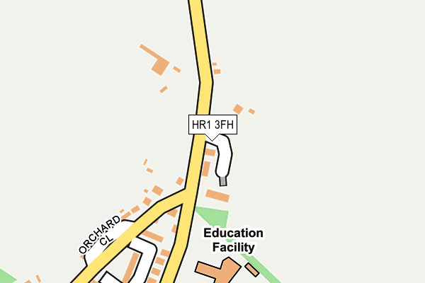
HR1 3FH is located in the Sutton Walls electoral ward, within the unitary authority of Herefordshire, County of and the English Parliamentary constituency of North Herefordshire. The Sub Integrated Care Board (ICB) Location is NHS Herefordshire and Worcestershire ICB - 18C and the police force is West Mercia. This postcode has been in use since June 2017.


GetTheData
Source: OS OpenMap – Local (Ordnance Survey)
Source: OS VectorMap District (Ordnance Survey)
Licence: Open Government Licence (requires attribution)
| Easting | 353481 |
| Northing | 245961 |
| Latitude | 52.110017 |
| Longitude | -2.680685 |
GetTheData
Source: Open Postcode Geo
Licence: Open Government Licence
| Country | England |
| Postcode District | HR1 |
| ➜ HR1 open data dashboard ➜ See where HR1 is on a map ➜ Where is Sutton St Nicholas? | |
GetTheData
Source: Land Registry Price Paid Data
Licence: Open Government Licence
| Ward | Sutton Walls |
| Constituency | North Herefordshire |
GetTheData
Source: ONS Postcode Database
Licence: Open Government Licence
| June 2022 | Other theft | On or near Fieldway | 303m |
| June 2022 | Other theft | On or near Fieldway | 303m |
| May 2022 | Other crime | On or near Orchard Close | 224m |
| ➜ Get more crime data in our Crime section | |||
GetTheData
Source: data.police.uk
Licence: Open Government Licence
| Golden Cross Inn (Hereford - Bodenham Road) | Sutton St Nicholas | 492m |
| Golden Cross Inn (Hereford To Bodenham Road) | Sutton St Nicholas | 497m |
| Bus Shelter (Hereford To Bodenham Road) | Franklands Gate | 612m |
| Bus Shelter (Hereford - Bodenham Road) | Franklands Gate | 615m |
| Wergins Bridge (Unclassified Road) | Sutton St Nicholas | 1,363m |
GetTheData
Source: NaPTAN
Licence: Open Government Licence
➜ Broadband speed and availability dashboard for HR1 3FH
| Percentage of properties with Next Generation Access | 40.0% |
| Percentage of properties with Superfast Broadband | 40.0% |
| Percentage of properties with Ultrafast Broadband | 0.0% |
| Percentage of properties with Full Fibre Broadband | 0.0% |
Superfast Broadband is between 30Mbps and 300Mbps
Ultrafast Broadband is > 300Mbps
| Median download speed | 23.5Mbps |
| Average download speed | 34.6Mbps |
| Maximum download speed | 76.88Mbps |
| Median upload speed | 1.3Mbps |
| Average upload speed | 5.7Mbps |
| Maximum upload speed | 20.00Mbps |
| Percentage of properties unable to receive 2Mbps | 0.0% |
| Percentage of properties unable to receive 5Mbps | 0.0% |
| Percentage of properties unable to receive 10Mbps | 0.0% |
| Percentage of properties unable to receive 30Mbps | 60.0% |
➜ Broadband speed and availability dashboard for HR1 3FH
GetTheData
Source: Ofcom
Licence: Ofcom Terms of Use (requires attribution)
GetTheData
Source: ONS Postcode Database
Licence: Open Government Licence


➜ Get more ratings from the Food Standards Agency
GetTheData
Source: Food Standards Agency
Licence: FSA terms & conditions
| Last Collection | |||
|---|---|---|---|
| Location | Mon-Fri | Sat | Distance |
| Sutton St Nicholas P.o. | 16:15 | 11:00 | 471m |
| Nunnington | 14:00 | 11:00 | 3,284m |
| The Vauld | 10:15 | 10:15 | 3,503m |
GetTheData
Source: Dracos
Licence: Creative Commons Attribution-ShareAlike
| Facility | Distance |
|---|---|
| Sutton Primary Academy Bayley Way, Sutton St. Nicholas, Hereford Grass Pitches | 191m |
| Sutton Primary School (Closed) Orchard Close, Sutton St. Nicholas, Hereford Grass Pitches | 256m |
| Amberley Park (Closed) Marden, Hereford Grass Pitches | 1.6km |
GetTheData
Source: Active Places
Licence: Open Government Licence
| School | Phase of Education | Distance |
|---|---|---|
| Sutton Primary Academy Bayley Way, Sutton St Nicholas, HEREFORD, HR1 3SZ | Primary | 191m |
| Marden Primary Academy Marden, Hereford, HR1 3EW | Primary | 1.9km |
| Withington Primary School Lock Road, Withington, Hereford, HR1 3QE | Primary | 3.8km |
GetTheData
Source: Edubase
Licence: Open Government Licence
The below table lists the International Territorial Level (ITL) codes (formerly Nomenclature of Territorial Units for Statistics (NUTS) codes) and Local Administrative Units (LAU) codes for HR1 3FH:
| ITL 1 Code | Name |
|---|---|
| TLG | West Midlands (England) |
| ITL 2 Code | Name |
| TLG1 | Herefordshire, Worcestershire and Warwickshire |
| ITL 3 Code | Name |
| TLG11 | Herefordshire, County of |
| LAU 1 Code | Name |
| E06000019 | Herefordshire, County of |
GetTheData
Source: ONS Postcode Directory
Licence: Open Government Licence
The below table lists the Census Output Area (OA), Lower Layer Super Output Area (LSOA), and Middle Layer Super Output Area (MSOA) for HR1 3FH:
| Code | Name | |
|---|---|---|
| OA | E00071112 | |
| LSOA | E01014081 | Herefordshire 008C |
| MSOA | E02002912 | Herefordshire 008 |
GetTheData
Source: ONS Postcode Directory
Licence: Open Government Licence
| HR1 3FJ | Willow Bank | 54m |
| HR1 3BL | 96m | |
| HR1 3DJ | Old School Close | 137m |
| HR1 3AU | Orchard Close | 266m |
| HR1 3BY | Fieldway | 280m |
| HR1 3FG | Lingen Field | 295m |
| HR1 3AZ | 350m | |
| HR1 3BF | St Ethelberts Close | 403m |
| HR1 3BD | Churchway | 417m |
| HR1 3AX | 522m |
GetTheData
Source: Open Postcode Geo; Land Registry Price Paid Data
Licence: Open Government Licence