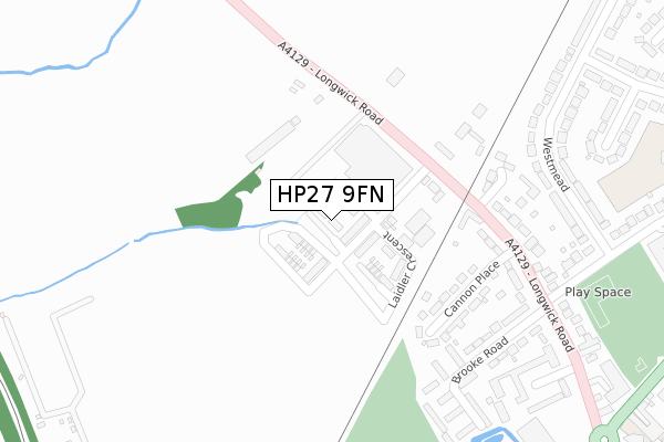
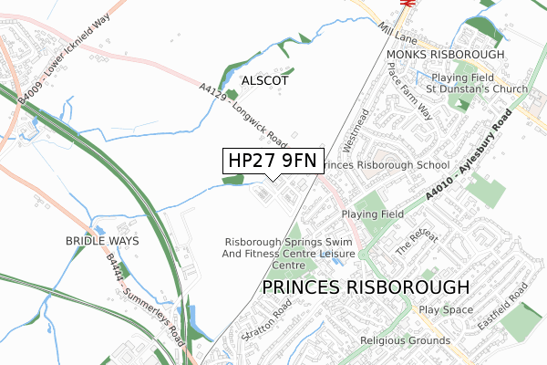
HP27 9FN is located in the The Risboroughs electoral ward, within the unitary authority of Buckinghamshire and the English Parliamentary constituency of Buckingham. The Sub Integrated Care Board (ICB) Location is NHS Buckinghamshire, Oxfordshire and Berkshire West ICB - 14Y and the police force is Thames Valley. This postcode has been in use since April 2019.


GetTheData
Source: OS Open Zoomstack (Ordnance Survey)
Licence: Open Government Licence (requires attribution)
Attribution: Contains OS data © Crown copyright and database right 2024
Source: Open Postcode Geo
Licence: Open Government Licence (requires attribution)
Attribution: Contains OS data © Crown copyright and database right 2024; Contains Royal Mail data © Royal Mail copyright and database right 2024; Source: Office for National Statistics licensed under the Open Government Licence v.3.0
| Easting | 480333 |
| Northing | 203968 |
| Latitude | 51.728688 |
| Longitude | -0.838239 |
GetTheData
Source: Open Postcode Geo
Licence: Open Government Licence
| Country | England |
| Postcode District | HP27 |
| ➜ HP27 open data dashboard ➜ See where HP27 is on a map ➜ Where is Princes Risborough? | |
GetTheData
Source: Land Registry Price Paid Data
Licence: Open Government Licence
| Ward | The Risboroughs |
| Constituency | Buckingham |
GetTheData
Source: ONS Postcode Database
Licence: Open Government Licence
| June 2022 | Possession of weapons | On or near Cannon Place | 232m |
| June 2022 | Drugs | On or near Cannon Place | 232m |
| June 2022 | Violence and sexual offences | On or near Cannon Place | 232m |
| ➜ Get more crime data in our Crime section | |||
GetTheData
Source: data.police.uk
Licence: Open Government Licence
| Westmead | Princes Risborough | 346m |
| Wellington Avenue | Princes Risborough | 359m |
| Wellington Avenue | Princes Risborough | 367m |
| Community Centre (Stratton Road) | Princes Risborough | 517m |
| Community Centre (Stratton Road) | Princes Risborough | 532m |
| Monks Risborough Station | 1km |
| Princes Risborough Station | 1.3km |
| Little Kimble Station | 3.3km |
GetTheData
Source: NaPTAN
Licence: Open Government Licence
| Percentage of properties with Next Generation Access | 100.0% |
| Percentage of properties with Superfast Broadband | 100.0% |
| Percentage of properties with Ultrafast Broadband | 100.0% |
| Percentage of properties with Full Fibre Broadband | 100.0% |
Superfast Broadband is between 30Mbps and 300Mbps
Ultrafast Broadband is > 300Mbps
| Percentage of properties unable to receive 2Mbps | 0.0% |
| Percentage of properties unable to receive 5Mbps | 0.0% |
| Percentage of properties unable to receive 10Mbps | 0.0% |
| Percentage of properties unable to receive 30Mbps | 0.0% |
GetTheData
Source: Ofcom
Licence: Ofcom Terms of Use (requires attribution)
GetTheData
Source: ONS Postcode Database
Licence: Open Government Licence

➜ Get more ratings from the Food Standards Agency
GetTheData
Source: Food Standards Agency
Licence: FSA terms & conditions
| Last Collection | |||
|---|---|---|---|
| Location | Mon-Fri | Sat | Distance |
| Longwick Road | 16:15 | 12:00 | 365m |
| Westmead | 16:15 | 12:00 | 441m |
| Tesco | 17:00 | 12:00 | 452m |
GetTheData
Source: Dracos
Licence: Creative Commons Attribution-ShareAlike
| Facility | Distance |
|---|---|
| Wades Park Stratton Road, Princes Risborough Grass Pitches | 388m |
| Risborough Springs Swim And Fitness Centre Stratton Road, Princes Risborough Swimming Pool, Health and Fitness Gym, Studio | 465m |
| Princes Risborough Primary School Wellington Avenue, Princes Risborough Grass Pitches, Sports Hall | 549m |
GetTheData
Source: Active Places
Licence: Open Government Licence
| School | Phase of Education | Distance |
|---|---|---|
| Princes Risborough Primary School Wellington Avenue, Princes Risborough, HP27 9HY | Primary | 549m |
| Princes Risborough School Merton Road, Princes Risborough, HP27 0DR | Secondary | 1.2km |
| Monks Risborough CofE Primary School Peters Lane, Princes Risborough, HP27 9LZ | Primary | 1.3km |
GetTheData
Source: Edubase
Licence: Open Government Licence
The below table lists the International Territorial Level (ITL) codes (formerly Nomenclature of Territorial Units for Statistics (NUTS) codes) and Local Administrative Units (LAU) codes for HP27 9FN:
| ITL 1 Code | Name |
|---|---|
| TLJ | South East (England) |
| ITL 2 Code | Name |
| TLJ1 | Berkshire, Buckinghamshire and Oxfordshire |
| ITL 3 Code | Name |
| TLJ13 | Buckinghamshire |
| LAU 1 Code | Name |
| E06000060 | Buckinghamshire |
GetTheData
Source: ONS Postcode Directory
Licence: Open Government Licence
The below table lists the Census Output Area (OA), Lower Layer Super Output Area (LSOA), and Middle Layer Super Output Area (MSOA) for HP27 9FN:
| Code | Name | |
|---|---|---|
| OA | E00090459 | |
| LSOA | E01017933 | Wycombe 001E |
| MSOA | E02003696 | Wycombe 001 |
GetTheData
Source: ONS Postcode Directory
Licence: Open Government Licence
| HP27 9RS | Longwick Road | 160m |
| HP27 9HL | Cannon Place | 206m |
| HP27 9JA | Purssell Place | 253m |
| HP27 9HN | Longwick Road | 257m |
| HP27 9HH | Brooke Road | 297m |
| HP27 9HJ | Brooke Road | 317m |
| HP27 9HP | Westmead | 326m |
| HP27 9HD | Longwick Road | 365m |
| HP27 9HR | Westmead | 365m |
| HP27 9HW | Wellington Avenue | 374m |
GetTheData
Source: Open Postcode Geo; Land Registry Price Paid Data
Licence: Open Government Licence