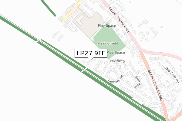
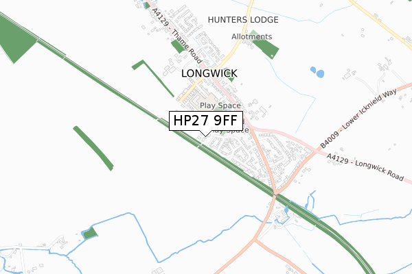
HP27 9FF is located in the The Risboroughs electoral ward, within the unitary authority of Buckinghamshire and the English Parliamentary constituency of Buckingham. The Sub Integrated Care Board (ICB) Location is NHS Buckinghamshire, Oxfordshire and Berkshire West ICB - 14Y and the police force is Thames Valley. This postcode has been in use since August 2019.


GetTheData
Source: OS Open Zoomstack (Ordnance Survey)
Licence: Open Government Licence (requires attribution)
Attribution: Contains OS data © Crown copyright and database right 2024
Source: Open Postcode Geo
Licence: Open Government Licence (requires attribution)
Attribution: Contains OS data © Crown copyright and database right 2024; Contains Royal Mail data © Royal Mail copyright and database right 2024; Source: Office for National Statistics licensed under the Open Government Licence v.3.0
| Easting | 478754 |
| Northing | 204690 |
| Latitude | 51.735402 |
| Longitude | -0.860934 |
GetTheData
Source: Open Postcode Geo
Licence: Open Government Licence
| Country | England |
| Postcode District | HP27 |
| ➜ HP27 open data dashboard ➜ See where HP27 is on a map ➜ Where is Longwick? | |
GetTheData
Source: Land Registry Price Paid Data
Licence: Open Government Licence
| Ward | The Risboroughs |
| Constituency | Buckingham |
GetTheData
Source: ONS Postcode Database
Licence: Open Government Licence
| June 2022 | Violence and sexual offences | On or near Meadow Drive | 227m |
| June 2022 | Violence and sexual offences | On or near Meadow Drive | 227m |
| June 2022 | Violence and sexual offences | On or near Meadow Drive | 227m |
| ➜ Get more crime data in our Crime section | |||
GetTheData
Source: data.police.uk
Licence: Open Government Licence
| Village Hall (Thame Road) | Longwick | 296m |
| Village Hall (Thame Road) | Longwick | 301m |
| Chestnut Way | Longwick | 385m |
| Chestnut Way | Longwick | 396m |
| Walkers Road (Thame Road) | Longwick | 637m |
| Monks Risborough Station | 2.2km |
| Princes Risborough Station | 2.3km |
| Little Kimble Station | 4.1km |
GetTheData
Source: NaPTAN
Licence: Open Government Licence
GetTheData
Source: ONS Postcode Database
Licence: Open Government Licence


➜ Get more ratings from the Food Standards Agency
GetTheData
Source: Food Standards Agency
Licence: FSA terms & conditions
| Last Collection | |||
|---|---|---|---|
| Location | Mon-Fri | Sat | Distance |
| Summerleys Road West | 16:30 | 07:00 | 1,886m |
| Horsendon | 16:45 | 07:30 | 1,905m |
| Westmead | 16:15 | 12:00 | 2,016m |
GetTheData
Source: Dracos
Licence: Creative Commons Attribution-ShareAlike
| Facility | Distance |
|---|---|
| Longwick Sports Field The Green, Longwick Grass Pitches | 236m |
| Longwick C Of E Combined School Walnut Tree Lane, Longwick, Princes Risborough Grass Pitches | 245m |
| Wades Park Stratton Road, Princes Risborough Grass Pitches | 2km |
GetTheData
Source: Active Places
Licence: Open Government Licence
| School | Phase of Education | Distance |
|---|---|---|
| Longwick Church of England Combined School Walnut Tree Lane, Longwick, Princes Risborough, HP27 9SJ | Primary | 247m |
| Princes Risborough Primary School Wellington Avenue, Princes Risborough, HP27 9HY | Primary | 2.2km |
| Monks Risborough CofE Primary School Peters Lane, Princes Risborough, HP27 9LZ | Primary | 2.8km |
GetTheData
Source: Edubase
Licence: Open Government Licence
The below table lists the International Territorial Level (ITL) codes (formerly Nomenclature of Territorial Units for Statistics (NUTS) codes) and Local Administrative Units (LAU) codes for HP27 9FF:
| ITL 1 Code | Name |
|---|---|
| TLJ | South East (England) |
| ITL 2 Code | Name |
| TLJ1 | Berkshire, Buckinghamshire and Oxfordshire |
| ITL 3 Code | Name |
| TLJ13 | Buckinghamshire |
| LAU 1 Code | Name |
| E06000060 | Buckinghamshire |
GetTheData
Source: ONS Postcode Directory
Licence: Open Government Licence
The below table lists the Census Output Area (OA), Lower Layer Super Output Area (LSOA), and Middle Layer Super Output Area (MSOA) for HP27 9FF:
| Code | Name | |
|---|---|---|
| OA | E00090237 | |
| LSOA | E01017885 | Wycombe 002A |
| MSOA | E02003697 | Wycombe 002 |
GetTheData
Source: ONS Postcode Directory
Licence: Open Government Licence
| HP27 9TE | Meadow Drive | 209m |
| HP27 9RF | Red Lion Lane | 232m |
| HP27 9QY | The Green | 244m |
| HP27 9RN | Boxer Road | 262m |
| HP27 9SG | Thame Road | 263m |
| HP27 9SL | Dorrells Road | 282m |
| HP27 9RP | Williams Way | 297m |
| HP27 9SF | Thame Road | 306m |
| HP27 9SJ | Walnut Tree Lane | 317m |
| HP27 9AP | Innkeepers Court | 344m |
GetTheData
Source: Open Postcode Geo; Land Registry Price Paid Data
Licence: Open Government Licence