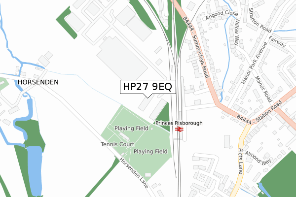
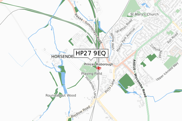
HP27 9EQ is located in the The Risboroughs electoral ward, within the unitary authority of Buckinghamshire and the English Parliamentary constituency of Buckingham. The Sub Integrated Care Board (ICB) Location is NHS Buckinghamshire, Oxfordshire and Berkshire West ICB - 14Y and the police force is Thames Valley. This postcode has been in use since March 2019.


GetTheData
Source: OS Open Zoomstack (Ordnance Survey)
Licence: Open Government Licence (requires attribution)
Attribution: Contains OS data © Crown copyright and database right 2024
Source: Open Postcode Geo
Licence: Open Government Licence (requires attribution)
Attribution: Contains OS data © Crown copyright and database right 2024; Contains Royal Mail data © Royal Mail copyright and database right 2024; Source: Office for National Statistics licensed under the Open Government Licence v.3.0
| Easting | 479849 |
| Northing | 202864 |
| Latitude | 51.718832 |
| Longitude | -0.845498 |
GetTheData
Source: Open Postcode Geo
Licence: Open Government Licence
| Country | England |
| Postcode District | HP27 |
| ➜ HP27 open data dashboard ➜ See where HP27 is on a map ➜ Where is Princes Risborough? | |
GetTheData
Source: Land Registry Price Paid Data
Licence: Open Government Licence
| Ward | The Risboroughs |
| Constituency | Buckingham |
GetTheData
Source: ONS Postcode Database
Licence: Open Government Licence
| June 2022 | Violence and sexual offences | On or near Station Road | 459m |
| May 2022 | Violence and sexual offences | On or near Sports/Recreation Area | 106m |
| May 2022 | Bicycle theft | On or near Milton Gardens | 190m |
| ➜ Get more crime data in our Crime section | |||
GetTheData
Source: data.police.uk
Licence: Open Government Licence
| Railway Station (Station Road) | Princes Risborough | 170m |
| Summerleys Road | Princes Risborough | 216m |
| Summerleys Road | Princes Risborough | 222m |
| Picts Lane North (Picts Lane) | Princes Risborough | 362m |
| Picts Lane North (Picts Lane) | Princes Risborough | 374m |
| Princes Risborough Station | 0.2km |
| Monks Risborough Station | 2.2km |
| Little Kimble Station | 4.5km |
GetTheData
Source: NaPTAN
Licence: Open Government Licence
GetTheData
Source: ONS Postcode Database
Licence: Open Government Licence


➜ Get more ratings from the Food Standards Agency
GetTheData
Source: Food Standards Agency
Licence: FSA terms & conditions
| Last Collection | |||
|---|---|---|---|
| Location | Mon-Fri | Sat | Distance |
| Summerleys Road | 16:30 | 11:45 | 229m |
| Summerleys Road West | 16:30 | 07:00 | 353m |
| Horsendon | 16:45 | 07:30 | 379m |
GetTheData
Source: Dracos
Licence: Creative Commons Attribution-ShareAlike
| Facility | Distance |
|---|---|
| Windsor Playing Fields - Risborough Rangers Football Club Horsenden Lane, Princes Risborough Outdoor Tennis Courts, Grass Pitches | 112m |
| Windsor Playing Fields - Princes Risborough Cricket Club Horsenden Lane, Princes Risborough Grass Pitches | 252m |
| Risborough Springs Swim And Fitness Centre Stratton Road, Princes Risborough Swimming Pool, Health and Fitness Gym, Studio | 831m |
GetTheData
Source: Active Places
Licence: Open Government Licence
| School | Phase of Education | Distance |
|---|---|---|
| Princes Risborough School Merton Road, Princes Risborough, HP27 0DR | Secondary | 1.2km |
| Princes Risborough Primary School Wellington Avenue, Princes Risborough, HP27 9HY | Primary | 1.6km |
| Monks Risborough CofE Primary School Peters Lane, Princes Risborough, HP27 9LZ | Primary | 2.3km |
GetTheData
Source: Edubase
Licence: Open Government Licence
The below table lists the International Territorial Level (ITL) codes (formerly Nomenclature of Territorial Units for Statistics (NUTS) codes) and Local Administrative Units (LAU) codes for HP27 9EQ:
| ITL 1 Code | Name |
|---|---|
| TLJ | South East (England) |
| ITL 2 Code | Name |
| TLJ1 | Berkshire, Buckinghamshire and Oxfordshire |
| ITL 3 Code | Name |
| TLJ13 | Buckinghamshire |
| LAU 1 Code | Name |
| E06000060 | Buckinghamshire |
GetTheData
Source: ONS Postcode Directory
Licence: Open Government Licence
The below table lists the Census Output Area (OA), Lower Layer Super Output Area (LSOA), and Middle Layer Super Output Area (MSOA) for HP27 9EQ:
| Code | Name | |
|---|---|---|
| OA | E00090449 | |
| LSOA | E01017930 | Wycombe 001B |
| MSOA | E02003696 | Wycombe 001 |
GetTheData
Source: ONS Postcode Directory
Licence: Open Government Licence
| HP27 9DD | Milton Gardens | 145m |
| HP27 9DS | Summerleys Road | 193m |
| HP27 9DW | Summerleys Road | 229m |
| HP27 9DT | Summerleys Road | 245m |
| HP27 9DN | Station Road | 277m |
| HP27 9NE | Horsenden Lane | 300m |
| HP27 9AU | Manor Park Avenue | 304m |
| HP27 9PU | Northmill | 305m |
| HP27 9BP | Station Road | 305m |
| HP27 9DL | Station Road | 360m |
GetTheData
Source: Open Postcode Geo; Land Registry Price Paid Data
Licence: Open Government Licence